Panama is one of the most ecologically dense countries on Earth, a narrow land bridge where continents, oceans, and climate systems meet. Within a relatively small territory, the country protects cloud forest mountains, lowland rainforest, mangrove wetlands, coral reef archipelagos, dry Pacific savanna, and vast wilderness corridors that stretch across international borders. What makes Panama’s conservation system especially remarkable is not only the diversity of landscapes but the way they connect. Protected areas function as an ecological network rather than isolated parks. Water captured in misty highland forests flows into rivers that feed wetlands and canals, while mountain corridors allow wildlife to move between regions and across national boundaries. Travelers experience this continuity most vividly in the western highlands, where the road from David toward Bocas del Toro climbs into cloud forest and the transition from civilization to wilderness happens almost without warning.
The Cloud Forest Heart of Western Panama
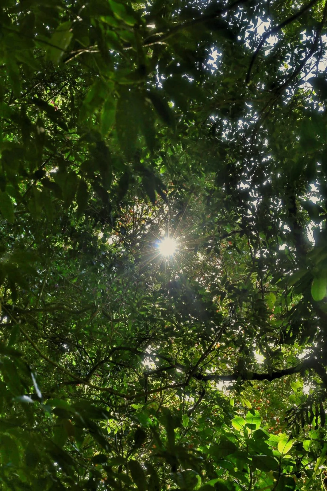
Fortuna Forest Reserve
Fortuna Forest Reserve protects one of Panama’s most immersive cloud forest environments. The forest here is shaped by elevation, moisture, and constant atmospheric change. Mists move through the canopy throughout the day, condensing on leaves and dripping steadily to the forest floor. Trees grow slowly in these conditions, producing twisted trunks heavily layered with moss, bromeliads, and orchids. This layered vegetation creates a vertical ecosystem where life exists at every level, from the soil to the canopy.
The reserve plays a critical role in regional water systems. Rainfall and cloud condensation feed streams that supply hydroelectric power and regulate water flow downstream. Because of this watershed importance, the forest remains largely undisturbed, allowing ecological processes to function with minimal interruption.
Visitors experience Fortuna in an unusually direct way. Lost and Found Hostel is positioned within the reserve’s ecosystem itself. Travelers arriving by public bus between David and Bocas del Toro can step off the roadside and enter cloud forest within minutes. Trails lead into river canyons, ridge forests, and wildlife habitat zones where birds, amphibians, and insects thrive in the cool climate.
What defines Fortuna is atmosphere. Visibility changes constantly, sound is softened by moisture, and the forest feels less like a place you visit and more like an environment you enter.
Palo Seco Forest Reserve
Palo Seco Forest Reserve surrounds and protects one of Central America’s most important conservation landscapes. Stretching across mountainous terrain, it functions as a biological buffer for La Amistad International Park and preserves one of the largest continuous forest corridors in the region.
The reserve encompasses multiple ecological zones stacked by elevation. Lower slopes support humid rainforest rich in plant diversity, while higher elevations transition into cloud forest. Because development is minimal, ecological relationships remain intact and wildlife populations are sustained across large territories.
Travelers typically access the reserve from the Fortuna region, where highland entry points allow exploration of forest edges and interior habitat. From this vantage point, visitors gain a sense of scale rarely experienced in accessible conservation areas. The forest does not present itself as a destination but as an expanse.
Palo Seco’s defining characteristic is continuity — forest stretching across mountains without visible interruption.
La Amistad International Park
La Amistad International Park represents wilderness on continental scale. Shared between Panama and Costa Rica, it protects rugged mountain rainforest largely unchanged by modern development. The park’s elevation range creates dramatic climate variation, producing habitats that support rare and endemic species.
Rivers originate in these mountains and flow outward to sustain ecosystems far beyond the park’s boundaries. The landscape is defined by steep ridges, dense forest, and remote valleys accessible primarily through guided expeditions.
Its significance lies not only in biodiversity but in ecological function. La Amistad acts as a climatic and biological anchor for surrounding regions.
Volcan Baru National Park
Volcán Barú rises above the surrounding highlands as Panama’s highest peak. The mountain’s slopes compress multiple ecosystems into a single ascent, transitioning from humid forest to sparse alpine terrain. Changing weather conditions shape the landscape continuously, with fog, wind, and sunlight altering visibility and temperature.
The summit provides a rare geographic perspective of the isthmus, where the Caribbean Sea and Pacific Ocean become visible from the same vantage point under clear conditions.
This vertical journey through climate zones illustrates Panama’s ecological diversity in condensed form.
Caribbean Coastal and Island Protection
Isla Bastimentos National Marine Park
This marine park protects an interconnected system of coral reefs, mangroves, beaches, and coastal rainforest. These ecosystems function together, with mangroves filtering water, reefs providing habitat, and forests stabilizing shorelines.
The park demonstrates how marine and terrestrial environments depend on one another for ecological stability. Its compact geography allows visitors to observe multiple habitat types within a short distance.
San San Pond Sak Wetland
San San Pond Sak protects coastal lagoons and mangrove systems recognized internationally for ecological importance. The wetland serves as a nursery for marine species and a stopover for migratory birds traveling between continents.
The environment is defined by still water, dense vegetation, and subtle ecological movement.
Canal Watershed Forest Protection
Soberania National Park
Soberanía protects mature rainforest within the Panama Canal watershed. Wildlife density is exceptionally high due to intact habitat and water availability. The forest supports one of the richest bird communities documented in the Americas.
Access routes follow historic infrastructure corridors that have become ecological pathways through intact forest.
Chagres National Park
Chagres protects rivers that supply water to surrounding communities and canal operations. The park demonstrates the direct connection between environmental conservation and human infrastructure.
Large forested watersheds dominate the landscape, with rivers shaping ecological patterns across the region.
Pacific Marine and Island Protection
Coiba National Park
Coiba protects island rainforest and one of the most biologically rich marine ecosystems in the eastern Pacific. Isolation preserved ecological processes that remain rare elsewhere.
The interaction between land and ocean defines the park’s identity.
Gulf of Chiriqui National Marine Park
Island chains and marine habitats create a dynamic ocean landscape supporting migration routes and breeding grounds for marine species.
Dry Pacific Landscape Protection
Sarigua National Park
Sarigua protects a rare dry ecosystem and archaeological history, revealing a stark environmental contrast within Panama’s diverse geography.
Eastern Frontier Wilderness
Darien National Park
Darién preserves one of the largest intact rainforests in the hemisphere. Ecological processes unfold across vast, uninterrupted terrain shaped by rivers and climate.
Panama’s protected areas collectively form a living environmental network where cloud forests capture water, rivers sustain wetlands, and mountain corridors connect continents. Travelers moving across the country encounter not isolated parks but a continuous landscape shaped by geography, climate, and time.