How They Are Done, Why They Matter So Much, What They Reveal, How They Connect to Law and Construction, and What They Really Cost in Real World Conditions
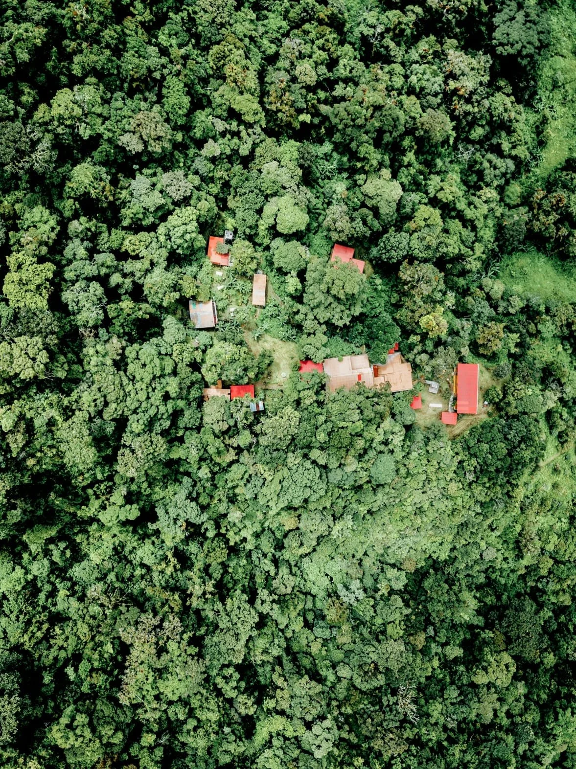
In Panama, land is never just land in the simple sense that many people initially assume when they begin looking at property. It is not a flat, uniform asset that can be understood from a listing description or a satellite image alone. Instead, it is a highly variable physical system shaped by mountains, volcanic formations, river basins, coastal plains, rainforest density, agricultural modification, and decades or centuries of uneven human settlement layered on top of natural terrain that changes dramatically over very short distances. Because of this, one of the most critical but often underestimated steps in any serious land decision in Panama is the creation of a topographic survey, a technical document that translates the physical reality of the land into precise measurable data that can be used for construction, legal clarification, engineering design, investment planning, and long term risk assessment. Without it, people are often operating on assumptions. With it, they are operating on reality.
A topographic survey is, at its core, a detailed three dimensional representation of a piece of land that captures not only its boundaries but its internal structure, including elevation changes, slope gradients, drainage behavior, vegetation patterns in some cases, existing structures, access routes, natural water flow, and any physical irregularities that affect how the land can actually be used. Unlike a simple cadastral or registry map that shows only legal boundaries and parcel divisions, a topographic map shows how the land behaves in space, which is ultimately what determines whether you can build on it, farm it, subdivide it, or develop it at scale. In a country like Panama, where a property can shift from flat usable ground to steep hillside or swampy lowland within a few meters, this distinction becomes absolutely essential.
The process of creating a topographic survey begins with hiring a licensed professional surveyor, typically a civil engineer or geomatics specialist who is authorized to conduct official land measurements and produce legally recognized or engineering grade documentation. These professionals use a combination of modern GPS systems, total station equipment, laser measurement tools, and increasingly drone based aerial mapping systems to capture highly accurate spatial data across the entire property. In more complex or remote areas, multiple methods are often combined to ensure accuracy, especially where dense vegetation, uneven terrain, or limited access makes ground based measurement more difficult.
Before any technical work begins, the survey process typically starts with a preliminary site visit. During this stage, the surveyor physically walks the land to understand its general shape, identify visible boundaries, locate existing markers such as fences or natural landmarks, and assess accessibility for equipment and personnel. This step is especially important in rural Panama where many properties, particularly those under ROP possession systems or semi rural titled land, may not have clearly defined or professionally marked boundaries. In these cases, initial assumptions about where land begins and ends may be based on informal agreements, historical use, or natural features such as rivers, trees, or ridgelines, all of which must be interpreted carefully before formal measurement can begin.
Once the site has been assessed, the actual data collection phase begins, which is the most technically intensive part of the process. Surveyors establish a network of reference points across the property using GPS coordinates that are tied into national geodetic systems. From these reference points, they measure thousands or sometimes tens of thousands of individual data points that represent changes in elevation and spatial position across the entire land area. Each point contributes to a digital model of the terrain, allowing engineers and planners to reconstruct the land in three dimensional form with high precision. In flatter urban areas, this process may be relatively straightforward, but in rural or mountainous regions, especially in provinces with significant elevation variation, the process becomes much more complex and time consuming due to the need to account for steep slopes, dense vegetation, and irregular terrain features.
In more advanced surveys, drone technology is often used to supplement or enhance ground based measurements. Drones equipped with high resolution cameras and photogrammetry software can generate detailed aerial models of the land surface, which are then processed into digital elevation models that provide extremely accurate contour mapping. This is particularly useful in Panama’s tropical environments where dense forest cover can make ground visibility limited. By combining aerial and ground data, surveyors can create highly accurate representations of both surface structure and underlying terrain.
Once field data has been collected, it is processed in specialized engineering software that converts raw measurements into contour maps, slope analyses, elevation models, and detailed topographic drawings. Contour lines are especially important because they represent lines of equal elevation, allowing users to visually interpret steepness, flatness, and directional flow of the terrain. The resulting map is not just a visual diagram but a technical instrument that can be used for engineering calculations, construction planning, hydrological analysis, and legal documentation.
The final output of the process is a complete topographic survey package, which may include printed maps, digital CAD files, coordinate datasets, elevation models, and sometimes official certification depending on the purpose of the survey. These documents are then used by architects, engineers, lawyers, developers, government agencies, and property owners to make informed decisions about land use. In many cases, the topographic survey becomes the foundational document upon which all other planning is based.
One of the most important uses of a topographic survey in Panama is construction planning. Before any building can begin, engineers must understand how the land will support structures, how water will drain across the site, and where soil stability is sufficient for foundations. Without this information, construction projects risk being placed in flood prone areas, unstable slopes, or zones that require extensive and expensive earthworks. A topographic map allows architects to position buildings in optimal locations, design foundations that match slope conditions, and plan infrastructure such as roads, driveways, retaining walls, and drainage systems in a way that aligns with the natural shape of the land rather than working against it.
Another major use of topographic surveys is land subdivision and development planning. When larger parcels of land are divided into smaller lots for residential or commercial development, the topographic map determines how roads will be laid out, how utilities will be routed, where drainage systems will be placed, and how individual lots will be shaped to ensure usability and compliance with local regulations. Developers rely heavily on this data because it directly impacts profitability. A poorly designed subdivision that ignores topography can result in unusable lots, excessive construction costs, or long term infrastructure failures.
Topographic surveys also play a critical role in legal and administrative processes related to land ownership, especially in contexts where boundaries are unclear or where land is transitioning between ROP possession and formal titled status. In such cases, the survey provides a precise technical record of land occupation, boundaries, and improvements, which can be used as supporting evidence in titling applications or dispute resolution processes. While the survey itself does not establish legal ownership, it provides the factual foundation upon which legal decisions are often based.
In Panama specifically, the importance of topographic surveys is amplified by the country’s extreme geographic diversity and the coexistence of formal titled property systems with ROP possession based systems. In many rural and semi rural areas, land boundaries may not have been formally surveyed for decades or may rely on informal agreements between neighboring land users. In these environments, a topographic survey is often the first step in bringing clarity and technical precision to land that has been managed historically through practical use rather than formal documentation.
The cost of a topographic survey in Panama varies significantly depending on multiple factors, including the size of the property, the complexity of the terrain, the density of vegetation, accessibility, and the level of detail required for the project. For small residential lots in accessible urban or suburban areas with relatively flat terrain, costs may be comparatively low and can sometimes be completed within a few hundred dollars depending on scope. However, as soon as the land becomes larger, more remote, or more topographically complex, costs increase substantially. Rural properties with steep slopes, dense jungle, or difficult access can require extensive fieldwork, specialized equipment, and longer processing times, which can push costs into the thousands of dollars range.
Additional factors that influence cost include whether drone mapping is used, whether boundary verification is required, whether the survey is intended for legal registration or engineering design, and whether the output needs to meet formal certification standards for government or banking use. In general, more detailed and more official surveys cost more, but they also provide significantly more value in terms of accuracy and usability.
Despite the cost, one of the most consistent realities in land development is that the cost of a topographic survey is almost always far lower than the potential financial risk of not having one. Construction mistakes, drainage failures, boundary disputes, and miscalculated usable land area can result in costs many times higher than the price of proper surveying. For this reason, experienced developers and engineers almost always consider topographic surveys a mandatory step rather than an optional one.
Common mistakes that occur when people skip or underestimate the importance of topographic surveys include assuming that land is flat when it is actually sloped, underestimating drainage complexity in tropical rainfall conditions, building structures in areas prone to flooding or erosion, misjudging how much land is actually usable for construction or agriculture, and misunderstanding boundary lines that may not align with physical features on the ground. These mistakes are particularly common among first time land buyers or foreign investors who may be accustomed to more uniform or highly regulated land systems in other countries.
Beyond construction and development, topographic surveys also play an important role in environmental planning and sustainability considerations. In Panama’s tropical climate, rainfall patterns and water flow dynamics are critical factors in land use planning. A topographic map allows engineers and planners to design drainage systems that work with natural water flow rather than against it, reducing erosion, preventing flooding, and protecting both structures and surrounding ecosystems. In agricultural contexts, topographic data can also help determine which areas are suitable for cultivation, which are prone to water retention, and how to optimize land use for productivity.
From a long term investment perspective, topographic surveys provide a level of insight that directly affects land value assessment. Properties with favorable topography, such as gentle slopes, stable elevation, good drainage, and accessible road connections, are generally more valuable because they require lower development costs and carry lower risk. Conversely, properties with steep slopes, unstable soil conditions, or poor drainage may still hold value but require significantly more investment to develop. This means that two properties with identical size and location can have very different real world value once topography is fully understood.
Ultimately, a topographic survey is one of the most important tools in the entire land development process because it transforms land from a conceptual asset into a measurable, analyzable, and actionable physical reality. In a country like Panama, where geography is highly variable, land tenure systems are layered, and development conditions can change dramatically over short distances, this document becomes the foundation for nearly every meaningful decision about property use. It connects the legal world of ownership with the physical world of terrain, bridging the gap between what land is on paper and what land actually is on the ground.
And in that sense, a topographic survey is not simply a technical requirement. It is a form of truth telling about land itself, revealing not only its shape and structure but its limitations, its potential, and its hidden complexities. It is the point at which land stops being an abstract idea and becomes something fully understood, measurable, and ready to be built upon with confidence, precision, and clarity.