
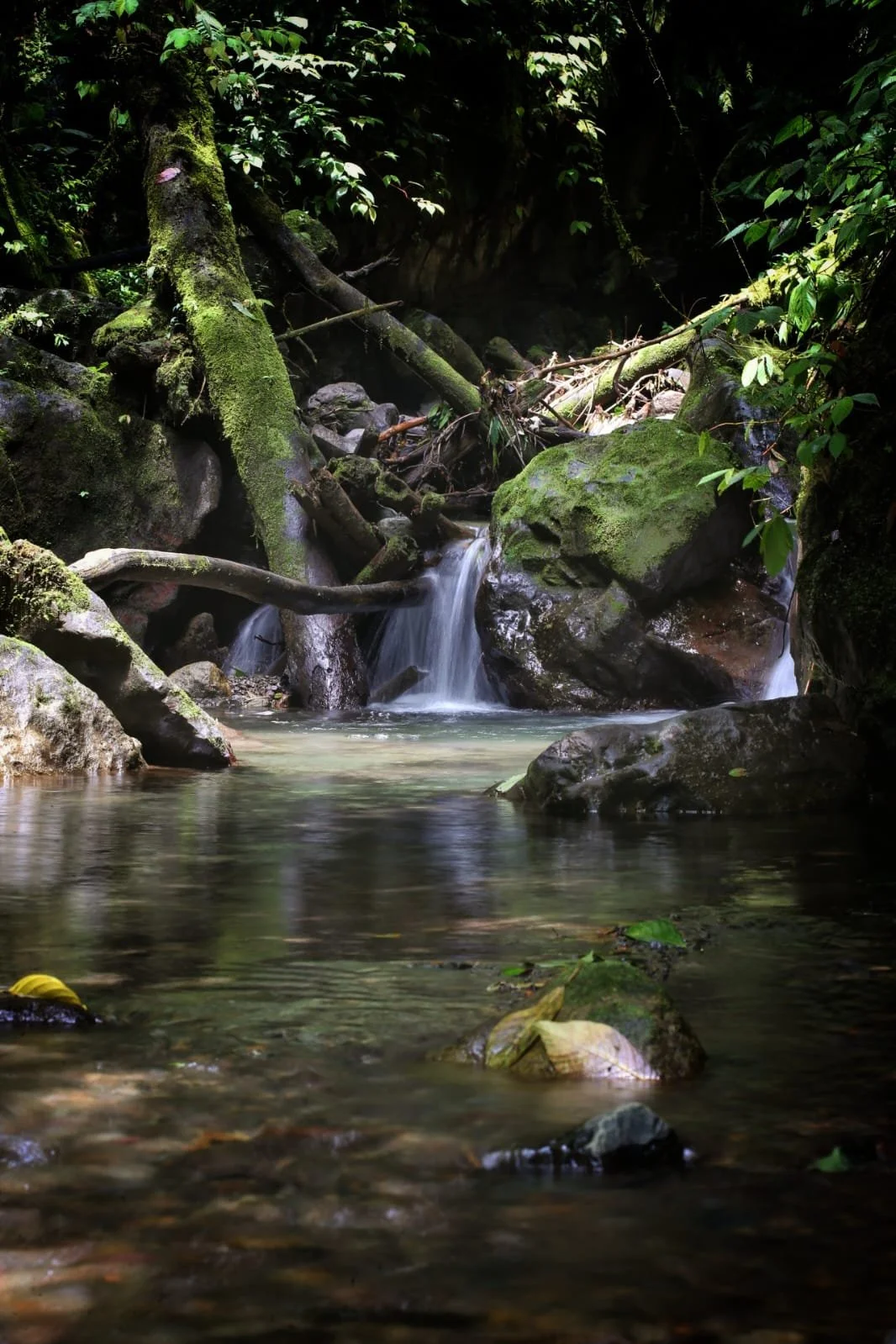
High in the mountains of central Panama, surrounded by cloud forest, rivers, waterfalls, and mist covered ridges, the town of Santa Fe feels isolated from the rest of the country. Travelers who arrive there often believe they have reached the end of the road. In many ways, they have. Santa Fe sits deep in the interior mountains of Veraguas, far from the skyscrapers of Panama City and far from the famous beaches that dominate most tourist brochures.
Yet hidden beyond Santa Fe is one of the most mysterious and little known roads in Panama. It is a rough route pushing northward through some of the wildest landscapes in the country toward the Caribbean coast. Many Panamanians themselves know little about it. Some have only heard rumors of forgotten villages, rivers without bridges, abandoned stretches of jungle road, or isolated Indigenous communities living near the sea at the very end.
For decades, this route has occupied an almost legendary place among overlanders, motorcyclists, adventurers, and people fascinated by Panama’s remote interior. Unlike the smooth highways connecting Panama’s major cities, this road feels uncertain and unfinished, as though civilization slowly dissolves into rainforest the farther north you travel.
The journey begins in the cool green mountains surrounding Santa Fe itself. The town sits at relatively high elevation compared to much of Panama, giving it a milder climate and lush vegetation. Rivers rush down from the hills in clear cold currents. Coffee farms cling to slopes. Orchids and moss cover trees in the cloud forest. The area already feels remote compared to most populated regions of the country.
North of town, however, the landscape becomes dramatically wilder. The paved roads gradually give way to rougher surfaces. Dense jungle closes in around the route. During the rainy season, mud can become a major obstacle, and landslides sometimes damage sections of the road. In some stretches, travelers may go long periods without seeing another vehicle.
This northern region of Veraguas forms part of the mountainous spine of Panama, where forests remain thick and human settlement sparse. The terrain is rugged, wet, and difficult to develop. Rivers cut deep valleys through the mountains, and clouds drift constantly through the forest canopy.
Part of what makes this road so fascinating is that it feels unfinished in both a literal and symbolic sense. Panama is a relatively modern and connected country in many areas, yet this route reveals how quickly infrastructure fades once you enter the deeper interior. It feels less like a highway and more like a corridor pushing into wilderness.
Travelers who venture northward eventually begin descending from the highlands toward lower elevations closer to the Caribbean watershed. The forests change subtly. Humidity increases. Tropical heat grows heavier. Bird calls echo from dense jungle, and the vegetation becomes almost overwhelmingly green.
Along the route are scattered rural communities, farms carved from forest clearings, and small settlements where life moves at a very different pace. Some residents raise cattle. Others grow crops or fish in nearby rivers. Electricity and services can become inconsistent farther from Santa Fe, and heavy rains sometimes isolate parts of the region entirely.
The deeper significance of this route lies in where it ultimately leads. At the northern end of the road lies the Caribbean coast of Veraguas, one of the least visited and least developed coastlines in all of Panama.
Unlike the better known Caribbean destinations of Bocas del Toro or the San Blas Islands, the Caribbean coast north of Santa Fe remains astonishingly isolated. There are no major resorts, cruise ship docks, or international tourism hubs waiting at the end. Instead, travelers encounter remote coastal villages, dense rainforest, black sand beaches, river mouths, and a sea that often feels raw and untamed.
One of the most important settlements near the end of the route is the area around Calovébora, a remote coastal community facing the Caribbean Sea. Reaching it has long been considered difficult, especially during bad weather. The road conditions have historically changed constantly due to rainfall, erosion, and limited maintenance.
Calovébora itself feels almost detached from the rest of Panama. Jungle presses directly against the coast. Rivers empty into the Caribbean in brown swirling currents after storms. The sea can appear calm and turquoise one day, then violent and gray the next.
The coastline there is dramatically different from the postcard Caribbean imagery many travelers expect. Rather than rows of resorts and beach bars, much of the region consists of untouched rainforest meeting the ocean. Giant trees stand close to the shore. Waves crash against rocky points and dark beaches. During storms, the Caribbean feels immense and powerful.
Historically, the isolation of this coast shaped the lives of the people who settled there. Fishing became central to survival. Rivers often served as transportation routes. Communities developed somewhat independently from Panama’s more connected Pacific side. Even today, some areas remain difficult to access except by rough road or boat.
The forests surrounding the route are also ecologically important. This region forms part of one of the largest remaining stretches of intact tropical forest in Panama. Wildlife includes monkeys, toucans, sloths, snakes, frogs, and countless insects. Jaguars and other elusive mammals are believed to still move through some of the more remote forests, though sightings are extremely rare.
The rivers flowing northward toward the Caribbean are another defining feature of the landscape. In the rainy season they become immense forces of erosion and movement. Flooding can wash out roads and isolate communities. Yet these rivers are also beautiful, often running clear and cold in the mountains before widening into muddy tropical waterways near the coast.
Part of the road’s mystique comes from how few tourists actually travel it. Most visitors to Panama remain near the canal, Pacific beaches, Bocas del Toro, or the highlands around Boquete. The Santa Fe to Caribbean route exists largely outside mainstream tourism. Information about conditions can be inconsistent, and many travelers hear conflicting stories about whether the road is passable at all.
Motorcyclists and overlanders often become especially fascinated with it because the route feels adventurous without leaving Panama. In a relatively small country known for modern banking districts and international shipping, this road reveals an entirely different reality. It exposes how rugged and undeveloped parts of Panama still remain.
There are also longstanding dreams and controversies surrounding the road. Some people see improving it as a way to bring economic development, tourism, and opportunity to isolated communities. Others fear that major development could damage fragile ecosystems and permanently alter one of the country’s last truly remote regions.
Environmental concerns are significant because the forests north of Santa Fe contain extraordinary biodiversity. Increased access could bring deforestation, land speculation, and habitat destruction. At the same time, many local residents understandably want better transportation, healthcare access, and economic possibilities.
This tension between isolation and development exists throughout much of rural Panama, but along this route it feels especially visible.
For travelers who finally reach the Caribbean coast after the long drive northward, the experience is often emotional rather than simply scenic. There is a feeling of having crossed hidden Panama from mountain cloud forest to tropical Caribbean jungle. The journey itself becomes more memorable than any single destination.
At the end of the road there is no giant tourist attraction waiting. No polished resort district appears from the forest. Instead there is wilderness, ocean, rain, rivers, and scattered communities living beside one of the least explored coastlines in the country.
That may be exactly why the road fascinates so many people.
In an era when most places are mapped, photographed, reviewed, and heavily visited, the route north from Santa Fe still carries an element of uncertainty. Mudslides may block it. Rivers may rise suddenly. Entire sections may feel abandoned. The jungle still seems stronger than the infrastructure pushing through it.
And at the very end lies the Caribbean, wild and remote, where the mountains of Panama finally collapse into the sea.