
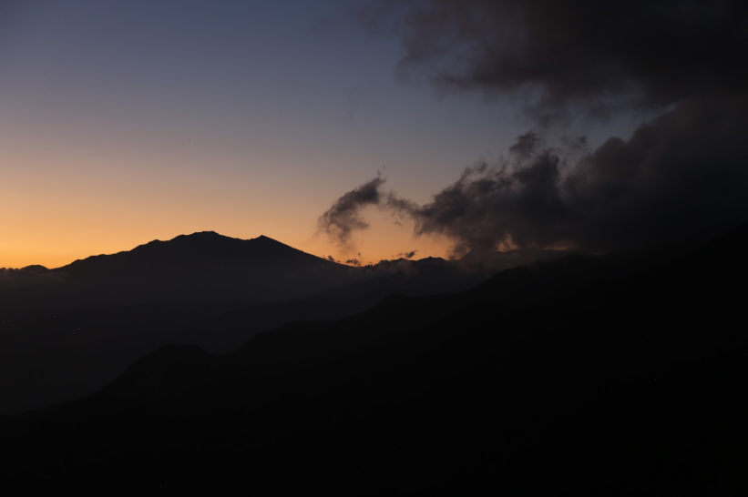
Cambutal: Panama’s Remote Pacific Paradise for Surfers, Nature Lovers, and Travelers Seeking the End of the Road

There are places in Panama that feel like destinations, and then there are places that feel like discoveries. Hidden at the far southern edge of the Azuero Peninsula, where rugged mountains descend into the Pacific Ocean and jungle-covered hills meet empty beaches, lies one of the country's most captivating coastal communities. Cambutal is not a place travelers stumble upon accidentally. Reaching it requires commitment. The road winds through cattle country, rolling hills, rivers, and remote villages before finally arriving at a coastline that feels worlds away from modern urban life. Yet for those who make the journey, Cambutal often becomes one of the most memorable places they experience in Panama.

Unlike better-known beach destinations that have grown into bustling tourism centers, Cambutal remains wonderfully remote. There are no towering hotel complexes dominating the shoreline. There are no crowded boardwalks or rows of high-rise condominiums. Instead, visitors find a laid-back village surrounded by wild nature, powerful Pacific waves, empty beaches, and some of the most dramatic scenery on the Azuero Peninsula.

The first thing many visitors notice is the feeling of arrival. The journey itself builds anticipation. The farther south one travels, the more developed Panama seems to disappear. Traffic fades away. Towns become smaller. The landscape becomes increasingly rural. Finally, the road reaches the coast, revealing a spectacular meeting point between jungle-clad mountains and the vast Pacific Ocean. The sense of isolation is immediate and deeply appealing.

Cambutal sits at the very end of the road, and that geographical reality has shaped its character. There is nowhere farther to drive. Beyond the village lies only coastline, ocean, and wilderness. This end-of-the-road atmosphere creates a sense of freedom and adventure that attracts surfers, backpackers, photographers, fishermen, and nature enthusiasts from around the world.

One of the greatest attractions of Cambutal is its spectacular coastline. Unlike the broad sandy beaches found elsewhere in Panama, the beaches around Cambutal are varied and dramatic. Rocky points jut into the ocean. Black volcanic rocks line sections of the coast. Long stretches of sand alternate with hidden coves and tidal formations. The result is a landscape that feels raw, untamed, and endlessly photogenic.

The Pacific Ocean dominates life in Cambutal. Waves roll in from distant horizons, crashing against rocks and sweeping across beaches. The sound of the surf becomes a constant companion, day and night. Unlike calmer beach destinations, Cambutal possesses an energy that comes from its direct exposure to the open Pacific.

This exposure has made the village increasingly famous among surfers. Cambutal is now considered one of Panama's most exciting emerging surf destinations. Waves break along various points and beaches, providing options for different skill levels depending on conditions. During the right swells, powerful surf attracts experienced surfers seeking uncrowded waves and authentic coastal experiences.

What sets Cambutal apart from more famous surf towns is the lack of crowds. Surfers often find themselves sharing waves with only a handful of others. The atmosphere remains relaxed and welcoming rather than competitive. The village retains the feeling of a place where surfing exists as part of everyday life rather than as a commercial industry.

Even visitors who never step on a surfboard can appreciate the spectacle. Watching waves explode against rocky shorelines while pelicans glide overhead and fishermen work nearby is an experience that perfectly captures the spirit of Cambutal.

Nature is another reason travelers fall in love with Cambutal. The village occupies a remarkable location where several ecosystems converge. Tropical dry forests, coastal habitats, rivers, beaches, and nearby mountain environments create extraordinary biodiversity. Wildlife remains an integral part of the experience.

Birdwatchers often find the region surprisingly rewarding. Pelicans patrol the shoreline. Frigatebirds soar effortlessly above the ocean. Herons hunt along estuaries and river mouths. Inland forests support numerous tropical species, making every walk an opportunity for discovery.

One of the most fascinating aspects of the region is its proximity to the wild landscapes of southern Azuero. The surrounding hills and forests remain relatively undeveloped, creating opportunities for hiking, exploration, and wildlife observation. Rivers descend from the mountains toward the sea, forming waterfalls, swimming holes, and scenic valleys hidden within the countryside.

The nearby Cerro Hoya National Park adds another layer of significance to the region. This remote protected area contains some of the most pristine forests in Panama and shelters wildlife that has become increasingly rare elsewhere. The park's rugged terrain and relative isolation have helped preserve ecosystems that remain largely untouched.

For adventurous travelers, Cambutal serves as one of the gateways to exploring this extraordinary wilderness. Although reaching the most remote sections requires effort, the possibility of venturing into one of Panama's least explored national parks adds an undeniable sense of adventure to any visit.

Fishing has long been part of life in Cambutal. Local fishermen continue traditions that stretch back generations, relying on the rich Pacific waters that surround the peninsula. The ocean supports a variety of fish species and contributes significantly to the area's cultural identity.

Fresh seafood naturally plays a major role in the local cuisine. Meals often feature fish caught only hours earlier, prepared simply and served with ingredients grown or sourced nearby. Dining in Cambutal frequently feels connected to the surrounding environment in a way that larger tourist destinations often lose.

The sunsets in Cambutal deserve special recognition. Facing directly west over the Pacific, the village enjoys some of the most spectacular sunsets in Panama. As evening approaches, the sky frequently transforms into a masterpiece of orange, crimson, pink, and gold. Clouds catch the fading light while waves reflect changing colors across the ocean surface.

Because the landscape remains relatively undeveloped, sunsets here feel particularly dramatic. There are few artificial distractions. The ocean stretches uninterrupted toward the horizon. The mountains become silhouettes. Every evening seems to offer a unique performance created by light, sea, and sky.

Nightfall brings another kind of beauty. The limited development and relatively low levels of light pollution allow impressive views of the stars. On clear nights, the sky can appear brilliantly illuminated by constellations and the Milky Way. The sound of waves breaking along the coast creates a soothing soundtrack that continues long after sunset.

One of Cambutal's greatest strengths is its authenticity. The village has certainly welcomed tourism, but it has not lost its identity in the process. Visitors still encounter a functioning coastal community rather than a destination built solely for outsiders. This authenticity creates a richer and more meaningful travel experience.

The pace of life is refreshingly slow. Days are shaped by tides, weather, surf conditions, and sunsets rather than schedules. Travelers often arrive planning to stay briefly and find themselves extending their visits. The combination of natural beauty and relaxed atmosphere has a way of making people reluctant to leave.

Photographers are particularly drawn to Cambutal because of the diversity of landscapes concentrated in a relatively small area. Beaches, cliffs, forests, rivers, wildlife, sunsets, and dramatic ocean conditions provide endless creative possibilities. Every turn of the coastline reveals another compelling scene.

What ultimately makes Cambutal special is the feeling that it represents a version of coastal Panama that has largely disappeared elsewhere. It remains wild without being inaccessible, beautiful without being overdeveloped, and welcoming without feeling commercialized.

For surfers, it offers powerful waves and uncrowded breaks. For hikers and nature lovers, it provides access to forests, rivers, and protected wilderness. For photographers, it delivers endless opportunities. For backpackers, it offers authenticity and adventure. For anyone seeking a deeper connection with nature, it presents one of the most rewarding destinations in the country.

In a nation celebrated for tropical islands, mountain towns, and bustling cities, Cambutal stands apart because it feels genuinely remote. It is a place where mountains meet the Pacific in spectacular fashion, where sunsets stop conversations, and where travelers can still experience the thrill of reaching the end of the road.

Those who make the journey often discover that Cambutal is more than just a beach destination. It is one of Panama's last great coastal frontiers, a place where wild landscapes, powerful oceans, and simple living come together to create an experience that lingers in memory long after the journey home.

Isla Cañas: Panama’s Sea Turtle Kingdom and One of the Pacific Coast’s Greatest Natural Wonders

Along the sun-drenched Pacific coast of the Azuero Peninsula, where mangrove forests meet tropical beaches and fishing boats drift across calm coastal waters, lies one of Panama’s most extraordinary wildlife destinations. To many travelers, the beaches of Los Santos are known for surfing, fishing, and peaceful coastal villages, but hidden among the wetlands and estuaries is a place that hosts one of nature’s most remarkable spectacles. Isla Cañas is a sanctuary of beaches, mangroves, wildlife, and conservation, famous throughout Panama as one of the most important sea turtle nesting sites in the entire Pacific region.

At first glance, Isla Cañas may appear to be just another tropical island. Long stretches of golden sand border the Pacific Ocean. Mangrove forests line quiet waterways. Palm trees sway in the coastal breeze. Birds soar overhead while fishermen navigate channels between the island and the mainland. Yet beneath this tranquil beauty lies an ecosystem of global importance, a place where thousands of sea turtles return every year to continue a cycle that has existed for millions of years.

Located off the coast of the district of Tonosí in Los Santos Province, Isla Cañas is separated from the mainland by a network of tidal channels and mangrove-lined waterways. The island stretches for many kilometers along the coast and contains a remarkable variety of habitats, including beaches, estuaries, wetlands, mangroves, and tropical vegetation. Together, these ecosystems support an extraordinary abundance of life.

For nature lovers, Isla Cañas represents one of the most rewarding destinations in Panama. While many visitors travel to famous islands for luxury resorts or nightlife, those who come to Isla Cañas are drawn by something far more powerful: the opportunity to witness one of the greatest wildlife events in the country.

The island’s international reputation is largely built around its sea turtles. Every year, thousands of turtles emerge from the Pacific Ocean under the cover of darkness and make their way onto the island’s beaches to lay eggs. The sight is among the most unforgettable wildlife experiences in all of Central America.

The species most commonly associated with Isla Cañas is the Olive Ridley Sea Turtle. Although smaller than leatherback turtles, Olive Ridleys are among the most fascinating sea turtles in the world. They undertake long migrations across the Pacific before returning to nesting beaches such as those found on Isla Cañas.

During nesting season, female turtles crawl slowly ashore, digging nests in the sand with remarkable precision. Once their eggs have been laid and carefully covered, they return to the ocean, leaving the next generation to develop beneath the sand. Weeks later, tiny hatchlings emerge and begin their perilous journey toward the sea, guided by moonlight and instinct.

Watching this process unfold is often described as magical. On certain nights, visitors may witness dozens of turtles arriving along the shoreline. The beach becomes a scene that has remained largely unchanged since long before the appearance of human civilization. Dinosaurs disappeared millions of years ago, but sea turtles continue their ancient migrations, returning to these shores generation after generation.

The importance of Isla Cañas for turtle conservation cannot be overstated. The island has become one of Panama’s most significant nesting sites and plays a crucial role in protecting turtle populations that face numerous threats worldwide. Conservation programs, researchers, and local communities work together to monitor nesting activity, protect eggs, and educate visitors about the importance of preserving these incredible animals.

Yet Isla Cañas is far more than a turtle destination. The island’s mangrove forests are among the most valuable ecosystems on Panama’s Pacific coast. These remarkable habitats serve as nurseries for fish, crustaceans, and countless marine species. Mangroves protect coastlines from erosion, filter water, and provide shelter for wildlife ranging from birds to reptiles.

Exploring the mangrove channels by boat reveals an entirely different side of the island. Narrow waterways wind through dense forests of twisted roots and overhanging branches. The water reflects the greenery above, creating a calm and almost mysterious atmosphere. Every turn seems to reveal another hidden corner of this coastal wilderness.

Birdwatchers often find Isla Cañas particularly rewarding. The combination of wetlands, beaches, mangroves, and estuaries supports an impressive diversity of bird species. Herons stalk fish in shallow water. Egrets stand motionless along muddy shorelines. Pelicans plunge dramatically into the sea. Ospreys patrol overhead searching for prey.

During migration seasons, even more species arrive from North and South America, transforming the island into a crucial stopover for birds undertaking incredible journeys between continents. The variety of habitats ensures that bird activity remains high throughout the year.

The beaches themselves are magnificent. Long stretches of sand extend toward the horizon, often with very few people in sight. Unlike heavily developed coastal destinations, much of Isla Cañas retains a natural and undeveloped character. Visitors can walk for kilometers along the shoreline while listening to the sound of waves and observing wildlife in its natural environment.

Sunsets on Isla Cañas are among the finest on Panama’s Pacific coast. As the sun descends toward the ocean, the sky often fills with brilliant shades of orange, pink, purple, and gold. The vast beach reflects the changing colors while seabirds cross the horizon. The combination of open space, natural beauty, and dramatic light creates an unforgettable spectacle every evening.

The surrounding waters are equally rich in marine life. Fish thrive within the estuaries and mangrove systems. Dolphins are occasionally spotted offshore. Seasonal visitors such as humpback whales migrate through nearby waters during certain times of the year, adding another dimension to the region’s biodiversity.

One of the most appealing aspects of Isla Cañas is its authenticity. The island remains closely connected to the fishing communities and rural culture of the Azuero Peninsula. Traditional lifestyles continue to shape daily life in the region, creating a sense of place that many travelers find increasingly rare.

Unlike destinations built around mass tourism, Isla Cañas remains primarily a conservation and nature destination. Visitors come not for entertainment complexes or luxury shopping but for wildlife, scenery, and genuine encounters with the natural world. This focus has helped preserve the island’s character and ecological value.

The journey to the island is part of the experience. Depending on tides and conditions, visitors may travel by boat through mangrove channels or across coastal waters before arriving on the island. The approach provides an opportunity to appreciate the scale and diversity of the surrounding ecosystem.

For photographers, Isla Cañas offers endless possibilities. Sea turtles, hatchlings, mangroves, birds, sunsets, beaches, and coastal landscapes provide a wealth of subjects. The changing light throughout the day continually transforms the scenery, ensuring that no two visits are exactly alike.

The island also serves as a powerful reminder of the importance of conservation. Sea turtles have survived for more than 100 million years, yet many species now face serious challenges from habitat loss, pollution, and fishing pressures. Places like Isla Cañas play a vital role in ensuring that these ancient creatures continue to thrive.

What ultimately makes Isla Cañas special is the combination of beauty and purpose. It is a place where visitors can experience stunning beaches and remarkable wildlife while also gaining an appreciation for the delicate ecological processes that sustain life along Panama’s Pacific coast.

For wildlife enthusiasts, the turtle nesting season is unforgettable. For birdwatchers, the wetlands and mangroves offer endless discoveries. For photographers, the scenery is spectacular. For travelers seeking authentic nature experiences, the island provides a glimpse of a world that remains wonderfully wild.

In a country famous for rainforests, mountains, islands, and biodiversity, Isla Cañas stands out as one of Panama’s greatest conservation success stories and one of its most inspiring natural destinations. It is a place where ancient sea turtles still return to the shore, where mangrove forests continue to shelter marine life, and where visitors can witness some of the most extraordinary wildlife spectacles in Central America.

Far from the crowds and commercialism of many beach destinations, Isla Cañas remains what it has always been: a sanctuary of sand, sea, and life. It is a place where nature continues to write its ancient story on the shores of the Pacific, one turtle nest at a time.

Isla Escudo de Veraguas: Panama’s Lost Caribbean World at the Edge of the Map

Far off the Caribbean coast of Panama, beyond the mainland forests of Bocas del Toro and well away from the routes traveled by most visitors, rises an island so remote, so biologically unique, and so stunningly beautiful that it feels almost mythical. Surrounded by turquoise waters, coral reefs, white-sand beaches, and dense tropical forest, Isla Escudo de Veraguas is one of the most extraordinary places in Panama and arguably one of the most fascinating islands in all of Central America.

To reach Escudo de Veraguas is to journey into one of the country's last true wilderness frontiers. Located roughly 20 kilometers offshore in the Caribbean Sea, the island rises dramatically from the ocean like a forgotten world. For many travelers, the experience of arriving here feels less like visiting a destination and more like discovering a place that has somehow remained hidden from modern civilization.

Unlike many tropical islands that have been shaped by tourism and development, Escudo de Veraguas remains largely untouched. There are no major hotels, no busy beach towns, and no crowds. Instead, visitors encounter a landscape dominated by rainforest, coral reefs, mangroves, and beaches so pristine that they often appear untouched by human activity.

The first sight of the island is unforgettable. As boats approach through the brilliant blue waters of the Caribbean, the forested cliffs and beaches gradually emerge from the horizon. The sea shifts through shades of turquoise, emerald, and sapphire. Palm trees sway above white sand. Coral formations can often be seen beneath the crystal-clear surface. It is a scene that looks more like a remote Pacific atoll than a Caribbean island only a few hours from the Panamanian mainland.

One of the most fascinating aspects of Escudo de Veraguas is its geological history. Thousands of years ago, rising sea levels separated the island from the mainland. This isolation allowed plants and animals to evolve independently, creating a remarkable concentration of species found nowhere else on Earth.

Perhaps the most famous resident of the island is the legendary Pygmy Three-Toed Sloth. This tiny sloth is one of the rarest mammals in the world and exists only on Escudo de Veraguas. Smaller than its mainland relatives, the pygmy sloth has become a symbol of the island's extraordinary biodiversity and conservation importance.

The fact that an entire mammal species is found nowhere else on the planet instantly elevates Escudo de Veraguas into the ranks of globally significant wildlife destinations. For biologists and conservationists, the island is a living laboratory that provides valuable insights into evolution, isolation, and biodiversity.

Yet the pygmy sloth is only one part of a much larger ecological story. The island's forests support numerous reptiles, amphibians, birds, insects, and plant species that have adapted to this isolated environment. Every hectare of forest contributes to an ecosystem unlike any other in Panama.

Walking through the island's interior feels like entering a primeval world. Massive trees tower overhead. Vines drape across the forest. Tropical birds call from hidden perches. The dense vegetation creates a sense of mystery and exploration that few places can match.

Because so few people visit Escudo de Veraguas compared to Panama's more accessible destinations, wildlife often behaves naturally and with relatively little disturbance. The result is an environment where patient visitors can observe ecological interactions that have remained largely unchanged for centuries.

The waters surrounding the island are equally extraordinary. Escudo de Veraguas sits within one of the richest marine environments in the Caribbean region of Panama. Coral reefs encircle much of the island, creating vibrant underwater ecosystems that support a tremendous variety of marine life.

Snorkelers often describe the waters around Escudo as some of the most beautiful in Panama. Coral formations host colorful reef fish, sea stars, sponges, crustaceans, and countless other organisms. Visibility can be excellent, allowing visitors to appreciate the complexity and beauty of the underwater world.

Sea turtles frequently inhabit the surrounding waters. Rays glide across sandy bottoms. Schools of fish move through coral gardens. Every snorkeling excursion offers the possibility of new discoveries.

The beaches themselves are spectacular. White sand stretches beneath coconut palms. Clear water laps gently against the shore. In many locations there are no buildings visible, no crowds, and no signs of development. Visitors can stand on a beach and feel as though they have arrived on a deserted island in the middle of the Caribbean.

The color of the water is one of Escudo's defining characteristics. Shallow areas glow with brilliant turquoise hues. Deeper channels shift toward rich blues. Sunlight illuminates the seabed, creating patterns that seem almost unreal. Photographs often struggle to capture the true intensity of the colors visible in person.

The island also has cultural significance for the local Ngäbe People, who have long maintained connections to the surrounding marine environment. For generations, communities along the nearby mainland coast have relied upon these waters for fishing and transportation. Their knowledge of the region forms an important part of the area's human history.

Because of its remoteness, reaching Escudo de Veraguas remains an adventure. Most journeys begin from small communities on the mainland coast of Bocas del Toro Province. Boats cross open Caribbean waters, often passing through stunning coastal scenery before the island finally appears on the horizon.

That journey contributes to the sense of discovery. Unlike destinations accessible by major highways or airports, Escudo requires effort. Visitors must actively seek it out. As a result, arriving on the island often feels genuinely rewarding.

For photographers, the island is a dream. The contrast between white sand, emerald forest, and turquoise sea creates endless opportunities for stunning images. Sunrise and sunset can be particularly dramatic as changing light transforms the colors of the landscape.

Marine photographers find equally compelling subjects beneath the surface. Coral reefs, tropical fish, and crystal-clear water create ideal conditions for underwater photography. Every snorkeling session has the potential to reveal something remarkable.

What makes Escudo de Veraguas especially fascinating is the feeling that it exists outside ordinary geography. While much of the world has become increasingly connected and developed, this island retains an atmosphere of genuine isolation. Visitors quickly become aware of how rare such places have become.

Conservation challenges also highlight the importance of protecting the island. The pygmy sloth, coral reefs, mangroves, and other sensitive ecosystems depend on careful stewardship. Scientists and environmental organizations continue working to better understand and preserve this unique environment for future generations.

For nature lovers, Escudo represents one of Panama's ultimate destinations. For wildlife enthusiasts, it offers opportunities to encounter species found nowhere else. For snorkelers, it provides access to beautiful Caribbean reefs. For adventurers, it delivers the thrill of reaching one of the country's most remote locations.

Yet perhaps the island's greatest gift is perspective. Standing on a beach where rainforest meets turquoise sea, watching waves break against coral reefs while knowing that rare species live in the forest behind you, it becomes clear how extraordinary this place truly is.

In a country celebrated for biodiversity, few places embody Panama's natural richness more completely than Escudo de Veraguas. It is an island of rare wildlife, pristine reefs, untouched beaches, and remarkable scientific importance. It is a place where evolution continues to tell its story, where forests remain wild, and where the Caribbean still looks much as it did centuries ago.

For those fortunate enough to visit, Escudo de Veraguas is not merely another island destination. It is a journey to one of the most unique places in the Americas, a lost world floating in the Caribbean Sea, where nature remains the true ruler and every horizon promises discovery.

Isla Boca Brava: The Wild Island Paradise of the Gulf of Chiriquí

Scattered across the warm Pacific waters of western Panama lies one of the country's most spectacular marine regions, a maze of forest-covered islands, hidden beaches, coral-rich waters, and abundant wildlife known as the Gulf of Chiriquí. While destinations such as Coiba often receive much of the attention, one island has quietly earned a reputation among adventurous travelers, nature lovers, sport fishermen, and those seeking a true escape from modern life. That island is Isla Boca Brava, a rugged, jungle-covered paradise located just offshore from the fishing village of Boca Chica.

Unlike many tropical islands that have been transformed by large-scale development, Boca Brava remains remarkably wild. Dense tropical forest blankets much of the island. Jungle trails wind through the interior. Monkeys move through the canopy. Empty beaches appear around remote corners. The sounds of waves, birds, and wildlife often replace the sounds of vehicles and crowds. For visitors seeking a glimpse of what much of Panama's coastline may have looked like generations ago, Boca Brava offers a rare and increasingly valuable experience.

One of the first things visitors notice about Isla Boca Brava is its dramatic setting. The island rises from the Pacific in a series of forested hills surrounded by mangroves, coves, rocky points, and sandy beaches. Viewed from the water, it appears as an emerald-green mass floating above deep blue seas. The surrounding Gulf of Chiriquí contains dozens of islands and islets, creating a spectacular marine landscape that stretches toward the horizon.

The journey to Boca Brava is part of the adventure. Most visitors begin in Boca Chica, a small fishing village that has become the gateway to the Gulf of Chiriquí. From there, a short boat ride carries travelers across calm waters to the island. As the mainland fades into the distance and jungle-covered shorelines approach, it becomes immediately clear that this is a place where nature remains firmly in control.

The island's greatest attraction may simply be its atmosphere. Unlike destinations crowded with day-trippers and large resorts, Boca Brava feels wonderfully remote. Visitors often find themselves walking jungle trails without encountering another person for hours. Beaches can feel completely private. The pace of life slows dramatically. The island encourages exploration, relaxation, and immersion in the natural world.

Hiking is one of the most rewarding activities on Boca Brava. Trails traverse the island's rugged terrain, climbing hills and descending through tropical forest. Along the way, hikers encounter enormous trees, tangled vines, colorful insects, and occasional glimpses of wildlife. The dense vegetation creates a sense of adventure, as though every trail might reveal a hidden beach or scenic overlook around the next bend.

One of the most popular hikes leads to elevated viewpoints that provide sweeping panoramas of the Gulf of Chiriquí. From these vantage points, visitors can see countless islands scattered across the Pacific. Forest-covered hills rise from the ocean in every direction. During clear weather, the scenery extends for many kilometers, showcasing one of the most beautiful coastal landscapes in Panama.

Wildlife is a major reason many travelers visit Boca Brava. The island supports healthy populations of animals that thrive in its relatively undisturbed forests. Among the most commonly observed are monkeys. Both howler monkeys and capuchin monkeys can often be seen moving through the canopy. Their calls echo through the forest, particularly during the early morning hours when the jungle begins to awaken.

The sound of a howler monkey troop can be astonishing for first-time visitors. Their deep vocalizations carry long distances and often seem much larger than the animals themselves. Hearing these calls while standing in a tropical forest overlooking the Pacific Ocean is one of the quintessential Boca Brava experiences.

Birdlife is equally impressive. Pelicans soar above the shoreline. Frigatebirds circle overhead using rising air currents. Herons patrol mangrove edges. Ospreys hunt fish in surrounding waters. Tropical songbirds inhabit the forest interior. For birdwatchers, the island offers a rich and constantly changing array of species to observe.

The beaches of Boca Brava are another highlight. Rather than a single large beach, the island features numerous coves and stretches of shoreline, each with its own character. Some are bordered by dense forest. Others feature rocky outcrops and tidal pools. Many remain completely undeveloped, allowing visitors to enjoy a sense of solitude that has become increasingly rare in popular beach destinations.

At low tide, the coastline reveals fascinating details. Shells, crabs, marine life, and intricate tidal patterns become visible. Mangrove roots emerge from shallow waters. Seabirds take advantage of feeding opportunities exposed by the receding ocean. The constantly changing tides add a dynamic element to the landscape.

The waters surrounding Boca Brava are part of one of Panama's richest marine ecosystems. The Gulf of Chiriquí supports extraordinary biodiversity, including fish, rays, dolphins, sea turtles, and seasonal visitors such as humpback whales. Marine life flourishes thanks to the relatively healthy condition of the surrounding environment.

Whale watching has become one of the region's most celebrated attractions. Between roughly July and October, migrating Humpback Whale populations arrive in Panamanian waters to breed and give birth. During this period, boat excursions departing from Boca Brava and Boca Chica often encounter whales displaying spectacular behaviors such as breaching, tail-slapping, and playful interactions between mothers and calves.

Sport fishing enthusiasts also regard the waters around Boca Brava as exceptional. The Gulf of Chiriquí is internationally recognized for offshore fishing opportunities. Species such as tuna, roosterfish, dorado, wahoo, and marlin attract anglers from around the world. The area's productive waters have helped establish western Panama as one of the premier fishing destinations in the eastern Pacific.

Kayaking and paddleboarding provide another excellent way to experience the island. The calm waters found in many protected areas of the gulf allow visitors to explore mangroves, beaches, and coastal formations at a leisurely pace. Moving quietly through these environments often leads to wildlife encounters that might otherwise be missed.

Sunsets on Boca Brava are unforgettable. As the sun descends toward the Pacific horizon, the sky frequently erupts in brilliant shades of orange, pink, red, and gold. Islands become dark silhouettes against the glowing backdrop. Reflections shimmer across the water. The peaceful atmosphere encourages visitors to pause and appreciate the beauty of the moment.

One of the most remarkable aspects of Boca Brava is how disconnected it feels from modern life despite being relatively accessible. Mobile signals may be inconsistent in some areas. There are few roads. Much of the island remains covered by forest. Visitors quickly adapt to a simpler rhythm centered around nature, tides, weather, and daylight.

This sense of escape is precisely what many travelers seek. In an increasingly connected world, places where people can genuinely disconnect have become increasingly valuable. Boca Brava offers an opportunity to replace screens with sunsets, traffic with bird calls, and schedules with exploration.

The island also serves as an excellent base for exploring the broader Gulf of Chiriquí. Numerous nearby islands offer additional opportunities for hiking, snorkeling, wildlife observation, and beach excursions. Day trips reveal the astonishing diversity of landscapes scattered throughout the archipelago.

Photographers often find themselves overwhelmed by the abundance of subjects. Jungle trails, monkeys, sunsets, marine wildlife, mangroves, islands, fishing boats, and dramatic coastal scenery provide endless opportunities for memorable images. Every hour brings different lighting conditions and new perspectives on the landscape.

What ultimately makes Isla Boca Brava so special is its authenticity. It has not been transformed into a highly commercialized resort destination. Nature remains the primary attraction. The forests are real forests. The wildlife is genuinely wild. The beaches retain their natural character. Visitors come not for entertainment complexes or nightlife but for adventure, tranquility, and a connection to the natural world.

For hikers, the island offers rewarding trails and stunning viewpoints. For wildlife enthusiasts, it provides opportunities to encounter monkeys, birds, dolphins, and whales. For anglers, it grants access to world-class fishing grounds. For photographers, it delivers some of the most beautiful coastal scenery in Panama. For travelers simply seeking peace and relaxation, it offers a rare chance to slow down and reconnect with nature.

In a country filled with remarkable islands, Boca Brava stands apart because of its wildness. It is a place where jungle meets ocean, where monkeys still rule the canopy, where whales pass offshore, and where every trail seems to lead toward another hidden beach or spectacular view.

For those willing to venture beyond Panama's most famous destinations, Isla Boca Brava reveals one of the country's most extraordinary secrets. It is not merely an island, it is a living example of the natural beauty that makes the Gulf of Chiriquí one of the most remarkable regions in all of Central America.

La Yeguada: Panama’s Hidden Mountain Paradise of Forests, Waterfalls, Pines, and Volcanic Landscapes

Deep in the highlands of central Panama, far from the crowded beaches and bustling cities that dominate many travel itineraries, lies one of the country's most beautiful and underrated natural destinations. Surrounded by mountains, forests, volcanic terrain, waterfalls, and one of the most unusual landscapes in Panama, La Yeguada Forest Reserve is a place that feels almost like a secret. It is a destination where mist drifts across pine-covered hills, where hikers can explore remote mountain trails, where birdwatchers discover rare species, and where visitors can enjoy some of the most peaceful scenery in the nation.

For many Panamanians, La Yeguada is synonymous with camping, freshwater lakes, cool mountain air, and outdoor adventure. Yet despite its beauty, it remains relatively unknown to international travelers. Those who make the journey into the mountains of Veraguas are rewarded with a side of Panama that is completely different from the tropical beaches and rainforests that often define the country in the minds of visitors.

One of the most remarkable aspects of La Yeguada is its setting. Located in the mountainous interior of Veraguas Province, the reserve occupies a landscape shaped by ancient volcanic activity. The terrain is dramatic and diverse, consisting of rolling highlands, steep slopes, forested ridges, volcanic formations, rivers, and lakes. The elevation creates a noticeably cooler climate than much of the rest of Panama, making the area particularly attractive during warmer months.

Arriving at La Yeguada often surprises first-time visitors. Many expect dense tropical rainforest, but instead discover a landscape where towering pine trees dominate entire hillsides. These pine forests create a scene that feels almost out of place in tropical Panama. The scent of pine needles fills the air. Sunlight filters through tall trunks. The cool breeze rustles branches overhead. It is an environment that can feel more reminiscent of mountain regions elsewhere in the world than the tropical lowlands most people associate with the country.

The presence of these pine forests is one of the defining characteristics of La Yeguada. Over the years, extensive reforestation efforts introduced pine species that now cover large portions of the reserve. While the area also contains native forests rich in biodiversity, the pine-covered hills have become one of the region's most recognizable features. The contrast between tropical vegetation and mountain pines creates a unique landscape rarely seen elsewhere in Panama.

At the heart of the reserve lies the beautiful La Yeguada Reservoir. This large artificial lake is surrounded by forested hills and mountains, creating one of the most scenic freshwater environments in the country. The reservoir reflects the surrounding landscape like a giant mirror, particularly during calm mornings when mist often hovers above the water's surface.

The lake serves as both a recreational destination and an important water resource. Visitors frequently come to fish, kayak, picnic, camp, or simply relax along its shores. The peaceful atmosphere encourages people to slow down and appreciate the natural beauty that surrounds them.

Camping is particularly popular at La Yeguada. Families, outdoor enthusiasts, and groups of friends regularly set up tents near the reservoir, enjoying cool evenings beneath star-filled skies. Unlike many lowland regions of Panama, temperatures here can become refreshingly cool at night, creating ideal conditions for campfires and outdoor gatherings.

One of the most fascinating geological features of the reserve is its volcanic history. Millions of years ago, volcanic activity helped shape the landscape that visitors see today. Evidence of this past remains visible throughout the region, particularly in areas where unusual rock formations emerge from the surrounding forests.

Among the most famous attractions is the striking volcanic formation known as Cerro Castillo. Rising dramatically above the landscape, this rocky peak resembles the ruins of an ancient fortress, which explains its name. Hikers who reach viewpoints near Cerro Castillo are rewarded with sweeping panoramas of forests, lakes, valleys, and mountains stretching across central Panama.

The hiking opportunities in La Yeguada are among the best in central Panama. Numerous trails wind through forests, across ridges, and toward scenic viewpoints. Some routes are relatively easy and suitable for casual visitors, while others require greater effort and reward hikers with spectacular vistas.

As visitors move through the reserve, they encounter an ever-changing landscape. Dense forest sections alternate with open areas that reveal distant mountains. Streams cross trails. Wildflowers appear along clearings. Every turn offers another perspective on the region's natural beauty.

Birdwatchers consider La Yeguada one of Panama's hidden gems. The combination of elevation, varied habitats, and relatively low levels of disturbance supports a rich diversity of bird species. Hummingbirds dart among flowering plants. Hawks soar above ridges. Woodpeckers, flycatchers, tanagers, and numerous other species inhabit the forests. Early mornings are particularly rewarding, as bird activity peaks shortly after sunrise.

Wildlife extends beyond birds. Mammals such as armadillos, agoutis, and various small forest species inhabit the reserve. Although larger animals are often elusive, the area's healthy ecosystems support a surprising variety of life. The forests also provide habitat for countless insects, amphibians, and reptiles that contribute to the ecological richness of the region.

Waterfalls add another layer of appeal to La Yeguada. Streams descending through the mountains create numerous cascades and scenic water features. During the rainy season, these waterfalls become especially impressive as increased water flow transforms them into powerful displays of natural beauty.

The climate plays a major role in shaping the experience. Because of its elevation, La Yeguada enjoys cooler temperatures than much of Panama. Mornings often begin with mist drifting through the trees. Afternoon temperatures remain comfortable even during warmer months. The fresh mountain air contributes significantly to the area's popularity among those seeking relief from the heat of the lowlands.

The rainy season transforms the landscape into an explosion of green. Forests become lush and vibrant. Streams and waterfalls flow vigorously. Clouds move dramatically across the mountains. Photographers often find this period particularly rewarding because of the rich colors and atmospheric conditions.

One of the most appealing aspects of La Yeguada is the sense of remoteness. Although accessible by road, the reserve remains relatively undeveloped compared to many better-known tourist destinations. Visitors often find themselves surrounded by nature with few signs of modern life. This feeling of escape contributes greatly to the area's charm.

The reserve also serves an important conservation role. Its forests help protect watersheds, support biodiversity, and preserve natural habitats within central Panama. As development continues in other regions, protected areas such as La Yeguada become increasingly valuable for both wildlife and people.

For photographers, the reserve offers endless opportunities. Sunrise over the reservoir, mist-covered pine forests, volcanic rock formations, waterfalls, and panoramic mountain views provide a constantly changing canvas. Every season reveals different aspects of the landscape's beauty.

What makes La Yeguada particularly special is the diversity of experiences it offers. Visitors can spend the morning hiking through mountain forests, enjoy lunch beside a tranquil lake, explore volcanic formations in the afternoon, and finish the day watching sunset colors reflect across the reservoir. Few destinations in Panama combine so many distinct environments within a single protected area.

Unlike destinations built around a single attraction, La Yeguada rewards exploration. The deeper visitors venture into the reserve, the more they discover. Hidden viewpoints, quiet forest trails, unexpected wildlife encounters, and dramatic landscapes continually reveal themselves to those willing to take their time.

For campers, hikers, birdwatchers, photographers, families, and anyone seeking a connection with nature, La Yeguada represents one of Panama's finest outdoor destinations. It is a place where cool mountain air replaces tropical heat, where forests stretch across volcanic landscapes, and where tranquility remains one of the greatest attractions.

In a country famous for beaches, canals, and rainforests, La Yeguada reveals another side of Panama, one defined by mountains, lakes, pines, and wilderness. It is a destination that surprises visitors, challenges expectations, and demonstrates the extraordinary diversity that makes Panama such a remarkable place.

Those who journey into the highlands of Veraguas often leave wondering why La Yeguada remains one of the country's best-kept secrets. With its scenic reservoir, towering pine forests, volcanic peaks, abundant wildlife, and peaceful atmosphere, it stands among the most beautiful natural landscapes in Panama. It is not simply a forest reserve; it is a mountain sanctuary where nature, adventure, and serenity come together in unforgettable fashion.

Las Lajas: Panama’s Endless Pacific Beach and One of the Country’s Greatest Hidden Coastal Escapes

In a nation blessed with spectacular coastlines, tropical islands, world-class surfing destinations, and countless beaches, it takes something truly special to stand out. Yet along the Pacific coast of western Panama, in the province of Chiriquí, there exists a beach so vast, so peaceful, and so breathtakingly beautiful that many visitors consider it one of the finest stretches of sand in the entire country. Playa Las Lajas is not famous for luxury resorts, towering hotels, or bustling nightlife. Instead, it captivates travelers through its sheer scale, natural beauty, tranquility, and authenticity.

For many first-time visitors, the most striking thing about Las Lajas is simply its size. The beach seems to stretch forever. Golden sand extends for kilometers in both directions, disappearing into the distance beneath an enormous Pacific sky. Unlike many popular beaches that become crowded with visitors, Las Lajas often feels astonishingly open and uncrowded. It is entirely possible to walk for long stretches without encountering more than a handful of people, creating a rare sense of freedom and solitude that has become increasingly difficult to find in many coastal destinations around the world.

Located roughly midway between the city of David and the border with Costa Rica, Las Lajas occupies a strategic position along Panama's western Pacific coast. Despite being easily accessible from the Pan-American Highway, the beach has somehow managed to avoid the intensive development seen in many other tropical destinations. As a result, it retains a relaxed atmosphere that appeals to backpackers, retirees, nature lovers, and travelers seeking a quieter side of Panama.

The geography of Las Lajas is one of its defining characteristics. While some beaches impress through dramatic cliffs or rocky formations, Las Lajas amazes through simplicity and scale. The shoreline unfolds in a long, sweeping arc bordered by palm trees, coastal vegetation, and rolling countryside. The beach itself is exceptionally wide, particularly during low tide when vast expanses of wet sand reflect the sky like a giant mirror.

Walking along the beach can feel almost meditative. The rhythmic sound of waves accompanies every step. Sea breezes provide relief from the tropical heat. Pelicans glide low above the water. The horizon appears endless. Unlike crowded urban beaches where activity dominates the experience, Las Lajas encourages visitors to slow down and appreciate the natural environment.

One of the reasons the beach is so appealing is its accessibility. The gentle slope of the shoreline and broad sandy areas make it suitable for long walks, beachcombing, and relaxation. Families often appreciate the space available for children to play, while couples enjoy the romantic atmosphere created by the expansive landscape and spectacular sunsets.

The Pacific Ocean at Las Lajas changes character throughout the day. During calm periods, the water invites swimming and leisurely enjoyment. At other times, waves become larger and more energetic, attracting surfers and bodyboarders. Conditions vary with tides, seasons, and weather patterns, ensuring that the beach never feels exactly the same from one visit to the next.

For surfers, Las Lajas offers an appealing alternative to Panama's more famous surf destinations. While it may not possess the international reputation of places like Santa Catalina or Playa Venao, the beach provides consistent waves and far fewer crowds. Many surfers appreciate the opportunity to enjoy quality conditions without competing for space in the water.

One of the greatest pleasures of visiting Las Lajas is experiencing the area's relaxed pace of life. The nearby community remains small and welcoming. Local businesses, small hotels, beach lodges, and family-run restaurants create an atmosphere that feels authentic rather than manufactured. Visitors often discover that days pass easily here without elaborate itineraries or scheduled activities.

Many travelers arrive intending to stay for a night or two and end up extending their visits. The beach has a way of encouraging people to linger. Morning walks along the shore become daily rituals. Afternoons are spent reading beneath palm trees or watching waves roll in from the Pacific. Evenings revolve around sunsets, seafood dinners, and conversations accompanied by the sound of the ocean.

The surrounding region adds further depth to the Las Lajas experience. Chiriquí Province is one of Panama's most geographically diverse areas, containing beaches, mountains, cloud forests, volcanic landscapes, and agricultural valleys. As a result, Las Lajas often serves as part of a broader journey through western Panama.

Many visitors combine time at the beach with excursions to destinations such as Boquete, Volcán, or Volcán Barú. This proximity allows travelers to experience both tropical coastlines and cool mountain environments within a relatively short distance. Few regions in Central America offer such dramatic contrasts so conveniently.

Nature enthusiasts often appreciate the wildlife that inhabits the coastal environment around Las Lajas. Shorebirds patrol the water's edge searching for food. Pelicans dive dramatically into the ocean. Frigatebirds soar overhead using ocean breezes to remain aloft for hours. Depending on the season, visitors may encounter a variety of migratory species that utilize the Pacific coastline during their journeys.

The area's sunsets deserve special recognition. Western-facing beaches frequently provide impressive evening views, but Las Lajas elevates the experience through the openness of its landscape. As the sun approaches the horizon, the immense sky often fills with vibrant shades of orange, pink, red, and purple. Reflections spread across wet sand and ocean surfaces, creating scenes of extraordinary beauty.

Many visitors consider sunset the highlight of each day. People gather along the shoreline to watch the changing colors. Photographers position themselves to capture reflections and silhouettes. Conversations pause as the sky becomes increasingly dramatic. The daily spectacle serves as a reminder that some of nature's finest performances require no admission ticket.

Unlike heavily commercialized beach destinations, Las Lajas still feels connected to the surrounding landscape. Cattle ranches, agricultural lands, and rural communities remain important features of the region. This connection to the countryside contributes to the area's authentic character and helps preserve the sense of openness that visitors find so appealing.

The climate is another major advantage. Chiriquí's Pacific coast experiences a pronounced dry season that brings abundant sunshine and favorable beach conditions. During these months, clear skies and warm temperatures create ideal circumstances for outdoor activities. Even during the rainy season, mornings are often pleasant before afternoon showers arrive to refresh the landscape.

The beach has also become increasingly popular among retirees and expatriates seeking a peaceful coastal lifestyle. Compared to more developed destinations, Las Lajas offers affordability, tranquility, and easy access to essential services. Small communities have grown around this appeal while generally preserving the relaxed atmosphere that attracted people in the first place.

What makes Las Lajas especially remarkable is what it does not have. There are no massive resort complexes dominating the shoreline. There are no crowds filling every section of sand. There is no overwhelming commercialization. Instead, visitors find space, simplicity, and nature. In an era when many beautiful coastlines have become densely developed, Las Lajas remains refreshingly understated.

The beach rewards those who appreciate subtle beauty. There may not be dramatic cliffs or famous landmarks, but there is something profoundly satisfying about standing on an almost endless stretch of sand with nothing but ocean, sky, and horizon in front of you. The scale of the landscape creates a feeling of openness that few destinations can match.

For backpackers traveling through Panama, Las Lajas offers an affordable and peaceful stop between larger destinations. For families, it provides a safe and spacious environment for beach vacations. For surfers, it delivers uncrowded waves. For retirees, it offers a comfortable coastal lifestyle. For photographers, it presents endless opportunities to capture light, reflections, and dramatic skies.

Ultimately, Las Lajas embodies a version of tropical paradise that many people fear has disappeared from much of the world. It is a place where nature remains the primary attraction, where the beach itself is enough, and where visitors can experience a sense of calm that is increasingly rare in modern travel.

Standing on the shoreline as waves roll gently across kilometers of golden sand, it becomes easy to understand why so many travelers fall in love with Las Lajas. It is not a beach that overwhelms visitors with attractions or activities. Instead, it succeeds through beauty, simplicity, and space.

In a country blessed with countless remarkable destinations, Las Lajas remains one of Panama's finest coastal treasures. It is a beach where sunsets seem larger, horizons seem farther away, and time itself appears to slow down. For those willing to venture beyond the most famous tourist hotspots, Las Lajas offers one of the most rewarding and authentic beach experiences in all of Panama.

Chame: The Gateway to Panama’s Pacific Beaches, Mountains, and Weekend Adventures

Just over an hour from the skyscrapers and traffic of Panama City lies a region that many Panamanians associate with freedom, relaxation, and the start of the weekend. Chame is often passed by on the way to beach resorts, surf towns, and coastal communities, yet this growing district is one of the most fascinating and strategically important areas along Panama's Pacific coast. Combining beaches, mountains, rural landscapes, expat communities, outdoor recreation, and easy access to some of the country's most popular destinations, Chame has evolved into one of the most desirable regions for both tourism and residential development.

For countless residents of Panama City, the mention of Chame immediately brings to mind road trips toward the Pacific, weekends at the beach, mountain retreats, and long sunny afternoons overlooking the ocean. Yet Chame is much more than a highway stop. It is a region where dramatic geography, rich agricultural traditions, modern development, and outdoor adventure come together in a uniquely Panamanian setting.

One of the first things that makes Chame remarkable is its location. Situated along the Pan-American Highway, it serves as the transition point between the metropolitan influence of Panama City and the more relaxed landscapes of Panama's Pacific coast. The journey westward from the capital gradually reveals a changing landscape. Skyscrapers give way to rolling hills. Urban neighborhoods become cattle pastures and farmland. Mountains begin to rise in the distance. Palm trees become more common. The air feels warmer and more relaxed. By the time travelers reach Chame, they have entered a completely different rhythm of life.

Geographically, Chame occupies one of the most interesting regions in western Panama Province. The district stretches from Pacific beaches to forested hills and mountain ridges, creating a remarkable diversity of landscapes within a relatively compact area. This variety is one reason why the area appeals to such a wide range of visitors and residents.

Perhaps the most iconic landmark associated with Chame is the magnificent Cerro Chame. Rising dramatically above the surrounding countryside, this distinctive mountain dominates the skyline and serves as one of the most recognizable natural features in the region. Visible from miles away, Cerro Chame has become a favorite destination for hikers and outdoor enthusiasts.

The climb to the summit is considered one of the more challenging day hikes near Panama City. The trail gains significant elevation and can be physically demanding, particularly under the tropical sun. However, those who reach the top are rewarded with some of the most spectacular views in central Panama. From the summit, hikers can see the Pacific Ocean, nearby beaches, rolling hills, distant mountains, and vast stretches of countryside extending toward the horizon. On clear days, the panorama is breathtaking.

For adventure seekers, Cerro Chame represents an exciting alternative to the beaches that often dominate tourism in the region. The mountain has become increasingly popular among hikers, photographers, trail runners, and nature enthusiasts looking for a challenge close to the capital.

Yet mountains are only part of Chame's appeal. The district also enjoys proximity to some of Panama's most beloved Pacific beaches. Communities such as Punta Chame have earned international recognition among kitesurfers, beach lovers, and outdoor adventurers. Punta Chame is particularly famous for its long sandy peninsula, strong winds, and spectacular coastal scenery.

Punta Chame's geography is unique. The narrow strip of land extends into the Pacific, creating conditions ideal for water sports. Consistent winds attract kitesurfers from around the world, while calm areas provide opportunities for paddleboarding, kayaking, and swimming. During low tide, enormous stretches of sand emerge, creating dramatic coastal landscapes that seem to stretch endlessly toward the horizon.

The area has become one of the premier kitesurfing destinations in Central America. Colorful kites fill the sky as athletes glide across the water, performing jumps and maneuvers against the backdrop of mountains and ocean. Even visitors who do not participate in the sport often enjoy watching the spectacle from the beach.

One of the most appealing aspects of Chame is the diversity of lifestyles it supports. Some visitors come for beach vacations. Others arrive seeking outdoor adventure. Many residents choose the region because it offers a balance between rural tranquility and modern convenience. Over the past two decades, Chame has experienced significant growth as retirees, expatriates, and Panamanians have discovered the area's advantages.

The region now includes residential developments, vacation homes, boutique hotels, beach communities, and mountain retreats. Despite this growth, much of Chame retains a relaxed atmosphere that distinguishes it from more densely developed areas closer to Panama City.

Agriculture remains an important part of local life. Ranches, farms, and agricultural lands continue to shape the landscape and economy. Driving through the district reveals cattle grazing in open pastures, fields of crops, and small rural communities where traditional ways of life remain strong. This agricultural heritage contributes to the region's character and helps preserve the open spaces that many residents value.

The climate is another major attraction. Like much of Panama's Pacific coast, Chame enjoys a pronounced dry season that brings months of sunshine and clear skies. During this period, beaches become especially popular, outdoor activities flourish, and visitors take full advantage of the region's natural beauty.

During the rainy season, the landscape transforms dramatically. Hills become intensely green. Rivers flow more vigorously. Forests flourish. While afternoon showers are common, they contribute to the lush tropical scenery that defines the area for much of the year.

Nature lovers often underestimate the biodiversity found within Chame. The combination of forests, mountains, wetlands, and coastal habitats supports a wide variety of wildlife. Birds are particularly abundant. Hawks soar above open fields. Herons patrol wetlands. Parrots and other tropical species inhabit forested areas. Birdwatchers regularly discover rewarding opportunities throughout the district.

The nearby coastline also supports marine life and attracts fishermen seeking species found in Pacific waters. Local fishing traditions remain important in several coastal communities, contributing to the area's cultural and economic diversity.

One reason Chame continues to grow in popularity is its accessibility. Unlike more remote regions of Panama that require lengthy travel times, Chame can be reached easily from the capital. This convenience has made it one of the country's premier destinations for weekend escapes. Families leave Panama City on Friday afternoons and arrive at beaches, mountain cabins, or countryside retreats within a relatively short time.

As a result, Chame has become deeply woven into the recreational life of many Panamanians. Generations of families have spent weekends and holidays in the region. Beach trips, camping adventures, hiking excursions, and family gatherings have created lasting memories for countless residents of the country.

The sunsets along this stretch of coast are among the finest in Panama. As the sun sinks toward the Pacific, the sky often explodes with shades of orange, pink, gold, and purple. Mountains become silhouettes against the horizon. Reflections shimmer across the ocean. Whether viewed from Punta Chame, a hillside terrace, or a countryside retreat, the end of the day frequently provides a spectacular display of natural beauty.

Food in the region reflects both coastal and rural influences. Fresh seafood, traditional Panamanian dishes, tropical fruits, and locally produced ingredients feature prominently in many meals. Small restaurants and roadside eateries often provide authentic culinary experiences that showcase the flavors of the Pacific coast.

What ultimately makes Chame special is its versatility. It is simultaneously a beach destination, an outdoor adventure hub, a growing residential area, an agricultural region, and a gateway to western Panama. Few places offer such a wide range of experiences within such a short distance of the capital.

For hikers, Cerro Chame provides a rewarding challenge and unforgettable views. For beach lovers, Punta Chame offers sand, wind, and ocean. For retirees and expatriates, the region provides a comfortable lifestyle close to nature. For families, it offers endless opportunities for weekend exploration. For photographers, it presents dramatic landscapes where mountains meet the sea.

Chame embodies a side of Panama that many visitors come to love. It is a place where development has not completely overshadowed nature, where open landscapes still dominate the horizon, and where outdoor adventure remains an integral part of daily life.

In a country known for its canal, islands, rainforests, and mountains, Chame stands out as one of the most accessible and rewarding regions to explore. It is where city dwellers escape to breathe fresh air, where adventurers test themselves on mountain trails, where kitesurfers chase the wind across the Pacific, and where some of Panama's most beautiful landscapes can be found just beyond the edge of the capital.

For anyone seeking to understand why so many people fall in love with Panama's Pacific coast, Chame is an excellent place to begin. It is not merely a destination, it is a gateway to adventure, relaxation, and some of the finest natural scenery in the country.

San San Pond Sak: One of Panama’s Wildest and Most Extraordinary Natural Sanctuaries

Far from the skyscrapers of Panama City, beyond the coffee farms of the highlands and the surf towns of the Pacific coast, there exists a corner of Panama that feels almost untouched by time. Hidden along the remote Caribbean shoreline of northwestern Panama, near the border with Costa Rica, lies San San-Pond Sak Wetland, one of the most important and least-known natural treasures in the country. This vast protected area is a world of coastal lagoons, tropical rainforest, mangrove forests, rivers, beaches, wetlands, and wildlife habitats that support an astonishing diversity of life.

For nature enthusiasts, San San-Pond Sak represents Panama at its wildest. It is a place where sea turtles nest on isolated beaches under the cover of darkness, where manatees glide silently through quiet waterways, where monkeys move through dense jungle canopies, and where hundreds of bird species thrive in one of the most biologically rich regions in Central America. Despite its global ecological importance, it remains far less visited than many of Panama's better-known destinations, giving visitors a rare opportunity to experience nature on a truly grand scale.

The protected area is located on the mainland portion of Bocas del Toro Province, a region that many travelers overlook while focusing exclusively on the province's famous islands. Yet the mainland contains some of the most spectacular and ecologically important landscapes in the country. San San-Pond Sak is perhaps the finest example of this hidden wilderness.

The geography of San San-Pond Sak is remarkably diverse. The protected area encompasses thousands of hectares of interconnected ecosystems that transition seamlessly from mountains to forests, rivers, wetlands, mangroves, lagoons, and beaches. Few places in Panama contain such a rich concentration of habitats within a relatively compact area.

One of the defining features of the region is its extensive wetland system. Wetlands are among the most productive ecosystems on Earth, serving as nurseries for fish, feeding grounds for birds, natural water filters, and critical habitat for countless species. In San San-Pond Sak, these wetlands create a complex network of waterways and flooded landscapes that support extraordinary biodiversity.

The area has been recognized internationally for its ecological significance and is protected under the Ramsar Convention as a wetland of global importance. This designation reflects the crucial role the region plays in conserving biodiversity and maintaining healthy ecological processes.

Visitors exploring the wetlands quickly notice how alive the landscape feels. Birds fill the air with calls. Fish break the surface of calm waters. Crabs scuttle through mangrove roots. Butterflies drift across sunny clearings. Every section of the ecosystem appears connected and active, creating an environment that rewards patient observation.

The mangrove forests are particularly impressive. These remarkable trees thrive where land and sea meet, their roots forming intricate networks that provide shelter for juvenile fish, crustaceans, and countless other organisms. Mangroves also protect coastlines from erosion and serve as important carbon sinks. In San San-Pond Sak, extensive mangrove stands form one of the foundations of the local ecosystem.

Perhaps the most famous residents of San San-Pond Sak are its sea turtles. The beaches of this remote Caribbean coast serve as critical nesting grounds for several species, including the magnificent Leatherback Sea Turtle, the largest sea turtle in the world. Adult leatherbacks can reach lengths of over two meters and weigh hundreds of kilograms, making them among the most impressive marine animals on the planet.

Each year, female turtles emerge from the sea under the cover of darkness to lay eggs on these beaches, continuing a reproductive cycle that has existed for millions of years. Watching a nesting sea turtle is often described as one of the most unforgettable wildlife experiences imaginable. The sight of such a massive and ancient creature laboriously making its way across the sand connects visitors to a natural process that predates human civilization.

Other turtle species also utilize the area's beaches, further enhancing its conservation importance. Numerous local and international organizations work to protect these nesting grounds, monitor turtle populations, and educate visitors about the challenges facing sea turtles worldwide.

The marine environment surrounding San San-Pond Sak is equally fascinating. Coastal waters support fish, rays, marine invertebrates, and a wide variety of other species. The region's rivers and estuaries create nutrient-rich conditions that contribute to high biological productivity throughout the coastal ecosystem.

Among the most elusive inhabitants of the area is the West Indian Manatee. These gentle aquatic mammals inhabit certain waterways within the region, although sightings are relatively rare. Manatees are among the most threatened marine mammals in the Caribbean, making the habitat provided by San San-Pond Sak especially valuable.

The forests surrounding the wetlands are equally rich in wildlife. Dense tropical rainforest covers much of the landscape, providing habitat for monkeys, sloths, reptiles, amphibians, and countless insects. Walking through these forests reveals a world of towering trees, tangled vines, colorful fungi, and an extraordinary diversity of plant life.

Birdwatchers find San San-Pond Sak particularly rewarding. Hundreds of bird species have been recorded in the area, making it one of Panama's premier destinations for avian observation. Herons patrol wetland edges. Kingfishers dive into waterways. Parrots fly overhead. Hawks circle above the forest canopy. Migratory species from North America also utilize the region during seasonal journeys.

Another fascinating aspect of San San-Pond Sak is its connection to local Indigenous communities. The surrounding region includes territories inhabited by members of the Ngäbe-Buglé, whose cultural traditions and knowledge of the environment have developed over generations. These communities maintain strong relationships with the land and contribute to the preservation of local ecological knowledge.

The area's relative remoteness has helped preserve both its ecosystems and cultural character. Unlike heavily developed tourist destinations, San San-Pond Sak remains largely free from large-scale infrastructure and urbanization. Visitors often experience a sense of isolation that is increasingly rare in today's world.

The journey to reach the area reinforces this feeling of adventure. Roads become less developed. Forests grow denser. Communities become smaller and more dispersed. By the time travelers arrive, they often feel as though they have reached one of the last truly wild corners of Panama.

The climate contributes significantly to the region's lushness. Rainfall is abundant throughout much of the year, feeding rivers, sustaining wetlands, and supporting the dense vegetation that characterizes the landscape. The result is an environment of exceptional productivity and biodiversity.

Photography enthusiasts often consider San San-Pond Sak a dream destination. Misty wetlands at dawn, sea turtles nesting beneath starlit skies, tropical birds perched among mangroves, and pristine Caribbean beaches provide endless opportunities for memorable images. The diversity of landscapes means that every day presents something new to photograph.

What makes San San-Pond Sak especially remarkable is the sense of ecological completeness. Here, ecosystems remain interconnected. Rivers flow into wetlands. Wetlands connect to mangroves. Mangroves support coastal waters. Forests surround the entire system. Wildlife moves between habitats largely as it has for centuries. Visitors witness nature functioning on a scale that has become increasingly uncommon elsewhere.

For travelers seeking nightlife, luxury resorts, or extensive tourism infrastructure, San San-Pond Sak may not be the ideal destination. But for those who value wilderness, biodiversity, wildlife encounters, and authentic natural experiences, it is one of Panama's greatest treasures.

Standing on a deserted Caribbean beach as waves roll ashore, watching birds cross the sky above mangrove-lined lagoons, or listening to the sounds of the rainforest at dusk, visitors gain an appreciation for the extraordinary richness of this landscape. The experience is not about entertainment or convenience. It is about connection to nature, to conservation, and to one of the most important ecosystems in Central America.

San San-Pond Sak serves as a powerful reminder that Panama's greatest wonders are not always found in its most famous destinations. Hidden away on the mainland of Bocas del Toro, this remarkable sanctuary protects ancient ecological relationships, endangered species, and landscapes of extraordinary beauty.

It is a place where sea turtles still return to nest, where manatees still glide through quiet waters, where rainforests still meet the Caribbean Sea, and where visitors can experience a vision of the natural world that remains astonishingly intact. In a country celebrated for its biodiversity, San San-Pond Sak stands among the very finest examples of why Panama is considered one of the world's great nature destinations.

The Quetzal Trail: Panama’s Most Legendary Hike Through Cloud Forests, Waterfalls, and the Realm of the Resplendent Quetzal

Hidden high in the mountains of western Panama, winding through ancient cloud forests draped in moss and mist, lies one of the most celebrated hiking trails in Central America. The Sendero Los Quetzales, commonly known as the Quetzal Trail, is far more than a hiking route. It is an immersive journey through one of the most beautiful ecosystems in Panama, a place where towering trees disappear into clouds, waterfalls tumble through dense forests, and one of the world's most magnificent birds still glides through the canopy. Connecting the mountain communities of Boquete and Cerro Punta, the trail offers hikers an unforgettable adventure into the wild heart of Panama's highlands.

For many nature enthusiasts, the Quetzal Trail represents the ultimate hiking experience in the country. While Panama is famous for its tropical beaches, islands, and rainforests, few places showcase the country's biodiversity and natural beauty as dramatically as this mountain route. The trail traverses the cloud forests of Volcán Barú National Park, a protected landscape surrounding the highest mountain in Panama. Here, elevation, climate, and geography combine to create an environment unlike anywhere else in the nation.

The experience begins long before hikers take their first steps. Simply arriving in the highlands of Chiriquí feels like entering another world. Temperatures are cooler. The air is fresh and crisp. Rolling mountains dominate the horizon. Clouds drift across ridges and valleys. Coffee farms, flower gardens, and forests create a landscape that feels more like a mountain paradise than the tropical Panama many visitors expect.

The Quetzal Trail stretches approximately nine to ten kilometers depending on the route taken and traverses elevations ranging from roughly 1,800 to over 2,400 meters above sea level. While not the longest hike in Panama, it is widely considered one of the most rewarding. The trail crosses some of the country's most pristine cloud forest, offering hikers a chance to experience an ecosystem that exists only in specific high-altitude environments.

Cloud forests are among the rarest and most fascinating habitats on Earth. Unlike typical tropical rainforests, these ecosystems are frequently enveloped in mist and low clouds. Moisture condenses directly onto leaves, branches, and mosses, creating an environment of extraordinary humidity and lushness. The result is a forest that often feels almost magical.

Every surface seems alive. Moss blankets tree trunks and branches. Ferns emerge from every crevice. Orchids cling to limbs high above the trail. Bromeliads collect water among their leaves. Vines twist through the canopy. The abundance of plant life creates a landscape of incredible texture and color. Green exists in dozens of different shades, from bright new growth to deep emerald moss covering ancient trees.

One of the most striking aspects of the Quetzal Trail is the sense of immersion. The forest quickly surrounds hikers completely. Dense vegetation limits visibility, while the canopy filters sunlight into soft beams that illuminate patches of mist. The atmosphere changes constantly as clouds drift through the trees. One moment, visibility may extend far into the forest. The next, mist obscures everything beyond a few meters, transforming the landscape into a dreamlike world.

The sounds of the cloud forest are equally captivating. Birds call from hidden perches. Streams rush through ravines. Wind moves gently through the canopy. Occasionally, the distant call of an elusive species echoes through the mist. Unlike urban environments filled with human noise, the forest possesses a soundtrack created entirely by nature.

The trail is named after its most famous resident: the magnificent Resplendent Quetzal. Widely regarded as one of the most beautiful birds in the world, the quetzal occupies a near-mythical status throughout Central America. Revered by ancient civilizations such as the Maya and Aztecs, the bird has long symbolized beauty, freedom, and the natural riches of the region.

Spotting a quetzal is often the highlight of any visit to the trail. Males possess brilliant emerald-green plumage that seems to shimmer in changing light. Their long tail feathers trail gracefully behind them as they move through the forest canopy. Combined with vivid red breast feathers, the result is a bird so striking that many first-time observers struggle to believe it is real.

Although sightings are never guaranteed, the cloud forests surrounding the trail provide some of the best quetzal habitat in Panama. Birdwatchers from around the world travel to Chiriquí specifically for the opportunity to see these remarkable birds. During certain seasons, particularly when wild avocado trees produce fruit, the chances of encountering quetzals increase significantly.

Yet the trail offers far more than quetzals alone. The region supports an astonishing diversity of wildlife. Hummingbirds dart among flowering plants. Trogons, tanagers, woodpeckers, and flycatchers occupy different levels of the forest. Butterflies drift through sunny clearings. Amphibians and reptiles thrive in the moist environment. Every section of the trail contains opportunities for discovery.

The changing scenery keeps hikers engaged throughout the journey. Portions of the trail follow ridges with occasional views into deep valleys. Other sections descend into dense forests where streams and waterfalls create dramatic natural features. Wooden bridges cross rushing rivers. Moss-covered roots form natural stairways. The route constantly shifts between different landscapes while maintaining the enchanting atmosphere that defines the cloud forest.

Water plays an important role in shaping the experience. Numerous streams originate in these mountains, fed by the constant moisture that characterizes the cloud forest ecosystem. Waterfalls cascade through rocky ravines, creating scenic highlights along the route. After periods of rain, the forest feels especially alive as water flows through every corner of the landscape.

The hike itself is moderately challenging. While not requiring technical climbing skills, the trail includes muddy sections, uneven terrain, steep portions, and frequent elevation changes. Conditions can vary significantly depending on weather. Rain is common throughout the year, and hikers should be prepared for wet and slippery surfaces. Good footwear is essential.

Many visitors choose to hike from Boquete to Cerro Punta, while others travel in the opposite direction. Some arrange transportation to one trailhead and hike through to the other, allowing them to experience the full route without needing to retrace their steps. Regardless of direction, the journey provides access to some of the most pristine forest remaining in Panama.

The trail also serves as a reminder of the ecological importance of Panama's highlands. These cloud forests play a critical role in water production, biodiversity conservation, and climate regulation. They support species found nowhere else and contribute to the health of ecosystems far beyond the mountains themselves. Protecting places like the Quetzal Trail ensures that future generations can continue to experience these extraordinary environments.

Photography enthusiasts often consider the trail one of the most rewarding destinations in the country. The combination of mist, ancient trees, waterfalls, wildlife, and dramatic lighting creates endless opportunities for memorable images. Every bend in the trail seems to reveal another scene worthy of a photograph.

What makes the Quetzal Trail particularly special is the sense of adventure it provides. Unlike heavily developed tourist attractions, the trail feels genuinely wild. Hikers enter an environment where nature dominates. The forest dictates the pace. Weather conditions can change quickly. Wildlife encounters occur unexpectedly. Every hike becomes a unique experience shaped by the conditions of that particular day.

Many visitors describe a feeling of tranquility while walking through the cloud forest. The cool temperatures, filtered light, and constant presence of nature create an atmosphere that encourages reflection and appreciation. The trail invites hikers to slow down, observe carefully, and become fully immersed in their surroundings.

As hikers emerge from the forest after hours of exploration, they often feel as though they have traveled much farther than the trail's actual distance. The richness of the environment creates a sense of journey that extends beyond kilometers. It is a journey through ecosystems, elevations, climates, and centuries of natural history.

For birdwatchers, the trail offers one of the finest wildlife experiences in Central America. For hikers, it provides a rewarding challenge through spectacular scenery. For photographers, it presents endless opportunities to capture the beauty of Panama's highlands. For nature lovers, it reveals one of the country's most precious ecosystems.

The Quetzal Trail is more than simply a path through the mountains. It is a gateway into one of Panama's most extraordinary natural worlds. Here, clouds drift through ancient forests, waterfalls emerge from hidden valleys, and the legendary quetzal still flies among the trees. It is a place where nature remains wild, where every step reveals something new, and where visitors can experience the magic of the cloud forest in its purest form.

Among all the hikes in Panama, few capture the imagination quite like the Quetzal Trail. It is a journey into mist, mountains, and mystery, a trail that showcases the very best of Panama's natural beauty and leaves a lasting impression on everyone fortunate enough to walk its path.

Chitré: The Vibrant Heart of the Azuero Peninsula and One of Panama’s Most Livable Cities

Nestled among the rolling hills, cattle ranches, and fertile farmlands of the Azuero Peninsula, Chitré occupies a unique place in Panama. It is not the country's largest city. It does not possess towering skyscrapers or world-famous beaches. Yet for many Panamanians, Chitré represents something equally valuable: a city that perfectly balances modern convenience, rich culture, strong community ties, economic opportunity, and an exceptional quality of life. Often referred to as the commercial and cultural capital of the interior, Chitré has become one of the most important urban centers outside Panama City and one of the most beloved cities in the nation.

For travelers exploring Panama, Chitré frequently serves as a gateway to the Azuero Peninsula. Yet those who spend time here quickly realize that the city is much more than a stopping point. Chitré possesses its own personality, history, traditions, and attractions. It is a place where modern shopping centers coexist with traditional markets, where folkloric festivals remain deeply important, and where visitors can experience authentic Panamanian life far from the country's most heavily touristed destinations.

One of the first things visitors notice about Chitré is its atmosphere. Unlike the frenetic pace of many large cities, Chitré feels welcoming and manageable. Streets are busy but rarely overwhelming. Residents greet one another warmly. Local businesses thrive alongside modern developments. The city maintains a sense of community that many larger urban areas have lost. It is large enough to provide excellent services and amenities while remaining small enough to feel personal and connected.

The history of Chitré stretches back centuries. Although the surrounding region had long been inhabited by Indigenous peoples, the modern city developed during the colonial era as agriculture and livestock production expanded throughout the Azuero Peninsula. Over time, Chitré's strategic location helped it emerge as an important commercial center linking rural communities with broader markets.

As agriculture flourished across Herrera Province, Chitré grew alongside it. Farmers, ranchers, merchants, and artisans contributed to the city's development. The surrounding countryside produced crops, livestock, and other goods that flowed through Chitré's markets and businesses. This relationship between city and countryside remains central to Chitré's identity today. Unlike many urban centers that have become disconnected from their rural surroundings, Chitré continues to maintain strong ties with the agricultural communities that surround it.

Agriculture remains one of the defining features of the wider region. Vast cattle ranches stretch across nearby landscapes. Fields of corn, rice, sugarcane, and other crops contribute to Panama's food production. The seasonal rhythms of farming still influence life throughout the province, helping preserve traditions that have shaped local culture for generations.

Yet Chitré is far from being merely an agricultural town. Over the years, it has evolved into one of the most important commercial hubs in the interior of Panama. Residents from across Herrera, Los Santos, Veraguas, and neighboring regions regularly travel to Chitré for shopping, education, healthcare, government services, and business opportunities. The city's economic importance continues to grow, making it one of the most dynamic urban centers outside the capital.

One reason for Chitré's popularity is its impressive infrastructure. Modern shopping centers, supermarkets, restaurants, banks, hotels, medical facilities, and educational institutions provide services often associated with much larger cities. This combination of convenience and affordability has made Chitré particularly attractive to retirees, families, and professionals seeking a comfortable lifestyle outside Panama City.

Culture lies at the heart of Chitré's identity. The city sits within the Azuero Peninsula, a region widely regarded as the cultural soul of Panama. Here, traditional music, folklore, artisan crafts, festivals, and community celebrations remain vibrant parts of everyday life. Visitors quickly discover that cultural traditions are not preserved merely for tourism; they remain deeply woven into local identity.

Throughout the year, Chitré hosts numerous festivals, fairs, and cultural events that celebrate the region's heritage. Traditional dances, folkloric performances, and musical gatherings bring communities together while preserving customs that have been passed down for generations. These events provide visitors with opportunities to experience authentic Panamanian culture in a setting where traditions remain genuinely meaningful.

Among the most significant annual events is the Feria Internacional de Azuero, one of the largest and most important fairs in the country. Each year, thousands of visitors arrive to enjoy agricultural exhibitions, livestock competitions, artisan displays, music, food, and cultural performances. The fair showcases the best of the Azuero region and highlights the economic and cultural importance of Chitré.

Music occupies a particularly important place in local life. Traditional Panamanian folk music remains popular throughout the region, and many cultural celebrations feature accordions, drums, guitars, and local musical styles that reflect the heritage of the peninsula. These sounds provide a soundtrack to community life and help maintain connections to the past.

The city's churches and public spaces also contribute to its character. Historic buildings, plazas, and parks provide gathering places where residents socialize, celebrate, and relax. The central areas of the city reflect a blend of traditional architecture and modern development, creating an environment that feels both contemporary and deeply rooted in local history.

Food is another reason many visitors fall in love with Chitré. The cuisine reflects the agricultural abundance of the surrounding countryside and the culinary traditions of the Azuero Peninsula. Fresh cheeses, corn-based dishes, meats, seafood, tropical fruits, and traditional recipes create a rich and varied culinary landscape. Local restaurants offer everything from authentic regional specialties to contemporary international cuisine.

The nearby countryside adds another dimension to the Chitré experience. Rolling hills, ranches, rivers, and small villages surround the city, creating opportunities for exploration beyond the urban center. Short drives reveal picturesque rural landscapes where traditional ways of life continue to thrive. Visitors interested in photography, cultural tourism, or simply enjoying scenic drives often find the surrounding region every bit as rewarding as the city itself.

Although Chitré is not located directly on the coast, several attractive beaches can be reached within a relatively short drive. This proximity allows residents and visitors to enjoy both inland and coastal experiences. The beaches of the Azuero Peninsula offer opportunities for swimming, fishing, surfing, and relaxation while remaining less crowded than some of Panama's better-known coastal destinations.

The climate contributes significantly to the city's appeal. Chitré experiences a warm tropical climate characterized by a distinct dry season and rainy season. During the dry months, sunny skies and warm temperatures create ideal conditions for outdoor activities. Even during the rainy season, showers often alternate with periods of sunshine, maintaining the lush beauty of the surrounding landscape.

One of the most remarkable aspects of Chitré is how frequently it appears on lists of desirable places to live in Panama. Many expatriates and retirees have discovered the city in recent years, attracted by its combination of affordability, infrastructure, healthcare, safety, and quality of life. Yet despite this growing popularity, Chitré has retained its authentic character and strong sense of community.

Walking through the city, visitors often encounter a friendliness that leaves a lasting impression. Shop owners greet customers by name. Neighbors stop to chat. Community events attract broad participation. The social fabric remains strong in ways that can be difficult to find in larger urban environments.

As evening arrives, Chitré takes on a particularly pleasant atmosphere. Families gather in parks and plazas. Restaurants fill with conversation. The pace of life slows slightly as residents enjoy cooler temperatures and time with friends and family. The city feels comfortable and welcoming, qualities that help explain why so many people develop a strong attachment to it.

What ultimately makes Chitré special is its balance. It successfully combines tradition and modernity, commerce and culture, convenience and community. It offers many of the amenities people expect from a modern city while preserving the warmth, authenticity, and cultural richness that define the Azuero Peninsula.

For travelers seeking a deeper understanding of Panama, Chitré provides an excellent opportunity to experience life beyond the capital. For those considering a longer stay, it offers one of the most attractive lifestyles in the country. For Panamanians, it remains a source of regional pride and an important center of economic and cultural activity.

In a nation often celebrated for its canal, rainforests, islands, and beaches, Chitré demonstrates that some of Panama's greatest treasures are found in its communities and traditions. It is a city where culture remains vibrant, where history continues to shape daily life, and where modern growth has not erased the values and connections that make a place feel like home.

Chitré is more than just the capital of Herrera Province. It is one of the true hearts of Panama, a city where the spirit of the Azuero Peninsula lives on and where visitors can discover a side of the country that is authentic, welcoming, and deeply memorable.

Fort San Lorenzo: The Mighty Caribbean Fortress That Guarded an Empire

Perched dramatically on a cliff high above the mouth of the Chagres River, surrounded by dense tropical rainforest and overlooking the endless blue waters of the Caribbean Sea, Fort San Lorenzo is one of the most spectacular and historically significant sites in Panama. Few places combine such breathtaking scenery with such a fascinating story. Here, towering stone walls, ancient cannons, pirate legends, imperial rivalries, tropical wilderness, and stunning coastal vistas come together in a setting that feels almost cinematic.

For centuries, Fort San Lorenzo stood as one of the most important military strongholds in the Spanish Empire. Its mission was simple but crucial: protect the mouth of the Chagres River, one of the most valuable transportation routes in the Americas. Through this river passed vast quantities of gold, silver, emeralds, and other treasures destined for Europe. Whoever controlled the Chagres controlled one of the great arteries of the Spanish colonial world. As a result, Fort San Lorenzo became both a symbol of imperial power and a constant target for pirates, privateers, and foreign enemies eager to seize the riches flowing through Panama.

Today, visitors arriving at Fort San Lorenzo often find themselves amazed before they even explore the ruins. The location alone is extraordinary. The fortress sits atop a rugged headland where steep cliffs plunge into the Caribbean Sea below. To one side stretches the vast ocean. To the other lies the mouth of the Chagres River as it winds inland through dense jungle toward the heart of the Isthmus. The surrounding rainforest remains lush and wild, creating a landscape that appears much as it would have centuries ago when Spanish soldiers stood watch from the battlements.

The story of Fort San Lorenzo begins in the sixteenth century, when Spain was building one of the largest empires the world had ever seen. Following the conquest of vast territories in South America, enormous quantities of precious metals began flowing toward Europe. Panama quickly became a critical link in this global network. Treasure extracted from Peru and other regions was transported northward to the Pacific coast, carried across the Isthmus, and then shipped from the Caribbean toward Spain.

The Chagres River played a vital role in this transportation system. Goods could be moved inland along the river before continuing overland to the Pacific side of Panama. Recognizing the strategic importance of this route, Spanish authorities established fortifications at its mouth to protect both the river and the valuable cargo passing through it.

The original defenses were relatively simple, but repeated attacks demonstrated the need for stronger fortifications. Over time, San Lorenzo evolved into a formidable military complex designed to withstand both naval assaults and land-based attacks. Thick stone walls, artillery batteries, lookout positions, and defensive structures transformed the site into one of the strongest fortresses on the Caribbean coast.

Yet despite its impressive defenses, Fort San Lorenzo found itself repeatedly tested by some of history's most infamous raiders. Among the most famous was Henry Morgan, whose name remains synonymous with Caribbean piracy. In 1671, Morgan launched a campaign that would become legendary. After capturing Fort San Lorenzo, his forces used the Chagres River route to advance toward Panama City. The subsequent destruction of the original colonial city of Panama remains one of the most dramatic episodes in the country's history.

Walking through the fortress today, visitors can still imagine the intensity of these conflicts. The thick walls bear witness to centuries of warfare, sieges, and reconstruction. Cannons once pointed toward the sea, ready to fire upon approaching ships. Soldiers stood watch from elevated positions scanning the horizon for enemy sails. Every section of the fort reflects the strategic importance of the location.

One of the most remarkable aspects of Fort San Lorenzo is the quality of its preservation. While time, weather, and tropical vegetation have inevitably left their mark, substantial portions of the fortress remain intact. Visitors can walk along defensive walls, explore former barracks, inspect artillery positions, and stand in areas where soldiers once prepared for battle. The ruins possess a raw authenticity that many heavily restored historical sites lack.

The views from the fortress are among the finest in Panama. Standing atop the walls, visitors enjoy sweeping panoramas of the Caribbean Sea stretching toward the horizon. The mouth of the Chagres River unfolds below, bordered by dense rainforest. Waves crash against rocky cliffs far beneath the fortifications. The dramatic scenery alone would justify a visit, even without the site's extraordinary historical significance.

The surrounding environment adds another layer to the experience. Fort San Lorenzo lies within the protected forests of San Lorenzo Protected Area, part of the broader ecosystem associated with the Panama Canal watershed. These forests support remarkable biodiversity and provide habitat for numerous species of wildlife.

Visitors traveling to the fort often encounter monkeys moving through the trees, colorful tropical birds soaring overhead, and butterflies fluttering along the roadside. The surrounding rainforest is home to sloths, toucans, parrots, and countless other species. It is not uncommon to hear the sounds of wildlife echoing through the forest while exploring the centuries-old ruins, creating a fascinating contrast between human history and the natural world.

The drive to Fort San Lorenzo is itself memorable. The route passes through lush tropical landscapes and portions of the former Canal Zone, eventually entering increasingly wild and forested terrain. As the road winds toward the coast, anticipation builds. The final approach reveals glimpses of the Caribbean before the fortress itself comes into view, perched dramatically above the sea.

One of the reasons Fort San Lorenzo feels so special is its relative isolation. Unlike some major tourist attractions that attract overwhelming crowds, the fortress often retains a peaceful atmosphere. Visitors can explore at their own pace, taking time to absorb the scenery, history, and atmosphere. This sense of solitude enhances the experience and makes it easier to imagine the site as it existed centuries ago.

The importance of Fort San Lorenzo extends far beyond Panama. The site forms part of the UNESCO World Heritage Site, a recognition that highlights its global historical significance. Together with nearby fortifications such as those found in Portobelo, San Lorenzo illustrates the immense effort Spain invested in protecting the wealth flowing through its colonial empire.

The fortress also provides insight into the broader geopolitical struggles that shaped the Caribbean. During the colonial era, Spain faced constant challenges from rival powers including England, France, and the Netherlands. Pirates and privateers frequently blurred the lines between warfare and criminal activity. Fort San Lorenzo stood at the center of these struggles, serving as both a defensive stronghold and a symbol of imperial authority.

Photography enthusiasts often consider San Lorenzo one of the most rewarding locations in Panama. The combination of ancient stonework, tropical vegetation, dramatic cliffs, and Caribbean seascapes creates endless opportunities for stunning images. Sunlight filtering through clouds, waves crashing below the walls, and rainforest-covered hills surrounding the river all contribute to a constantly changing visual experience.

Sunset can be particularly magical. As the afternoon light softens, the fortress takes on a golden glow. The Caribbean reflects shades of orange and blue. Shadows lengthen across the ruins. The atmosphere becomes almost timeless, allowing visitors to feel connected to the generations of sailors, soldiers, traders, and explorers who once passed through this strategic gateway.

What ultimately makes Fort San Lorenzo so extraordinary is the way it combines multiple dimensions of Panama's identity. It is a historical monument that tells the story of empire, trade, and conflict. It is an architectural achievement reflecting centuries of military engineering. It is a wildlife destination surrounded by tropical rainforest. It is a scenic viewpoint offering some of the most spectacular coastal landscapes in the country.

For history enthusiasts, the site offers a direct connection to some of the most dramatic events of the colonial era. For nature lovers, it provides access to rich ecosystems and beautiful scenery. For photographers, it delivers endless opportunities to capture the interplay of history and landscape. For casual travelers, it offers a memorable day trip unlike any other in Panama.

Standing atop the fortress walls, looking out across the Caribbean Sea while rainforest stretches behind you and the Chagres River flows below, it becomes easy to understand why this location was considered so valuable for so long. It controlled a gateway between oceans, a route through the wilderness, and a pathway for unimaginable wealth.

Today, the treasure fleets are gone, the cannons are silent, and the battles have long since ended. Yet Fort San Lorenzo remains. The walls still stand against the Caribbean winds. The rainforest still surrounds the cliffs. The river still flows toward the sea. And visitors who make the journey continue to discover one of Panama's most remarkable places, a fortress where history, nature, and breathtaking beauty come together on the edge of the Caribbean world.

Portobelo and the Surrounding Caribbean Coast: Panama’s Forgotten Treasure of Forts, Rainforests, Reefs, Culture, and History

On Panama’s Caribbean coast, hidden between emerald-green mountains and the turquoise waters of the Caribbean Sea, lies one of the most fascinating and historically important places in the Americas. To many travelers, Portobelo is a small and sleepy coastal town. But beneath its quiet appearance lies a story of unimaginable wealth, pirate attacks, colonial empires, African heritage, religious devotion, tropical wilderness, and some of the most beautiful coastal scenery in Panama. Few places in the country combine history, culture, and nature in such an extraordinary way.

For centuries, Portobelo was one of the most important ports in the Spanish Empire. Today, it is a destination where visitors can explore ancient fortresses overlooking the Caribbean, snorkel among coral reefs, hike through rainforest-covered mountains, discover Afro-Panamanian traditions, and experience a side of Panama that feels completely different from the modern skyline of Panama City. The surrounding region is equally remarkable, encompassing hidden beaches, protected marine environments, dense jungles, island archipelagos, and communities that preserve traditions dating back hundreds of years.

The natural setting of Portobelo is breathtaking. The town sits on one of the finest natural harbors in the Caribbean, surrounded by steep hills blanketed in tropical rainforest. The bay itself curves inward like a giant protected amphitheater, creating calm waters that have attracted ships for centuries. Even before understanding the town's history, visitors are struck by its beauty. The combination of jungle-covered mountains, historic stone ruins, colorful fishing boats, and sparkling Caribbean waters creates a landscape unlike anywhere else in Panama.

The history of Portobelo begins in 1597 when Spanish authorities established the settlement as a major Caribbean port. Its location was carefully chosen because the harbor offered excellent protection for ships. Over time, Portobelo became one of the most important commercial centers in the New World. Treasure from Peru and other Spanish colonies traveled across the Isthmus of Panama before being loaded onto ships in Portobelo for transport to Europe.

At the height of its importance, enormous treasure fleets gathered here. Gold, silver, emeralds, spices, and valuable goods worth fortunes passed through the town. Merchants, sailors, soldiers, clergy, and government officials crowded its streets. During the famous Portobelo Fairs, traders arrived from across the Spanish Empire to participate in one of the largest commercial events in the Americas.

Such wealth inevitably attracted unwanted attention. Pirates, privateers, and rival nations viewed Portobelo as a tempting target. As a result, the Spanish constructed an impressive network of fortifications around the harbor. Massive stone walls, cannons, bastions, and defensive structures transformed the bay into one of the most heavily fortified locations in the Caribbean.

Today, many of these fortifications survive as part of the UNESCO World Heritage Site. Visitors can explore impressive ruins that once guarded the treasure fleets of an empire. Walking among these weathered stones, overlooking the same waters where Spanish galleons once anchored, provides a powerful connection to the past.

Among the most notable fortifications is Fort San Felipe, which commands spectacular views over the harbor. The thick walls and strategic location reveal the immense importance that Spain placed on protecting its Caribbean gateway. Nearby ruins scattered throughout the town further illustrate the scale of Portobelo's former significance.

Yet Portobelo is far more than a collection of historic ruins. One of the town's most remarkable qualities is its vibrant Afro-Panamanian culture. The Caribbean coast of Panama has long been home to communities whose roots trace back to Africa through centuries of migration, trade, and cultural exchange. These influences remain deeply visible in local music, dance, cuisine, language, and traditions.

Throughout the region, visitors encounter cultural expressions that differ significantly from those found elsewhere in Panama. Rhythmic drumming traditions, colorful celebrations, and unique culinary styles contribute to an identity that feels distinctly Caribbean. The town serves as one of the most important centers of Afro-Panamanian heritage in the country.

Perhaps the most famous cultural and religious event associated with Portobelo revolves around the revered image known as the Black Christ of Portobelo. Each year, thousands of pilgrims travel from across Panama and beyond to honor this important religious figure. The annual pilgrimage transforms the town into one of the country's most significant spiritual destinations, demonstrating the deep religious devotion that continues to shape local life.

The surrounding natural environment is equally extraordinary. Portobelo lies within and adjacent to protected areas that preserve some of the most beautiful ecosystems on Panama's Caribbean coast. Rainforests descend almost directly to the sea, creating a landscape where tropical wilderness and marine environments merge seamlessly.

The nearby Portobelo National Park protects extensive areas of forest, coastline, mangroves, and marine habitats. Wildlife enthusiasts exploring the region may encounter monkeys, sloths, toucans, parrots, butterflies, and countless other tropical species. The forests surrounding Portobelo remain surprisingly wild, particularly considering their proximity to Panama City.

One of the most rewarding aspects of visiting the area is the opportunity to explore beaches that remain relatively undeveloped compared to more famous Caribbean destinations. Hidden coves, stretches of golden sand, and quiet bays can be found throughout the region. Some are accessible by road, while others require boats or hikes through the forest.

Among the most famous nearby destinations is Isla Grande, a picturesque Caribbean island located a short distance from Portobelo. Known for its relaxed atmosphere, palm-lined beaches, and crystal-clear waters, Isla Grande has become a favorite destination for both local and international travelers. Despite its popularity, it retains a laid-back charm that contrasts sharply with heavily developed resort areas elsewhere in the Caribbean.

The waters surrounding Portobelo offer some of the best snorkeling and diving opportunities on Panama's Caribbean coast. Coral reefs, seagrass beds, and rocky marine habitats support an impressive diversity of marine life. Colorful tropical fish, rays, sea stars, and coral formations attract divers and snorkelers seeking underwater adventures.

Unlike some of Panama's Pacific beaches, where waves and currents can dominate the experience, many areas around Portobelo feature calm, clear waters ideal for swimming and marine exploration. Boat tours frequently visit nearby reefs, islands, and hidden beaches that are difficult to access from land.

The drive to Portobelo itself is part of the experience. Leaving Panama City behind, travelers cross the isthmus toward the Caribbean, passing through landscapes that gradually become greener and more tropical. The route reveals another side of Panama, one characterized by dense forests, rivers, and coastal scenery. Upon reaching the Caribbean coast, the environment changes dramatically. The air feels different. The architecture changes. Cultural influences become more evident. Visitors quickly realize they have entered a distinct region of the country.

Food reflects this Caribbean identity as well. Seafood plays a central role in local cuisine. Fresh fish, coconut-based dishes, rice, plantains, and Caribbean seasonings create flavors that differ from those found in other regions of Panama. Meals often reflect a fusion of African, Indigenous, Spanish, and Caribbean influences that have shaped the region over centuries.

One of the most appealing aspects of Portobelo is that it still feels authentic. Despite its incredible historical significance and natural beauty, the town has avoided the large-scale tourism development found in many famous Caribbean destinations. Life continues at a relaxed pace. Fishermen work the bay. Families gather in public spaces. Local traditions remain central to community life.

Visitors often arrive expecting a brief stop to see historic ruins and leave having discovered a much richer destination. The combination of colonial history, Afro-Caribbean culture, tropical nature, marine environments, and religious traditions creates an experience that feels layered and complex.

As evening settles over the harbor, the beauty of Portobelo becomes especially apparent. The surrounding hills darken into silhouettes. Fishing boats drift quietly on calm waters. The ruins of centuries-old fortifications overlook the bay as they have for generations. Tropical birds return to their roosts. The atmosphere becomes peaceful and reflective.

Standing on the shore and gazing across the harbor, it is easy to imagine the countless ships that once gathered here carrying the wealth of an empire. It is equally easy to appreciate the vibrant communities that continue to call this place home today. Portobelo exists at the intersection of history and nature, where centuries-old stories unfold against one of the most beautiful coastal landscapes in Panama.

For travelers seeking beaches, wildlife, culture, history, and authentic Caribbean atmosphere, Portobelo and its surrounding region offer one of the most rewarding experiences in the country. It is a place where pirate legends, colonial fortresses, tropical forests, coral reefs, and living cultural traditions all come together in a setting of extraordinary beauty.

While many visitors to Panama focus on the canal, the capital, or the country's islands, those who venture to Portobelo discover something equally remarkable: a destination where the Caribbean spirit of Panama shines brightly and where every bay, fort, forest, and village tells part of one of the most fascinating stories in the Americas.

Cerro Ancón: The Historic Hill That Watches Over Panama City

Towering quietly above Panama City, covered in lush tropical vegetation and crowned by one of the largest national flags in the country, Cerro Ancón is far more than just a hill. Rising approximately 199 meters above sea level, Cerro Ancón is one of the most recognizable landmarks in Panama and one of the few places where visitors can truly appreciate the extraordinary geography, history, and development of the nation all at once. From its summit, modern skyscrapers, colonial churches, the Panama Canal, tropical forests, Panama Bay, distant mountains, and bustling neighborhoods all come into view, creating one of the most spectacular panoramas in Central America.

For many Panamanians, Cerro Ancón is much more than a scenic viewpoint. It is a symbol of national identity, sovereignty, and pride. The hill has witnessed some of the most important events in the country's history and continues to hold a special place in the national imagination. While countless visitors travel to Panama City to see the canal, explore Casco Viejo, or admire the skyline, those who make the journey up Cerro Ancón often leave with a deeper understanding of Panama itself.

One of the first things visitors notice about Cerro Ancón is its unusual location. Unlike many urban viewpoints that require a lengthy drive into the countryside, Cerro Ancón rises directly beside the city. The hill stands near the entrance to the Panama Canal, adjacent to the historic former Canal Zone, and only minutes from downtown Panama City. Yet despite its proximity to busy streets and urban development, the hill remains surprisingly peaceful. Dense tropical vegetation covers its slopes, creating a green oasis amid one of Latin America's fastest-growing capitals.

The road leading to the summit has become one of the city's most popular walking routes. Early each morning, residents begin making their way uphill. Some come for exercise, others for birdwatching, photography, or simply to enjoy the cooler air and beautiful scenery. Cars are restricted during certain hours, allowing walkers to enjoy the climb in relative tranquility. The gradual ascent provides increasingly impressive views with every turn.

As visitors climb higher, the city slowly unfolds beneath them. Skyscrapers emerge above the trees. The waters of Panama Bay shimmer in the distance. Cargo ships can often be seen waiting offshore. The contrast between tropical forest and urban development becomes increasingly dramatic. It is one of the few places where the unique relationship between Panama City and its natural environment can be fully appreciated.

The history of Cerro Ancón is deeply intertwined with the history of the Panama Canal. During the canal's construction, the hill occupied a strategic position overlooking the engineering project that would forever change global transportation. The surrounding area eventually became part of the former Canal Zone, a territory administered by the United States for much of the twentieth century. For decades, Cerro Ancón stood within a region that represented both cooperation and tension between Panama and the United States.

As a result, the hill acquired enormous symbolic significance. Following the gradual transfer of canal-related territories back to Panama, Cerro Ancón became one of the most visible symbols of national sovereignty. Today, the enormous Panamanian flag flying near the summit can be seen from many parts of the city. Measuring dozens of meters across, it serves as a constant reminder of the country's independence and control over its own territory.

The summit itself offers one of the most extraordinary urban viewpoints in the Americas. Looking east, visitors can admire the gleaming skyline of Panama City, where hundreds of modern towers rise above the waterfront. The concentration of skyscrapers is among the largest in Latin America, creating a scene that often surprises first-time visitors. The city appears almost futuristic from this vantage point, with glass towers reflecting sunlight against the backdrop of the Pacific Ocean.

Turning south reveals another of Panama's greatest treasures: the historic district of Casco Viejo. From above, the district's colonial churches, plazas, and historic streets become clearly visible. The contrast between Casco Viejo's centuries-old architecture and the modern skyline beyond creates one of the city's most striking visual juxtapositions. Few places illustrate the coexistence of history and modernity so effectively.

To the west lies the engineering marvel that helped shape the modern world: the Panama Canal. From Cerro Ancón, visitors can observe portions of the canal corridor as it cuts through the landscape. Ships moving toward the locks appear surprisingly small from this elevation, providing a sense of the immense scale of both the canal and the vessels that transit it.

The surrounding forests add another dimension to the experience. Despite being located in the middle of a major city, Cerro Ancón supports a surprising amount of wildlife. Monkeys are occasionally spotted moving through the trees. Sloths inhabit the forested slopes. Iguanas bask in sunny clearings. Birdwatchers regularly encounter toucans, hawks, parrots, and numerous other tropical species. The presence of such wildlife within a capital city reinforces Panama's reputation as one of the world's most biodiverse countries.

Many visitors are surprised by how natural Cerro Ancón feels. Although the city surrounds it, the hill remains heavily forested. Walking along the road often feels more like exploring a nature reserve than an urban attraction. Tropical trees provide shade. Birds sing from the canopy. Butterflies drift through patches of sunlight. The sounds of the city become muted beneath the forest cover.

One of the most rewarding times to visit is early morning. As the sun rises over Panama Bay, golden light illuminates the skyline and surrounding hills. Temperatures remain comfortable, wildlife is often more active, and visibility tends to be excellent. Watching the city awaken from the summit offers a perspective that few other locations can match.

Sunset is equally spectacular. The skyscrapers begin to glow as the lowering sun reflects from their glass facades. The Pacific Ocean turns shades of gold and orange. Long shadows stretch across the city. As darkness falls, thousands of lights illuminate the skyline, transforming Panama City into a glittering urban landscape beneath the hill.

Beyond its scenic appeal, Cerro Ancón also serves as a reminder of Panama's remarkable geographic position. From the summit, visitors gain an appreciation for the narrowness of the isthmus and the strategic importance that has shaped the country's history for centuries. Looking across the landscape, it becomes easy to understand why Panama has long served as a crossroads connecting continents, oceans, cultures, and economies.

The hill's role in public life extends beyond tourism. Residents frequently use it for exercise and recreation. School groups visit to learn about history and ecology. Photographers come to capture panoramic views. Nature enthusiasts explore the surrounding vegetation. It functions simultaneously as a historical monument, urban park, wildlife refuge, and scenic lookout.

What makes Cerro Ancón particularly special is its ability to tell multiple stories at once. It is a natural landmark covered in tropical forest. It is a historical symbol connected to the canal and national sovereignty. It is a wildlife habitat in the middle of a city. It is a viewpoint offering extraordinary perspectives on one of Latin America's most dynamic capitals. Few places manage to combine so many different identities so successfully.

Visitors often arrive expecting a pleasant walk and a nice view. They leave having gained a much broader appreciation for Panama's geography, history, and character. The summit reveals not only the physical layout of the city but also the forces that shaped it: the canal, the oceans, the forests, the colonial past, and the modern global economy.

In many ways, Cerro Ancón serves as Panama City's natural balcony. From this single vantage point, visitors can see nearly every chapter of the nation's story. The colonial era is visible in Casco Viejo. The canal era appears in the engineering corridor stretching across the landscape. Modern Panama rises through the skyscrapers of the financial district. The country's extraordinary biodiversity survives in the forests surrounding the hill itself.

For travelers seeking the best view in Panama City, Cerro Ancón is difficult to surpass. For history enthusiasts, it offers profound symbolic significance. For nature lovers, it provides an unexpected tropical refuge. For photographers, it delivers endless opportunities to capture one of the most dramatic urban landscapes in the Americas.

Standing beneath the giant Panamanian flag at the summit, looking out across oceans, forests, canals, and skyscrapers, it becomes clear why Cerro Ancón occupies such a special place in the nation's heart. It is not simply the highest point in the city. It is a place where Panama's past, present, and future can all be seen at once. A hill that has watched over the city for generations, Cerro Ancón remains one of the most meaningful and unforgettable destinations in the entire country.

Metropolitan Natural Park: The Extraordinary Tropical Rainforest Hidden Within Panama City

In a world where cities continue to expand and natural spaces become increasingly rare, there are few places as remarkable as Metropolitan Natural Park. Located in the heart of Panama City, surrounded by highways, neighborhoods, skyscrapers, and urban development, this protected tropical forest stands as one of the most unique urban parks anywhere on Earth. It is a place where monkeys swing through trees only minutes from financial districts, where toucans can be spotted against the backdrop of modern skyscrapers, and where visitors can experience a genuine tropical rainforest without ever leaving the capital city.

For many first-time visitors, the very existence of Metropolitan Natural Park comes as a surprise. Most major cities are defined by concrete, glass, and steel. While urban parks certainly exist around the world, very few contain authentic tropical rainforest ecosystems filled with native wildlife. Even fewer are located in the center of a capital city. Yet Metropolitan Natural Park offers exactly that. It provides an extraordinary opportunity to step out of the urban environment and immediately immerse yourself in one of the richest ecosystems in the Americas.

The park covers approximately 265 hectares of protected forest and forms part of a larger network of green spaces that help preserve the biodiversity of the Panama Canal watershed. Although relatively small compared to Panama's vast national parks, its importance is enormous. It serves as a refuge for wildlife, a center for environmental education, a recreational destination for residents, and one of the most accessible places in the country to experience tropical nature.

The contrast between the city and the forest is one of the park's most fascinating features. Visitors often arrive after navigating busy streets, traffic, and urban neighborhoods. Within minutes of entering the trails, the sounds of the city begin to fade. Towering trees create a canopy overhead. Tropical birds call from hidden branches. Insects buzz through the undergrowth. The air feels cooler and more humid. Suddenly, it becomes difficult to believe that one of Latin America's most modern skylines lies only a short distance away.

The park represents a rare example of what much of the region around Panama City looked like before urban development transformed the landscape. Long before skyscrapers and highways appeared, dense tropical forests covered the hills surrounding the isthmus. Metropolitan Natural Park preserves a fragment of that original environment, offering visitors a glimpse into the natural world that once dominated the area.

One of the park's greatest attractions is its wildlife. Despite being surrounded by urban development, the forest supports an astonishing variety of species. Many visitors arrive hoping to see monkeys, and they are often rewarded. White-faced capuchin monkeys move through the canopy in search of food, while Geoffrey's tamarins dart among branches. Watching these animals navigate the forest while knowing that office towers stand nearby creates one of the most unusual wildlife experiences in the world.

Sloths are another favorite among visitors. These famously slow-moving animals spend much of their lives high in the trees, often remaining perfectly still for hours at a time. Spotting a sloth requires patience and a careful eye, but discovering one resting among the branches is always exciting. For many travelers, seeing a wild sloth in the middle of a capital city feels almost unbelievable.

Birdwatchers consider Metropolitan Natural Park one of Panama City's greatest treasures. More than two hundred bird species have been recorded within the park, making it an exceptional destination for birding. Toucans, motmots, woodpeckers, flycatchers, hawks, tanagers, and parrots are among the many species that can be encountered along the trails. Early mornings are particularly rewarding as birds become active shortly after sunrise.

The vegetation itself is equally impressive. Massive trees rise above the forest floor, their trunks covered in vines, mosses, and epiphytes. Tropical plants flourish in every direction. Ferns line the trails. Orchids and bromeliads cling to branches. The diversity of plant life reflects Panama's status as one of the most biologically rich countries in the world.

Several well-maintained trails wind through the park, allowing visitors to explore different sections of the forest. Some routes are relatively short and easy, making them suitable for casual visitors and families. Others climb to higher elevations and require more effort. Regardless of which trail is chosen, each offers opportunities to encounter wildlife and experience the rainforest environment.

The most famous destination within the park is the lookout point known as Cerro Cedro. Reaching this viewpoint requires a moderate uphill hike through the forest, but the reward is extraordinary. From the summit, visitors enjoy panoramic views that perfectly illustrate what makes Metropolitan Natural Park so unique. Dense rainforest fills the foreground while the skyscrapers of Panama City rise dramatically in the distance. Beyond them lies the Pacific Ocean, with ships moving through Panama Bay and toward the Panama Canal. It is one of the few places on Earth where tropical wilderness and modern urban development can be viewed together so clearly.

Photographers are particularly drawn to this viewpoint because of the remarkable contrast it provides. The image of rainforest canopy stretching toward a skyline of glass towers has become one of the defining visual symbols of Panama City. It captures the city's unusual identity as a place where nature and urban life coexist more closely than almost anywhere else.

The park also plays a crucial role in environmental education. Schools, universities, researchers, and conservation organizations use the area as a living classroom where people can learn about ecology, biodiversity, and conservation. Educational programs help residents and visitors understand the importance of protecting natural habitats, particularly in rapidly developing urban environments.

One reason the park remains so biologically rich is its connection to larger protected areas surrounding the Panama Canal watershed. These forests form part of a broader ecological network that allows wildlife to move between habitats and helps maintain healthy populations of numerous species. Without these protected corridors, many of the animals found in the park would struggle to survive.

The experience changes throughout the year. During the rainy season, the forest becomes especially lush and vibrant. Streams flow more actively, vegetation flourishes, and the rainforest feels intensely alive. During the dry season, visibility often improves, making wildlife observation easier in some areas. Both seasons offer unique opportunities for exploration and photography.

Another fascinating aspect of the park is how quickly it can change a visitor's perception of Panama City. Many travelers arrive expecting a city defined primarily by the Panama Canal, modern architecture, and business districts. Metropolitan Natural Park reveals another side of the capital, one deeply connected to nature and biodiversity. It demonstrates that Panama City is not simply a metropolis built beside a rainforest; it is a city that still contains rainforest within its boundaries.

The sounds of the forest contribute significantly to the experience. Bird calls echo through the canopy. Insects create a constant background chorus. Leaves rustle as monkeys move overhead. Occasionally, distant city sounds drift into the forest, creating a subtle reminder of the urban environment beyond the trees. This blend of natural and human sounds is unique to urban rainforests and adds another layer to the park's character.

For residents, the park serves as a valuable escape from daily life. It provides opportunities for exercise, relaxation, wildlife observation, and connection with nature without requiring a long journey outside the city. Many locals visit regularly, using the trails for hiking and appreciating the peace that the forest provides.

For international visitors, Metropolitan Natural Park often becomes one of the most memorable surprises of a trip to Panama. Few expect to encounter monkeys, sloths, and tropical birds while remaining within a capital city. The experience challenges assumptions about what urban environments can be and highlights Panama's remarkable commitment to preserving natural spaces.

What ultimately makes Metropolitan Natural Park so extraordinary is its uniqueness. There are larger rainforests in Panama. There are more remote wilderness areas. There are national parks with greater biodiversity. Yet there are very few places in the world where visitors can leave a modern skyline behind and enter an authentic tropical rainforest within minutes. The park offers an experience that feels almost impossible until you witness it yourself.

In many ways, Metropolitan Natural Park symbolizes the broader story of Panama. It reflects the country's position as a bridge between worlds: between North and South America, between oceans, between development and conservation, and between urban life and wild nature. It demonstrates that progress and preservation do not always have to exist in opposition. Here, they stand side by side.

For hikers, birdwatchers, photographers, nature lovers, and curious travelers, Metropolitan Natural Park offers one of the most rewarding experiences in Panama City. It is a place where monkeys roam beneath the shadow of skyscrapers, where tropical forests survive in the center of a capital, and where visitors can discover that one of the city's greatest attractions is not made of concrete or steel but of trees, wildlife, and living rainforest.

In a rapidly urbanizing world, Metropolitan Natural Park remains a powerful reminder that nature can still thrive in unexpected places. Hidden within the heart of Panama City, this extraordinary forest continues to offer adventure, discovery, education, and inspiration to everyone who steps beneath its canopy.

Isla Taboga: Panama’s Enchanting Island of Flowers, Beaches, History, and Timeless Tropical Charm

Just a short boat ride from the skyscrapers of Panama City lies a destination that feels worlds away from the noise and pace of the modern capital. Surrounded by the sparkling waters of the Pacific Ocean and framed by lush green hills, Taboga Island is one of Panama's most beloved and historic island destinations. Known as the "Island of Flowers," Taboga combines tropical beauty, fascinating history, charming village life, sandy beaches, and spectacular ocean views into a uniquely appealing destination that has captivated visitors for centuries. While many travelers rush toward Panama's more distant islands, those who make the short journey to Taboga often discover one of the country's most charming and rewarding escapes.

One of the first things that makes Taboga special is its accessibility. Located only about twenty kilometers from Panama City, the island can be reached by ferry in less than an hour. Yet despite its proximity to one of Latin America's most modern cities, arriving on Taboga feels like stepping into a completely different world. The towering skyline disappears behind the horizon, replaced by colorful homes, tropical vegetation, narrow streets, and a slower rhythm of life that has characterized the island for generations.

As the ferry approaches the island, visitors are greeted by one of the most picturesque scenes in Panama. Green hills rise directly from the ocean. White boats bob gently in sheltered waters. Colorful buildings cluster around the waterfront. Palm trees sway in the sea breeze. The combination of natural beauty and historic charm immediately explains why Taboga has remained a favorite getaway for both locals and international visitors for centuries.

The history of Taboga is every bit as fascinating as its scenery. Long before modern ferries transported visitors across Panama Bay, the island played an important role in regional history. Indigenous peoples inhabited the area long before the arrival of Europeans, taking advantage of the island's strategic location and abundant marine resources. When Spanish explorers arrived in the sixteenth century, they quickly recognized Taboga's importance as a safe anchorage and supply point for ships traveling along the Pacific coast.

Over the centuries, Taboga became connected to many of the major events that shaped Panama and the wider Pacific region. Explorers, merchants, missionaries, soldiers, pirates, and travelers all passed through its shores. The island provided fresh water, food supplies, and shelter to vessels crossing the Pacific. During the California Gold Rush, thousands of fortune seekers traveling between the Atlantic and Pacific Oceans stopped in Panama, and many passed through Taboga during their journeys northward.

One of the island's most significant historical landmarks is the beautiful Church of San Pedro. Dating back to the sixteenth century, it is often considered one of the oldest churches continuously in use in the Western Hemisphere. Standing quietly in the center of the village, the church serves as a reminder of the island's remarkable longevity and historical importance. Its simple elegance reflects centuries of faith, community, and resilience.

Walking through the village is one of the greatest pleasures of visiting Taboga. Unlike many modern resort destinations, the island retains a genuine sense of place. Narrow streets wind between colorful homes decorated with flowers and tropical plants. Bougainvillea cascades from balconies. Small cafes and family-run businesses line the pathways. The atmosphere feels relaxed, friendly, and authentic. Every corner seems to offer another charming view or glimpse into island life.

The nickname "Island of Flowers" is well deserved. Throughout much of the year, vibrant tropical flowers bloom across the island, adding bursts of color to gardens, streets, and hillsides. Bougainvillea, hibiscus, and numerous other flowering plants contribute to an environment that feels lush and inviting. The abundance of flowers creates a visual character that distinguishes Taboga from many other islands in the region.

Of course, no discussion of Taboga would be complete without mentioning its beaches. For generations, Panamanians have traveled to the island specifically to enjoy its sandy shores and calm Pacific waters. The main beach, located adjacent to the village, offers a convenient place to swim, sunbathe, relax, and enjoy the tropical atmosphere. The beach's gentle waters make it particularly appealing for families and casual visitors seeking an easy escape from the city.

Yet some of the island's most rewarding beaches require a bit of exploration. Trails and coastal paths lead to quieter stretches of shoreline where visitors can often find greater solitude and even more spectacular scenery. Hidden coves, rocky headlands, and secluded beaches reward those willing to venture beyond the main waterfront area. These quieter locations provide opportunities to experience the island's natural beauty at a slower pace.

The hills rising above the village offer another dimension to the Taboga experience. Hiking trails lead toward elevated viewpoints that provide sweeping panoramas of Panama Bay, neighboring islands, and the distant skyline of Panama City. The contrast between the tranquil island environment and the modern metropolis visible across the water is striking. Few places allow visitors to enjoy such a dramatic juxtaposition of urban and natural landscapes.

Nature enthusiasts often find surprises on Taboga as well. Although relatively small, the island supports a variety of wildlife and bird species. Tropical birds move through flowering trees. Frigatebirds and pelicans soar above the surrounding waters. Iguanas can sometimes be spotted basking in sunny locations. The surrounding marine environment supports fish, rays, and other coastal species that contribute to the island's ecological richness.

The waters surrounding Taboga are particularly beautiful during the dry season when visibility is often excellent and ocean conditions remain calm. Boat tours, kayaking excursions, and swimming opportunities allow visitors to experience the island from different perspectives. Looking back toward the village from the water reveals the full beauty of the island's setting, with colorful buildings nestled between green hills and the blue Pacific.

One of the most appealing aspects of Taboga is its atmosphere. Unlike destinations dominated by large resorts and intensive development, the island maintains a sense of intimacy and authenticity. Visitors often find themselves slowing down naturally. Meals linger longer. Walks become leisurely explorations. Conversations unfold without hurry. The island encourages a pace of life that contrasts sharply with the bustle of Panama City.

Food forms an important part of the experience as well. Fresh seafood features prominently in local cuisine, reflecting the island's long connection to the ocean. Restaurants and small eateries offer fish, ceviche, shrimp, and other regional specialties often enjoyed with views of the water. Dining becomes as much about the setting as the food itself.

Sunsets on Taboga are among the finest in Panama Bay. As the day draws to a close, the sky frequently fills with brilliant colors reflected across the ocean. Boats return to shore. The village begins to quiet. The surrounding hills take on golden hues. Watching the sun descend into the Pacific while sitting on the beach or overlooking the bay is one of the simple pleasures that keeps visitors returning year after year.

Taboga's cultural significance extends beyond tourism. The island has inspired artists, writers, and musicians for generations. Its beauty, tranquility, and history have left lasting impressions on countless visitors. Throughout Panama, the name Taboga evokes images of tropical escape, historic charm, and relaxed island living.

The island also serves as a reminder that extraordinary destinations do not always require long journeys. In less than an hour, travelers can move from the financial district of Panama City to a place where flowers line quiet streets, centuries-old churches overlook the sea, and daily life follows rhythms shaped by tides and traditions rather than traffic and schedules.

What ultimately makes Isla Taboga so special is its balance. It offers history without feeling like a museum. It provides beaches without becoming a resort town. It remains accessible while preserving its character. It combines natural beauty, cultural heritage, and island tranquility in a way that feels genuine rather than manufactured.

For history enthusiasts, the island offers centuries of fascinating stories. For beach lovers, it provides an easy tropical escape. For photographers, it presents endless opportunities to capture colorful streets, ocean views, and spectacular sunsets. For anyone seeking a break from the pace of city life, it delivers relaxation just beyond the horizon.

Isla Taboga is far more than a day-trip destination. It is one of Panama's oldest communities, one of its most charming islands, and one of its most enduring treasures. Here, flowers bloom beside historic churches, fishing boats drift across calm waters, and the Pacific Ocean provides a constant backdrop to a way of life that has endured for centuries. In a country filled with remarkable destinations, Taboga remains one of the most timeless, a small island with a big story, where history, beauty, and tropical charm come together in unforgettable fashion.

Hiking Volcán Barú: The Ultimate Adventure to the Roof of Panama

There are many great hikes in Panama, but only one leads to the highest point in the entire country. Rising 3,475 meters (11,401 feet) above sea level, Volcán Barú dominates the landscape of western Panama and offers an experience unlike any other in Central America. For hikers, adventurers, photographers, and nature enthusiasts, reaching the summit of Volcán Barú is more than simply completing a trail. It is a journey through multiple ecosystems, changing climates, breathtaking scenery, and one of the most unique viewpoints in the world. Standing at the summit as the sun rises above the horizon, with the possibility of seeing both the Pacific Ocean and the Caribbean Sea on a clear morning, is an experience that remains etched into memory long after the descent is complete.

Volcán Barú is an extinct stratovolcano that towers above the highlands of Chiriquí. Visible from much of western Panama, it serves as both a geographic landmark and a symbol of adventure. The volcano forms the centerpiece of Volcán Barú National Park, a protected area encompassing cloud forests, high-altitude ecosystems, wildlife habitats, and some of the country's most spectacular mountain scenery. While many visitors admire the volcano from towns such as Boquete and Volcán, thousands each year are drawn to the challenge of reaching its summit on foot.

What makes the hike so fascinating is the incredible variety of environments encountered along the way. Most hikers begin in the cool mountain climate of Boquete, where coffee farms, gardens, and forests characterize the landscape. As the trail climbs higher, dense cloud forests gradually replace agricultural areas. Moss-covered trees line the route. Ferns flourish beneath the forest canopy. Mist drifts through the branches. The atmosphere often feels almost prehistoric, as though hikers have entered a forgotten world suspended above the lowlands.

The trail itself is demanding. The most commonly used route from Boquete covers approximately 13.5 kilometers each way and gains well over 1,500 meters of elevation. While technically straightforward and requiring no climbing equipment, the hike is physically challenging due to its length, steep sections, rocky terrain, and altitude. Many hikers underestimate the effort required, only to discover that Volcán Barú demands both endurance and determination. Yet this challenge is also part of the mountain's appeal. Reaching the summit feels genuinely earned.

For many adventurers, the journey begins shortly before midnight. Hiking in darkness may seem unusual, but it has become the classic Volcán Barú experience. Equipped with headlamps, warm clothing, water, and plenty of determination, hikers begin ascending under a canopy of stars. The forest is quiet except for the sounds of insects, distant birds, and the crunch of boots on volcanic gravel. The darkness creates a unique atmosphere. Without visible scenery to distract from the climb, attention focuses on the rhythm of movement and the anticipation of what awaits at the summit.

As the hours pass, temperatures drop significantly. One of the surprises for many visitors is how cold Volcán Barú can become. While Panama is often associated with tropical heat and beaches, summit temperatures frequently approach freezing, especially before sunrise. Strong winds can make conditions feel even colder. It is not uncommon to see hikers bundled in jackets, hats, and gloves at the top of the mountain while much of the rest of the country enjoys warm tropical weather.

The final stages of the climb often test both physical and mental endurance. The air becomes thinner. Fatigue accumulates. The trail grows steeper in places. Yet excitement increases with every step because the summit is drawing closer. Eventually, hikers emerge from the darkness onto the upper slopes, where communication towers mark the highest point in Panama.

Then comes the moment that makes the entire journey worthwhile.

As dawn approaches, the horizon begins to glow. Layers of mountains emerge from the darkness. Clouds drift through valleys thousands of feet below. The first rays of sunlight gradually illuminate western Panama. The transformation is breathtaking. What moments earlier seemed like a dark and silent mountaintop becomes one of the most spectacular viewpoints in Central America.

On exceptionally clear mornings, Volcán Barú offers one of the rarest geographical views in the world. Because of its height and position on the narrow Isthmus of Panama, it is sometimes possible to see both the Pacific Ocean and the Caribbean Sea from the summit simultaneously. Few locations on Earth provide such a perspective. Looking west, Costa Rica's mountains rise in the distance. Looking east, the ridges of Chiriquí stretch toward the horizon. The scale of the landscape is immense, and the feeling of standing above an entire nation is difficult to describe.

Photographers often consider sunrise on Volcán Barú one of the greatest photographic opportunities in Panama. The interplay of clouds, mountains, sunlight, and distant oceans creates constantly changing scenes. Some mornings feature crystal-clear visibility stretching for extraordinary distances. Others produce dramatic cloud inversions in which mountain peaks rise like islands above a sea of mist. No two sunrises are exactly alike.

Beyond the scenery, Volcán Barú possesses significant ecological importance. The volcano's slopes support a remarkable range of habitats due to the dramatic changes in elevation. Wildlife enthusiasts may encounter species rarely seen elsewhere in Panama. Birds are particularly abundant. The highlands around Barú are among the best birdwatching destinations in the country, attracting enthusiasts hoping to observe species adapted to cooler mountain environments.

One of the most sought-after sightings is the magnificent Resplendent Quetzal, widely regarded as one of the most beautiful birds in the world. Although sightings are never guaranteed, the cloud forests surrounding the volcano provide important habitat for this iconic species. Other birds, mammals, and countless plant species contribute to the extraordinary biodiversity of the region.

The descent offers a completely different experience from the ascent. Trails traversed in darkness are suddenly revealed in daylight. Hikers discover panoramic viewpoints, forests, valleys, and landscapes that were invisible during the climb. The changing scenery provides a constant reminder of how much elevation has been gained. As temperatures rise and forests become greener, the mountain gradually transitions back toward the lower elevations surrounding Boquete.

Although hiking is the traditional way to reach the summit, some visitors choose to ascend via four-wheel-drive vehicles. Rugged tours transport passengers to the top using the same rough road that hikers follow. This option allows people who may not be able to complete the strenuous climb to experience the summit and sunrise. Nevertheless, many outdoor enthusiasts believe that hiking remains the most rewarding way to experience the mountain because it creates a deeper connection to the landscape and a greater sense of accomplishment.

The cultural significance of Volcán Barú should not be overlooked. For generations, the volcano has shaped life in western Panama. Its fertile volcanic soils support agriculture throughout the region. Coffee farms thrive on its slopes. Communities such as Boquete and Volcán owe much of their character and economy to the mountain's presence. It serves as both a natural landmark and a defining feature of regional identity.

The mountain also demonstrates Panama's extraordinary geographic diversity. Many international visitors arrive expecting tropical beaches and rainforests. Few anticipate standing in near-freezing temperatures at over 3,400 meters above sea level while watching the sunrise above a sea of clouds. Volcán Barú reveals a side of Panama that surprises even experienced travelers.

What ultimately makes hiking Volcán Barú so memorable is not simply reaching the highest point in the country. It is the combination of challenge, anticipation, beauty, and perspective. The climb demands effort. The summit rewards perseverance. The sunrise provides awe. The view offers a new understanding of Panama's geography and natural beauty.

For some hikers, the experience becomes a personal achievement. For others, it is a chance to witness one of Central America's finest mountain landscapes. For photographers, birdwatchers, and nature enthusiasts, it offers endless opportunities for discovery. Regardless of motivation, most who reach the summit agree on one thing: standing atop Volcán Barú as dawn breaks across two oceans is one of the most extraordinary experiences Panama has to offer.

In a country celebrated for its biodiversity, beaches, islands, and canal, Volcán Barú stands above them all, literally and figuratively. It is a place where clouds drift beneath your feet, where the horizon seems endless, and where the rewards of adventure are measured not only in kilometers climbed but in memories that last a lifetime. For anyone seeking the ultimate hiking experience in Panama, the journey to the summit of Volcán Barú remains an unforgettable pilgrimage to the roof of the nation.

The Cinta Costera and the Amador Causeway: Panama City’s Spectacular Waterfront Playground Where Ocean, Skyline, History, and Recreation Meet

Few urban waterfronts in the Americas are as impressive, accessible, and beloved as Panama City's Cinta Costera and Amador Causeway. Together, these two iconic landmarks form the city's grand connection to the Pacific Ocean, creating miles of scenic promenades, parks, bike paths, recreational spaces, viewpoints, and gathering places that have transformed how residents and visitors experience Panama's capital. More than simply roads or public works projects, the Cinta Costera and the Amador Causeway have become symbols of modern Panama City itself, places where people come to exercise, relax, socialize, celebrate, and admire some of the most breathtaking urban scenery in Latin America.

For many visitors arriving in Panama City, the first glimpse of the Cinta Costera immediately changes their perception of the capital. Stretching gracefully along the shores of Panama Bay, the waterfront combines dramatic ocean views with one of the most impressive skylines in the Western Hemisphere. Towering skyscrapers rise behind landscaped parks and walking paths while the Pacific Ocean extends endlessly toward the horizon. The result is a setting that feels simultaneously tropical, modern, and uniquely Panamanian.

Before the construction of the Cinta Costera, much of Panama City's waterfront lacked the public spaces that residents enjoy today. Traffic congestion affected major routes through the city, and access to the shoreline was limited in many areas. The creation of the Cinta Costera fundamentally transformed the relationship between the city and the sea. What emerged was not simply a roadway but an enormous public space where recreation, transportation, and urban beauty coexist.

Today, the Cinta Costera stretches for several kilometers along the bay, creating one of the largest and most attractive waterfront parks in Central America. Wide pedestrian promenades invite visitors to stroll beside the ocean. Dedicated cycling lanes allow cyclists to travel safely while enjoying uninterrupted views of the city and bay. Large grassy areas provide space for picnics, sports, and relaxation. Playgrounds attract families, while fitness stations encourage exercise against the backdrop of one of the world's most unusual skylines.

What makes the Cinta Costera particularly remarkable is its role as a democratic public space. On any given day, people from all walks of life gather here. Business professionals take lunchtime walks. Families bring children to playgrounds. Elderly residents enjoy the sea breeze. Athletes train along the waterfront. Tourists stop to photograph the skyline. Students meet friends after classes. The Cinta Costera belongs to everyone, and this diversity contributes significantly to its vibrant atmosphere.

Early mornings possess a special energy. Before the tropical heat intensifies, joggers and cyclists fill the paths. The skyline reflects the soft light of sunrise while fishing boats head toward the open waters of the Pacific. The city slowly awakens behind the waterfront. For many residents, beginning the day along the Cinta Costera has become part of their daily routine.

As the day progresses, the waterfront continues to evolve. Food vendors appear. Families gather in shaded areas. Visitors stop to admire the views. Throughout the afternoon, the Pacific breeze provides relief from the city's warmth. Yet it is during the evening that the Cinta Costera truly comes alive.

Sunset transforms the entire landscape. The sky often explodes into brilliant shades of orange, pink, red, and gold as the sun descends toward the Pacific horizon. The glass towers of the financial district reflect the changing colors while the waters of Panama Bay shimmer beneath them. As darkness falls, thousands of lights illuminate the skyline, creating one of the most spectacular urban panoramas in Latin America. The waterfront becomes filled with people enjoying the cooler temperatures and extraordinary scenery.

One of the most fascinating aspects of the Cinta Costera is the perspective it provides on the city's history. Looking west, visitors can admire the gleaming towers of modern Panama City. Looking east, they see the historic district of Casco Viejo, whose colonial churches and centuries-old buildings stand in striking contrast to the modern skyline. Few places illustrate Panama's journey from colonial outpost to global metropolis as clearly as this waterfront.

At the southern end of the waterfront experience lies another of Panama City's most beloved landmarks: the Amador Causeway. Known locally as the Calzada de Amador, the causeway represents one of the most unique engineering and recreational spaces in the country. Built using rock excavated during the construction of the Panama Canal, the causeway stretches several kilometers into the Pacific Ocean, connecting the mainland to a series of small islands.

The history of the Amador Causeway is closely tied to the construction of the canal itself. During the massive excavation project that reshaped global shipping forever, millions of tons of rock and earth were removed from the continental divide. Some of this material was used to create the causeway, which would eventually become both a protective barrier for the canal entrance and a transportation link connecting nearby islands.

Today, the causeway serves a very different purpose. It has become one of the most popular recreational destinations in Panama City and one of the finest urban waterfront experiences anywhere in the region. Visitors walking, cycling, or driving along the causeway enjoy panoramic views in every direction. To one side lies the vast Pacific Ocean. To another rises the dramatic skyline of Panama City. In the distance, ships wait their turn to enter the canal. The visual experience is constantly changing and endlessly fascinating.

The islands connected by the causeway each contribute something unique to the overall experience. Restaurants, cafes, marinas, parks, and cultural attractions create an environment that feels simultaneously relaxed and vibrant. Unlike the intensity of the downtown business district, the causeway encourages visitors to slow down and enjoy the surroundings.

Perhaps the most famous attraction along the causeway is the striking Biomuseo. Designed by renowned architect Frank Gehry, the museum's colorful and unconventional design immediately captures attention. Beyond its architecture, the museum tells the remarkable story of how the formation of the Isthmus of Panama changed global biodiversity and influenced the evolution of life across entire continents. It serves as both an architectural landmark and a celebration of Panama's unique natural history.

The causeway also provides one of the best locations in the city for observing maritime activity. Panama's role as a global shipping hub becomes immediately apparent when watching vessels move toward the canal. Massive container ships, tankers, cruise ships, and specialized vessels pass through nearby waters, reminding visitors of the country's importance to international commerce.

Cycling has become particularly popular along the Amador Causeway. The relatively flat route, combined with ocean breezes and spectacular views, creates ideal conditions for recreational riding. Bike rentals are widely available, allowing visitors to explore the entire length of the causeway while stopping at viewpoints and attractions along the way.

Wildlife enthusiasts often find surprises here as well. Pelicans dive dramatically into the water in pursuit of fish. Frigatebirds soar overhead. Dolphins occasionally appear offshore. During certain times of year, lucky observers may even spot whales passing through nearby waters. Despite being located adjacent to a major city, the causeway maintains a strong connection to the surrounding marine environment.

One of the most extraordinary experiences occurs at night. As darkness settles over Panama Bay, the skyline begins to glow. Thousands of lights illuminate the towers of the financial district while reflections shimmer across the water. From the causeway, the view resembles something from a futuristic postcard. Many visitors consider this one of the finest nighttime urban vistas in the Americas.

The combination of the Cinta Costera and the Amador Causeway creates something rare in modern cities: a continuous waterfront experience that balances recreation, transportation, nature, history, and public life. Together they provide residents and visitors with opportunities to exercise, relax, photograph, socialize, learn, and simply appreciate the beauty of their surroundings.

What ultimately makes these two landmarks so special is their ability to showcase everything that defines Panama City. They reveal the city's relationship with the ocean. They highlight its remarkable skyline. They connect visitors to the history of the canal. They provide access to nature and marine environments. They create spaces where people from every background can gather and enjoy the city together.

In many cities, waterfronts become exclusive spaces accessible only to a few. In Panama City, the Cinta Costera and Amador Causeway have become shared public treasures. They belong to joggers and cyclists, families and tourists, photographers and fishermen, locals and newcomers alike. They are places where everyday life unfolds against an extraordinary backdrop of ocean, ships, history, and skyscrapers.

For visitors seeking to understand the spirit of modern Panama City, there may be no better place to begin than along these waterfronts. Here, the city's past, present, and future all come into view at once. The Pacific Ocean stretches toward the horizon. The skyline rises behind it. Ships move toward the canal. People gather to enjoy the evening breeze. It is a scene that captures everything that makes Panama City unique: a global crossroads, a tropical capital, and one of the most fascinating urban landscapes in the Americas.

Casco Viejo: The Timeless Heart of Panama City Where Empires, Pirates, Revolutionaries, Artists, and Dreamers Left Their Mark

Few places in Latin America combine history, beauty, culture, architecture, and atmosphere quite like Casco Viejo. Rising above the waters of the Pacific Ocean on a small peninsula jutting into Panama Bay, this historic district is far more than a collection of old buildings. It is the living heart of Panama's story, a place where centuries of triumphs, tragedies, transformations, and reinventions can still be felt in every cobblestone street and every weathered stone wall. While modern Panama City dazzles visitors with its soaring skyscrapers and futuristic skyline, Casco Viejo offers something equally compelling: a journey into the soul of the nation itself.

Today, Casco Viejo is one of the most visited destinations in Panama and one of the most beautiful historic districts in the Americas. Yet its appeal goes far beyond tourism. It is a place where history remains alive. Residents still live behind centuries-old facades. Church bells continue to ring across plazas first laid out hundreds of years ago. Artists, musicians, chefs, entrepreneurs, and historians have helped transform the district into a thriving neighborhood where the past and present exist side by side. Walking through Casco Viejo is not simply sightseeing. It feels like stepping through layers of time while remaining firmly connected to the vibrant energy of modern Panama.

The story of Casco Viejo begins with destruction. Panama's original colonial capital, now known as Panama Viejo, was founded in 1519 and became one of the most important cities in the Spanish Empire. For more than 150 years it served as a critical link in the transportation of gold, silver, and treasures from South America to Europe. Wealth flowed through the city on a scale difficult to imagine today. Merchants, soldiers, explorers, clergy, and adventurers passed through its streets as Panama became one of the most strategically important locations in the New World.

That prosperity attracted enemies. In 1671, the notorious privateer Henry Morgan launched an attack that devastated the city. Much of Panama Viejo was destroyed, forcing colonial authorities to reconsider its location. Rather than rebuild on the same site, they selected a small, defensible peninsula several kilometers away. Surrounded by water on three sides and protected by walls and fortifications, this new settlement would become what we know today as Casco Viejo.

Construction began in 1673, and over the following centuries the district evolved into one of the most important colonial cities on the Pacific coast of the Americas. Spanish officials, merchants, military leaders, and wealthy families built churches, mansions, plazas, convents, and government buildings that reflected the architectural styles of their era. The narrow streets were carefully designed to provide shade from the tropical sun while creating a compact urban environment that could be defended against future attacks.

What makes Casco Viejo particularly fascinating is the extraordinary variety of architectural influences visible throughout the district. Unlike many colonial cities that reflect a single period of development, Casco evolved continuously over centuries. Spanish colonial buildings stand beside French-inspired mansions. Caribbean influences appear in colorful balconies and wooden details. Republican-era architecture reflects Panama's emergence as an independent nation. Art Deco structures from the early twentieth century add yet another layer to the visual landscape. Every street reveals a different chapter in the district's architectural evolution.

One of the first things visitors notice is the remarkable atmosphere. Unlike many restored historic districts that feel frozen in time, Casco Viejo remains a living neighborhood. Residents walk to work. Children play in plazas. Musicians perform in courtyards. Artists display their work in galleries. Restaurants fill historic buildings with conversation and laughter. The district feels authentic because it continues to serve as an active part of the city rather than merely a preserved monument.

The plazas of Casco Viejo are among its greatest treasures. These open spaces have served as gathering places for centuries and remain central to community life today. Plaza de la Independencia holds particular historical significance because it was here that Panama's separation from Colombia was proclaimed in 1903. Standing in the plaza today, surrounded by historic buildings and shaded by trees, it is possible to imagine the excitement and uncertainty that accompanied the birth of a new nation.

Nearby, Plaza Bolívar honors the legacy of Simón Bolívar, whose vision of a united Latin America once inspired leaders across the continent. The plaza remains one of the most beautiful and peaceful corners of the district, framed by historic architecture and often visited by locals and travelers alike.

Churches play a prominent role in shaping Casco Viejo's skyline and identity. The district contains some of the most significant religious buildings in Panama. Among the most iconic is Metropolitan Cathedral Basilica of Santa María la Antigua, whose twin towers dominate the surrounding streetscape. Constructed over more than a century, the cathedral represents one of the finest examples of colonial religious architecture in the country. Its interior reflects centuries of faith, craftsmanship, and history.

Equally impressive is Church of San José, home to the famous Golden Altar. According to local legend, priests hid the altar from Henry Morgan's forces during the destruction of Panama Viejo, ensuring its survival for future generations. Whether entirely factual or partially embellished through centuries of storytelling, the tale adds another layer of intrigue to Casco Viejo's rich historical tapestry.

Throughout much of the twentieth century, Casco Viejo experienced periods of decline. As Panama City expanded, wealthier residents moved into newer neighborhoods. Many historic buildings deteriorated. Some structures were abandoned altogether. By the late twentieth century, parts of the district faced serious challenges. Yet what followed became one of the most remarkable urban revitalization stories in Latin America.

Recognizing the district's immense historical and cultural value, restoration efforts began transforming Casco Viejo. Historic buildings were carefully renovated. Infrastructure improved. Cultural institutions moved into restored structures. New businesses opened. Artists and entrepreneurs recognized the district's potential. The process accelerated after Casco Viejo received recognition as a UNESCO World Heritage Site, drawing international attention to its significance.

Today, Casco Viejo represents one of the most successful examples of historic preservation in the region. Walking through the district reveals beautifully restored facades, elegant courtyards, boutique hotels, museums, galleries, cafes, and restaurants occupying buildings that might otherwise have been lost to time. Yet despite this transformation, much of the district's original character remains intact.

The culinary scene has become one of Casco Viejo's defining features. Some of Panama's finest restaurants occupy historic buildings throughout the district. Visitors can enjoy traditional Panamanian cuisine, fresh seafood, international fine dining, fusion concepts, and innovative culinary experiences while surrounded by centuries-old architecture. Rooftop restaurants and bars have become particularly popular, offering stunning views of both the historic district and the modern skyline rising across the bay.

That skyline creates one of Casco Viejo's most extraordinary visual contrasts. Standing on the seawall and looking toward the financial district, visitors witness a scene unlike almost anywhere else in the world. In the foreground stand colonial churches, historic plazas, and centuries-old buildings. Beyond them rises a forest of gleaming glass skyscrapers reflecting the tropical sun. The juxtaposition of old and new perfectly captures Panama City's identity as a place where history and modernity coexist.

The district's cultural life continues to evolve. Art galleries showcase local and international talent. Museums explore subjects ranging from colonial history to the construction of the Panama Canal. Live music drifts from bars and plazas. Festivals, exhibitions, and community events bring residents and visitors together throughout the year. Casco Viejo has become a center of creativity as well as preservation.

As evening approaches, the district takes on a particularly magical atmosphere. Warm light reflects from historic facades. Church towers glow against the darkening sky. Musicians perform in plazas. Couples stroll along waterfront promenades. Rooftop terraces fill with people watching the sunset over the Pacific. The district feels simultaneously historic and contemporary, elegant and approachable, lively and reflective.

What ultimately makes Casco Viejo so special is its ability to tell Panama's story through physical space. Every building, plaza, church, and street corner contributes to a narrative spanning more than three centuries. It is a place where colonial ambitions, pirate attacks, independence movements, economic transformations, cultural reinventions, and modern revitalization efforts have all left visible marks.

For history enthusiasts, Casco Viejo offers one of the richest urban environments in the Americas. For photographers, it provides endless opportunities to capture architectural beauty and dramatic contrasts. For food lovers, it delivers some of the finest dining experiences in Panama. For casual visitors, it offers the simple pleasure of wandering beautiful streets filled with stories waiting to be discovered.

Casco Viejo is not merely a historic district. It is the living heart of Panama's past, present, and future. It is where the nation's story can be seen, heard, tasted, and experienced. It is a place where empires rose and fell, where nations were born, where cultures blended, and where generations of Panamanians have left their mark. Standing among its plazas and balconies, watching the modern skyline shimmer across the bay, one realizes that Casco Viejo is more than one of Panama's greatest treasures, it is one of the most fascinating urban neighborhoods anywhere in the Americas.

Los Santos: The Soul of Traditional Panama and a Land of Beaches, Festivals, Folklore, Ranches, and Living History

Among all of Panama's provinces, few places embody the country's identity as deeply and authentically as Los Santos. Located on the southern portion of the Azuero Peninsula and bordered by the Pacific Ocean, Los Santos is often described as the cultural heart of Panama. It is a province where traditions remain alive not as performances for tourists but as genuine parts of everyday life. It is a land of cattle ranches, rolling hills, historic towns, folkloric festivals, artisan crafts, beautiful beaches, agricultural communities, and proud cultural traditions that have been passed down through generations. While international visitors often focus on Panama's famous canal, tropical islands, or mountain destinations, many Panamanians will tell you that if you truly want to understand the country's soul, you must spend time in Los Santos.

The province possesses a character that feels distinctly different from many other regions of Panama. Unlike the dense rainforests of the Caribbean coast or the towering cloud forests of Chiriquí, Los Santos is defined by open landscapes, pastoral scenery, and a strong connection to rural life. Vast cattle ranches stretch across rolling countryside. Small villages dot the landscape. Farmers work fertile fields beneath wide skies. Historic churches stand at the center of communities that have preserved their traditions for centuries. Everywhere there is a sense of continuity between the past and present, a feeling that the rhythms of life remain deeply connected to the land and to the cultural heritage of the region.

The history of Los Santos is deeply intertwined with the history of Panama itself. Long before the arrival of Europeans, Indigenous peoples inhabited the region, taking advantage of its fertile lands and coastal resources. Later, Spanish settlers established towns and ranches that would become important centers of agriculture and livestock production. Over the centuries, the province developed a strong identity shaped by farming, ranching, religion, music, craftsmanship, and community traditions. Many of these influences remain visible today, making Los Santos one of the most culturally rich destinations in the country.

Perhaps nowhere is this cultural heritage more evident than in the city of Las Tablas, often considered the cultural capital of Panama. This vibrant city is famous throughout the country for its festivals, traditions, and celebrations. Throughout the year, Las Tablas hosts events that showcase music, dance, costumes, folklore, and community pride. The city's streets, plazas, and historic buildings provide a backdrop for some of the most colorful cultural expressions in the nation.

The most famous of these celebrations is undoubtedly Carnival. While many countries celebrate Carnival, the festivities in Las Tablas have achieved legendary status within Panama. For days, the city transforms into a massive celebration filled with elaborate floats, dazzling costumes, live music, fireworks, and friendly rivalry between competing groups. The event attracts visitors from across the country and beyond, creating an atmosphere unlike anything else in Panama. Yet even outside Carnival season, Los Santos remains a province where traditional culture is celebrated and preserved with remarkable enthusiasm.

Folklore is woven into daily life throughout the province. Traditional music echoes through festivals and community gatherings. Folk dances continue to be taught and performed. Artisans create handcrafted goods using techniques passed down through generations. Traditional clothing remains an important symbol of cultural identity. The magnificent Pollera, widely regarded as one of the most beautiful traditional dresses in the world, has particularly strong connections to the Azuero region. Intricately embroidered and often adorned with elaborate jewelry, the pollera represents both artistry and cultural pride.

Music plays an equally important role in shaping the identity of Los Santos. Traditional Panamanian folk music remains vibrant throughout the province. Accordions, guitars, drums, and traditional instruments provide the soundtrack for festivals, family gatherings, and community events. Many of Panama's most beloved musical traditions trace their roots to the Azuero Peninsula, where cultural preservation remains a source of immense pride.

Beyond its cultural significance, Los Santos is blessed with extraordinary natural beauty. The province occupies a large portion of the Azuero Peninsula, creating hundreds of kilometers of Pacific coastline characterized by beaches, cliffs, estuaries, and fishing communities. Unlike some of Panama's more heavily developed coastal destinations, many beaches in Los Santos retain a peaceful and natural atmosphere.

Among the province's most famous coastal destinations is Playa Venao, which has emerged as one of Panama's premier surfing locations. Once a relatively isolated beach known mainly to locals and adventurous travelers, Playa Venao has developed into an internationally recognized surf destination. Consistent waves, stunning scenery, and a laid-back atmosphere attract surfers from around the world. Yet despite its growing popularity, the beach retains much of its natural charm.

Nearby beaches offer entirely different experiences. Some provide calm waters suitable for swimming and relaxation, while others feature dramatic coastlines and opportunities for wildlife observation. Fishing villages continue to dot the shoreline, maintaining traditions that have sustained coastal communities for generations. Watching fishing boats return with the day's catch remains a common sight along many parts of the coast.

Nature enthusiasts often overlook Los Santos in favor of Panama's rainforests and mountain regions, yet the province possesses fascinating ecosystems of its own. Dry tropical forests cover portions of the landscape, creating habitats that differ significantly from the country's wetter regions. These forests support a variety of wildlife adapted to seasonal conditions. Birdwatchers frequently encounter hawks, parrots, herons, and numerous other species throughout the province.

One of the most remarkable natural attractions is Isla Iguana Wildlife Refuge, a protected island located off the Pacific coast. Surrounded by coral reefs and crystal-clear waters, Isla Iguana offers excellent opportunities for snorkeling, swimming, and wildlife observation. The island serves as an important refuge for seabirds and marine life, making it one of the most significant conservation areas in the region.

Agriculture remains central to life in Los Santos. The province's fertile lands support the production of crops ranging from corn and rice to fruits and vegetables. Cattle ranching occupies a particularly important place in the regional economy and culture. Vast ranches stretch across the countryside, contributing to the province's distinctive landscape. Cowboys, known locally as sabaneros, remain important cultural figures whose traditions continue to influence local identity.

The towns and villages of Los Santos each possess their own unique character. Communities such as Las Tablas, Guararé, Pedasí, and Macaracas contribute to the province's rich cultural tapestry. Historic churches, town squares, traditional homes, and local markets create environments where visitors can experience authentic Panamanian life.

Guararé holds particular significance as the home of the renowned Festival Nacional de la Mejorana, one of the country's most important celebrations of folklore and traditional music. Each year, performers, artisans, musicians, and visitors gather to celebrate the cultural traditions that have shaped the region for centuries.

Meanwhile, Pedasí has emerged as one of Panama's most attractive coastal towns. Known for its relaxed atmosphere, beautiful beaches, and growing international community, it offers a fascinating blend of traditional Panamanian culture and modern coastal living. Nearby wildlife refuges, surfing opportunities, and fishing excursions further enhance its appeal.

The climate of Los Santos also contributes to its distinctive character. The province experiences a pronounced dry season that transforms much of the landscape into shades of gold and brown before the arrival of rains restores vibrant greenery. This seasonal cycle has influenced agriculture, architecture, and daily life for generations. The dry season's sunny skies and warm temperatures make it particularly attractive for visitors seeking outdoor activities and coastal exploration.

Food in Los Santos reflects both the agricultural abundance and cultural traditions of the region. Corn occupies a central place in local cuisine, appearing in countless traditional dishes. Fresh seafood from the Pacific complements meats, vegetables, and locally produced ingredients. Family recipes passed down through generations continue to shape the culinary landscape, offering visitors a taste of authentic Panamanian heritage.

Perhaps what makes Los Santos truly special is its authenticity. Many destinations around the world preserve traditions primarily for tourism. In Los Santos, cultural practices remain deeply embedded in community life. Festivals are celebrated because they matter to local people. Music continues because it remains part of everyday culture. Traditional clothing is worn with genuine pride. Folklore survives not as a performance but as a living heritage passed from one generation to the next.

As the sun sets over the Pacific coast or across the rolling hills of the interior, it becomes clear why Los Santos occupies such a special place in the hearts of many Panamanians. The province represents continuity in a rapidly changing world. It preserves traditions while embracing the future. It combines natural beauty with cultural richness. It offers visitors not only attractive landscapes and beaches but also an opportunity to understand the values, history, and identity that have shaped Panama for centuries.

Los Santos is far more than a province on the Azuero Peninsula. It is the cultural heartbeat of Panama, a land where folklore, music, craftsmanship, ranching, agriculture, festivals, and community traditions remain vibrantly alive. For travelers seeking a deeper understanding of the country beyond its famous attractions, Los Santos provides one of the most rewarding experiences available. It is a place where Panama's past continues to thrive in the present and where every town, festival, and landscape tells part of the story of a nation.

Los Santos: The Soul of Traditional Panama and a Land of Beaches, Festivals, Folklore, Ranches, and Living History

Among all of Panama's provinces, few places embody the country's identity as deeply and authentically as Los Santos. Located on the southern portion of the Azuero Peninsula and bordered by the Pacific Ocean, Los Santos is often described as the cultural heart of Panama. It is a province where traditions remain alive not as performances for tourists but as genuine parts of everyday life. It is a land of cattle ranches, rolling hills, historic towns, folkloric festivals, artisan crafts, beautiful beaches, agricultural communities, and proud cultural traditions that have been passed down through generations. While international visitors often focus on Panama's famous canal, tropical islands, or mountain destinations, many Panamanians will tell you that if you truly want to understand the country's soul, you must spend time in Los Santos.

The province possesses a character that feels distinctly different from many other regions of Panama. Unlike the dense rainforests of the Caribbean coast or the towering cloud forests of Chiriquí, Los Santos is defined by open landscapes, pastoral scenery, and a strong connection to rural life. Vast cattle ranches stretch across rolling countryside. Small villages dot the landscape. Farmers work fertile fields beneath wide skies. Historic churches stand at the center of communities that have preserved their traditions for centuries. Everywhere there is a sense of continuity between the past and present, a feeling that the rhythms of life remain deeply connected to the land and to the cultural heritage of the region.

The history of Los Santos is deeply intertwined with the history of Panama itself. Long before the arrival of Europeans, Indigenous peoples inhabited the region, taking advantage of its fertile lands and coastal resources. Later, Spanish settlers established towns and ranches that would become important centers of agriculture and livestock production. Over the centuries, the province developed a strong identity shaped by farming, ranching, religion, music, craftsmanship, and community traditions. Many of these influences remain visible today, making Los Santos one of the most culturally rich destinations in the country.

Perhaps nowhere is this cultural heritage more evident than in the city of Las Tablas, often considered the cultural capital of Panama. This vibrant city is famous throughout the country for its festivals, traditions, and celebrations. Throughout the year, Las Tablas hosts events that showcase music, dance, costumes, folklore, and community pride. The city's streets, plazas, and historic buildings provide a backdrop for some of the most colorful cultural expressions in the nation.

The most famous of these celebrations is undoubtedly Carnival. While many countries celebrate Carnival, the festivities in Las Tablas have achieved legendary status within Panama. For days, the city transforms into a massive celebration filled with elaborate floats, dazzling costumes, live music, fireworks, and friendly rivalry between competing groups. The event attracts visitors from across the country and beyond, creating an atmosphere unlike anything else in Panama. Yet even outside Carnival season, Los Santos remains a province where traditional culture is celebrated and preserved with remarkable enthusiasm.

Folklore is woven into daily life throughout the province. Traditional music echoes through festivals and community gatherings. Folk dances continue to be taught and performed. Artisans create handcrafted goods using techniques passed down through generations. Traditional clothing remains an important symbol of cultural identity. The magnificent Pollera, widely regarded as one of the most beautiful traditional dresses in the world, has particularly strong connections to the Azuero region. Intricately embroidered and often adorned with elaborate jewelry, the pollera represents both artistry and cultural pride.

Music plays an equally important role in shaping the identity of Los Santos. Traditional Panamanian folk music remains vibrant throughout the province. Accordions, guitars, drums, and traditional instruments provide the soundtrack for festivals, family gatherings, and community events. Many of Panama's most beloved musical traditions trace their roots to the Azuero Peninsula, where cultural preservation remains a source of immense pride.

Beyond its cultural significance, Los Santos is blessed with extraordinary natural beauty. The province occupies a large portion of the Azuero Peninsula, creating hundreds of kilometers of Pacific coastline characterized by beaches, cliffs, estuaries, and fishing communities. Unlike some of Panama's more heavily developed coastal destinations, many beaches in Los Santos retain a peaceful and natural atmosphere.

Among the province's most famous coastal destinations is Playa Venao, which has emerged as one of Panama's premier surfing locations. Once a relatively isolated beach known mainly to locals and adventurous travelers, Playa Venao has developed into an internationally recognized surf destination. Consistent waves, stunning scenery, and a laid-back atmosphere attract surfers from around the world. Yet despite its growing popularity, the beach retains much of its natural charm.

Nearby beaches offer entirely different experiences. Some provide calm waters suitable for swimming and relaxation, while others feature dramatic coastlines and opportunities for wildlife observation. Fishing villages continue to dot the shoreline, maintaining traditions that have sustained coastal communities for generations. Watching fishing boats return with the day's catch remains a common sight along many parts of the coast.

Nature enthusiasts often overlook Los Santos in favor of Panama's rainforests and mountain regions, yet the province possesses fascinating ecosystems of its own. Dry tropical forests cover portions of the landscape, creating habitats that differ significantly from the country's wetter regions. These forests support a variety of wildlife adapted to seasonal conditions. Birdwatchers frequently encounter hawks, parrots, herons, and numerous other species throughout the province.

One of the most remarkable natural attractions is Isla Iguana Wildlife Refuge, a protected island located off the Pacific coast. Surrounded by coral reefs and crystal-clear waters, Isla Iguana offers excellent opportunities for snorkeling, swimming, and wildlife observation. The island serves as an important refuge for seabirds and marine life, making it one of the most significant conservation areas in the region.

Agriculture remains central to life in Los Santos. The province's fertile lands support the production of crops ranging from corn and rice to fruits and vegetables. Cattle ranching occupies a particularly important place in the regional economy and culture. Vast ranches stretch across the countryside, contributing to the province's distinctive landscape. Cowboys, known locally as sabaneros, remain important cultural figures whose traditions continue to influence local identity.

The towns and villages of Los Santos each possess their own unique character. Communities such as Las Tablas, Guararé, Pedasí, and Macaracas contribute to the province's rich cultural tapestry. Historic churches, town squares, traditional homes, and local markets create environments where visitors can experience authentic Panamanian life.

Guararé holds particular significance as the home of the renowned Festival Nacional de la Mejorana, one of the country's most important celebrations of folklore and traditional music. Each year, performers, artisans, musicians, and visitors gather to celebrate the cultural traditions that have shaped the region for centuries.

Meanwhile, Pedasí has emerged as one of Panama's most attractive coastal towns. Known for its relaxed atmosphere, beautiful beaches, and growing international community, it offers a fascinating blend of traditional Panamanian culture and modern coastal living. Nearby wildlife refuges, surfing opportunities, and fishing excursions further enhance its appeal.

The climate of Los Santos also contributes to its distinctive character. The province experiences a pronounced dry season that transforms much of the landscape into shades of gold and brown before the arrival of rains restores vibrant greenery. This seasonal cycle has influenced agriculture, architecture, and daily life for generations. The dry season's sunny skies and warm temperatures make it particularly attractive for visitors seeking outdoor activities and coastal exploration.

Food in Los Santos reflects both the agricultural abundance and cultural traditions of the region. Corn occupies a central place in local cuisine, appearing in countless traditional dishes. Fresh seafood from the Pacific complements meats, vegetables, and locally produced ingredients. Family recipes passed down through generations continue to shape the culinary landscape, offering visitors a taste of authentic Panamanian heritage.

Perhaps what makes Los Santos truly special is its authenticity. Many destinations around the world preserve traditions primarily for tourism. In Los Santos, cultural practices remain deeply embedded in community life. Festivals are celebrated because they matter to local people. Music continues because it remains part of everyday culture. Traditional clothing is worn with genuine pride. Folklore survives not as a performance but as a living heritage passed from one generation to the next.

As the sun sets over the Pacific coast or across the rolling hills of the interior, it becomes clear why Los Santos occupies such a special place in the hearts of many Panamanians. The province represents continuity in a rapidly changing world. It preserves traditions while embracing the future. It combines natural beauty with cultural richness. It offers visitors not only attractive landscapes and beaches but also an opportunity to understand the values, history, and identity that have shaped Panama for centuries.

Los Santos is far more than a province on the Azuero Peninsula. It is the cultural heartbeat of Panama, a land where folklore, music, craftsmanship, ranching, agriculture, festivals, and community traditions remain vibrantly alive. For travelers seeking a deeper understanding of the country beyond its famous attractions, Los Santos provides one of the most rewarding experiences available. It is a place where Panama's past continues to thrive in the present and where every town, festival, and landscape tells part of the story of a nation.