
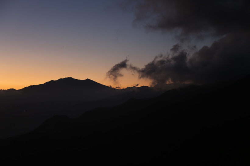
Pirates of the Tropical Sky: The Extraordinary World of Frigatebirds in Panama

Few birds are as instantly recognizable or as fascinating as the frigatebird. With their enormous wings, sharply forked tails, and almost otherworldly ability to remain aloft for days at a time, frigatebirds are among the true masters of the tropical skies. In Panama, where the Caribbean Sea meets the Pacific Ocean and where thousands of islands, mangrove forests, coral reefs, and coastal wetlands create an abundance of marine habitats, frigatebirds are a constant presence. They drift high above fishing boats, circle over remote islands, patrol coastal bays, and soar effortlessly along ocean currents. To many visitors, their dark silhouettes against a brilliant blue sky become one of the defining images of Panama's coastlines. Yet beneath their graceful appearance lies a remarkable story of adaptation, survival, and aerial mastery that has allowed these birds to dominate tropical oceans across the world.

Frigatebirds are among the most extraordinary flying animals on Earth. Unlike most seabirds, they possess wings that are incredibly long relative to their body size. Their wingspan can exceed two meters, yet their bodies remain surprisingly lightweight. This design allows them to exploit rising air currents with astonishing efficiency. Watching a frigatebird in Panama often raises a simple question: does it ever flap its wings? The answer is yes, but far less frequently than many other birds. Frigatebirds are experts at soaring. They can spend hours gliding above the ocean while expending very little energy, banking gracefully through invisible currents of air as they search for food or travel between feeding grounds. Scientists have discovered that frigatebirds can remain airborne for extended periods, even sleeping while soaring at great heights over the ocean. This ability places them among the most accomplished aerial specialists in the entire animal kingdom.

Panama provides ideal conditions for frigatebirds because of its unique geography. Few countries possess coastlines on two oceans separated by such a short distance. On the Caribbean side, archipelagos such as Bocas del Toro and the San Blas Islands offer countless nesting and feeding opportunities. On the Pacific side, island groups such as Coiba National Park, the Pearl Islands, and the waters surrounding the Gulf of Chiriquí National Marine Park provide equally rich habitats. The country's extensive coastlines support large populations of fish and other marine life, creating feeding opportunities that attract frigatebirds year round. Warm tropical temperatures and consistent ocean winds further enhance conditions for these birds, making Panama one of the best places in Central America to observe them.

One of the most remarkable characteristics of frigatebirds is their unusual relationship with water. Although they are seabirds and spend most of their lives near the ocean, they are surprisingly poor swimmers. Unlike pelicans, gulls, or many other marine birds, frigatebirds cannot comfortably rest on the water's surface. Their feathers are not as waterproof as those of many seabirds, and their lightweight bodies make prolonged contact with water risky. As a result, they have evolved a lifestyle that minimizes the need to land on the ocean. Instead, they capture prey near the surface while remaining airborne or snatch food from other birds in flight. This adaptation has led to one of the behaviors for which frigatebirds are most famous: aerial piracy.

The nickname "pirates of the sky" is not an exaggeration. Frigatebirds are notorious for stealing food from other seabirds. They often target species such as boobies, terns, and gulls returning from successful fishing trips. Once a potential victim is spotted, the frigatebird begins an aerial pursuit. With remarkable agility, it chases the other bird through the sky, harassing it until the frightened bird drops its catch. Before the fish can fall into the ocean, the frigatebird swoops down and catches it in midair. This behavior, known as kleptoparasitism, is one of the most dramatic spectacles in tropical marine ecosystems. Along Panama's coastlines, observers occasionally witness these aerial chases unfolding above bays and islands, providing a glimpse into the competitive world of seabirds. Despite their reputation as thieves, frigatebirds are also skilled hunters in their own right and consume flying fish, squid, and a variety of other marine organisms.

Perhaps no feature of the frigatebird is more famous than the bright red throat pouch displayed by males during the breeding season. This inflatable sac can expand into a brilliant scarlet balloon that contrasts dramatically with the bird's otherwise dark plumage. During courtship, males perch in colonies and inflate their pouches while rattling their bills and spreading their wings in elaborate displays designed to attract females. The sight is one of the most unusual and unforgettable spectacles in the bird world. In nesting colonies throughout tropical regions, dozens or even hundreds of males may sit with their red pouches fully inflated, transforming coastal trees into living displays of color and movement. Although nesting colonies are often located in remote or protected areas, Panama's islands and coastal reserves provide important breeding habitats for several frigatebird populations.

The islands of Panama play a particularly important role in the life cycle of these birds. Remote islands offer safety from many predators and provide suitable locations for nesting colonies. Mangrove forests, coastal shrubs, and low trees often become nesting sites where frigatebirds raise their young. The process requires patience. Frigatebirds have one of the longest parental care periods of any bird. Chicks remain dependent on their parents for many months, and successful breeding demands a substantial investment of time and energy. Because of this extended care period, frigatebirds generally raise fewer young than many other bird species. However, this strategy increases the likelihood that each chick survives and eventually joins the aerial ranks of its species.

For birdwatchers visiting Panama, frigatebirds are often among the easiest seabirds to identify. Their silhouettes are unmistakable. The combination of exceptionally long wings and deeply forked tails creates a shape unlike any other bird in the region. Even from great distances, experienced observers can recognize a frigatebird gliding overhead. They are especially common around coastal communities, fishing ports, islands, and marine protected areas. Visitors traveling by boat to islands in the Pacific or Caribbean frequently encounter frigatebirds soaring above the vessel, seemingly suspended motionless against the sky. Their effortless flight often inspires comparisons to kites, gliders, or even small aircraft. Unlike many birds that appear hurried or restless, frigatebirds project an image of complete confidence and control.

The ecological importance of frigatebirds extends far beyond their beauty. As top predators and scavengers within marine ecosystems, they help regulate populations of smaller organisms and contribute to the health of coastal food webs. Their nesting colonies also transport nutrients from the ocean to island ecosystems through droppings that enrich soils and support plant growth. In this way, frigatebirds act as ecological connectors, linking marine and terrestrial environments. Their presence often serves as an indicator of healthy coastal ecosystems, abundant fish populations, and productive ocean waters.

Panama's protected areas provide critical safeguards for frigatebirds and countless other marine species. Marine reserves, national parks, and island sanctuaries help preserve nesting habitats and feeding grounds that these birds depend upon. Protected regions such as Coiba National Park, a UNESCO World Heritage Site, support rich marine ecosystems that benefit frigatebirds and many other seabirds. Conservation efforts aimed at reducing habitat destruction, protecting mangrove forests, and maintaining healthy fisheries ultimately contribute to the long term survival of these remarkable birds. As coastal development and environmental pressures continue to increase throughout the tropics, the importance of preserving such habitats becomes even more apparent.

To watch a frigatebird soaring above Panama's coast is to witness one of nature's most extraordinary aerial specialists. These birds embody freedom in a way few creatures can. They travel immense distances over open oceans, ride invisible currents of air with effortless grace, and spend much of their lives suspended between sea and sky. Their existence is tied to the rhythms of tropical waters, ocean winds, and island ecosystems that have shaped their evolution over millions of years. Whether drifting above the turquoise waters of Bocas del Toro, circling over the remote islands of the Pacific, or gliding across the entrance to the Panama Canal, frigatebirds remain among the most captivating symbols of Panama's coastal wilderness. Their silhouettes against the tropical sky tell a story of endurance, adaptation, and mastery of flight that continues to inspire awe in everyone fortunate enough to look upward and watch these magnificent birds at work.

Masters of the Tropical Sky: The Remarkable Story of Swallow Tailed Kites in Panama

Few birds capture the imagination quite like the swallow tailed kite. With its gleaming white body, jet black wings, and deeply forked tail that seems to slice effortlessly through the air, this elegant raptor is often considered one of the most beautiful birds in the Americas. In Panama, where tropical forests meet mountains, rivers, coastlines, and vast stretches of wilderness, the swallow tailed kite is a familiar sight to birdwatchers and nature enthusiasts. Yet despite how graceful and seemingly carefree these birds appear as they drift high above the landscape, their lives are connected to one of the most extraordinary migration stories in the natural world. Every year, swallow tailed kites travel thousands of kilometers between North and South America, and Panama occupies a crucial position along this incredible journey. The country serves not only as an important migration corridor but also as a place where these magnificent birds can be observed soaring above forests, rivers, agricultural valleys, and even the outskirts of cities. Their annual movements link distant ecosystems across continents and remind observers that the skies above Panama are part of a much larger natural network stretching from the southeastern United States deep into South America.

The swallow tailed kite is a master of flight in a way that few other birds can match. Unlike many raptors that rely on powerful wingbeats, these birds seem to float effortlessly through the sky. They twist, glide, bank, and turn with astonishing precision, often appearing more like giant swallows than birds of prey. Their long, pointed wings and dramatically forked tails allow them to perform aerial maneuvers that seem almost impossible. Observers frequently watch them changing direction without a single wingbeat, riding invisible currents of warm air while covering enormous distances. In Panama, this graceful flight is often seen over forested hillsides, river valleys, and open landscapes where thermals help lift the birds higher and higher into the sky. The sight of a swallow tailed kite circling above a tropical forest against a backdrop of green mountains and white clouds is one of the most memorable experiences that birdwatchers can have in the country.

Panama occupies a uniquely important position in the migration route of swallow tailed kites because it forms the narrow bridge between North and South America. This slender isthmus funnels millions of migrating birds through a relatively small geographic area, creating one of the world's greatest migration spectacles. For swallow tailed kites, Panama is both a passageway and a vital resting and feeding region. Birds traveling south from North America must eventually cross Central America, and Panama represents one of the final stages before they enter the vast landscapes of South America. During migration periods, observers may witness groups of kites soaring together over ridges and forests as they continue their long journey. The country's geography channels these birds through mountain ranges, valleys, and lowland corridors where favorable wind conditions help them conserve energy. Because of this, Panama has become one of the best places in the world to observe migrating raptors, and swallow tailed kites are among the most admired participants in this aerial movement.

The migration itself is astonishing in scale. Many swallow tailed kites that breed in the southeastern United States undertake journeys of several thousand kilometers every year. After raising their young during the northern summer, they begin moving southward. Their route carries them across the Gulf Coast, through Mexico and Central America, and eventually into South America, where they spend the non breeding season. Some individuals travel all the way to regions of Brazil, Bolivia, Paraguay, and northern Argentina. The journey requires remarkable endurance and precise navigation. Unlike human travelers who rely on maps, technology, and transportation networks, these birds navigate using instincts shaped by countless generations of evolution. They locate favorable weather patterns, exploit rising air currents, and move through landscapes that they have never consciously learned. Each migration represents a triumph of natural adaptation, demonstrating abilities that continue to fascinate scientists and bird enthusiasts alike.

Panama's forests provide critical resources for migrating swallow tailed kites. Although they spend much of their lives in the air, these birds depend on healthy ecosystems below. Swallow tailed kites feed on a variety of prey, including insects, small reptiles, frogs, and other small animals that they often capture without landing. Their hunting style is as elegant as their flight. Rather than perching and waiting for prey like many raptors, they frequently snatch food directly from vegetation while gliding through the air. In Panama's tropical forests, where biodiversity is exceptionally rich, these birds can find abundant feeding opportunities during migration. Forest edges, river corridors, wetlands, and secondary growth areas are especially valuable because they support large populations of insects and other prey species. The health of these ecosystems directly influences the success of migration, highlighting the importance of conservation efforts throughout the country.

One of the most fascinating aspects of swallow tailed kites is their relationship with weather and atmospheric conditions. These birds are experts at reading the sky. They rely heavily on thermals, which are rising columns of warm air created when the sun heats the ground. By circling within these invisible elevators, the birds can gain altitude with minimal effort. Once high enough, they glide long distances before finding another thermal and repeating the process. This strategy allows them to travel efficiently over vast distances while conserving energy. In Panama, where tropical sunlight and varied topography create excellent soaring conditions, swallow tailed kites often spend hours circling high above ridges and valleys. During migration, favorable weather can produce impressive concentrations of birds moving through the same areas. Birdwatchers stationed at strategic observation points sometimes witness dozens or even hundreds of raptors sharing the same airspace as they take advantage of ideal conditions.

The country's protected areas play an essential role in safeguarding these magnificent migrants. National parks and reserves such as Soberanía National Park, La Amistad International Park, and Darién National Park protect vast expanses of habitat that benefit countless migratory species. While swallow tailed kites may spend only part of the year in any particular location, their survival depends on a chain of healthy ecosystems extending across continents. Conservation in Panama therefore contributes not only to local biodiversity but also to the success of migration systems that connect North and South America. Every protected forest corridor, river basin, and wetland becomes part of a larger network supporting one of nature's most impressive movements.

Birdwatchers visiting Panama often rank swallow tailed kites among their favorite sightings. Unlike some tropical birds that remain hidden deep within dense vegetation, these raptors are frequently visible against open skies, allowing prolonged observation of their behavior. Popular birding destinations throughout the country offer opportunities to see them, especially during migration seasons. Along forest roads, near rivers, above agricultural valleys, and over mountain ridges, observers may suddenly notice a distinctive silhouette gliding overhead. The deeply forked tail immediately distinguishes the bird from any other raptor in the region. For many visitors, seeing a swallow tailed kite soaring above the rainforest becomes one of the defining memories of their trip. The combination of beauty, grace, and the knowledge that the bird may be undertaking a journey spanning continents creates a sense of wonder that few wildlife encounters can equal.

The future of swallow tailed kites remains closely tied to the health of the landscapes through which they migrate. Habitat loss, deforestation, changes in land use, and climate related shifts in weather patterns all have the potential to affect migration routes and feeding opportunities. Because these birds depend on ecosystems across multiple countries, their conservation requires international cooperation. Fortunately, increasing awareness of migratory bird conservation has highlighted the importance of preserving critical habitats throughout the Americas. Panama's role within this effort is especially significant because of its strategic geographic position. By protecting forests, maintaining ecological corridors, and supporting conservation initiatives, the country helps sustain one of the great natural phenomena of the Western Hemisphere.

To watch a swallow tailed kite in Panama is to witness a creature perfectly adapted to life between continents. It is a bird that spends much of its existence riding winds that connect distant forests, rivers, and mountain ranges. It links the cypress swamps and woodlands of the southeastern United States with the immense tropical landscapes of South America. Along the way, Panama serves as one of its most important gateways. High above the rainforest canopy, over rolling hills and winding rivers, these birds continue a migration that has unfolded for countless generations. Their effortless flight conceals an extraordinary story of endurance, navigation, and survival. For those fortunate enough to look skyward at the right moment, the sight of a swallow tailed kite drifting across the Panamanian sky offers a glimpse into one of the most elegant and awe inspiring journeys in the natural world.

Love All: The Complete Story of Tennis in Panama

Tennis in Panama occupies a fascinating space within the country's sporting culture. While baseball often dominates conversations in many provinces and soccer captures national attention during major international competitions, tennis has quietly built a passionate and diverse community that stretches from the skyscraper districts of Panama City to mountain towns in Chiriquí and beach communities along both coasts. What makes tennis in Panama particularly interesting is that it appeals to such a wide range of people. On any given day, a court might be occupied by a young junior player dreaming of representing the country, a retiree enjoying an active lifestyle, a business executive fitting in a morning match before work, or a newly arrived expatriate searching for friends and a sense of community. Unlike some sports that require large teams or specialized environments, tennis offers a unique combination of competition, exercise, social interaction, and lifelong participation. In Panama's warm tropical climate, where outdoor activities are possible throughout most of the year, tennis has found ideal conditions to flourish. The result is a sporting landscape that is far richer and more extensive than many visitors or even residents realize.

The history of tennis in Panama is closely connected to the country's international character. During the era of canal construction and later throughout the years of the Canal Zone, foreign communities helped introduce and popularize the game. American influence played a particularly important role, with courts being constructed in residential areas, military installations, and recreational facilities connected to canal operations. Over time, Panamanians embraced the sport and began establishing their own clubs, organizations, and competitive structures. What started as a pastime enjoyed by relatively small groups gradually expanded into a nationwide activity supported by schools, sports federations, private clubs, and local communities. Today the sport is governed by the Federación Panameña de Tenis, which oversees tournaments, player development, coaching certification, junior programs, and international representation. The federation has worked to strengthen the sport at every level, creating opportunities for players of all ages to participate while helping promising young athletes pursue competitive careers.

For anyone interested in playing tennis in Panama, the capital city is unquestionably the center of activity. Panama City contains the highest concentration of courts, coaches, clubs, tournaments, and active players in the country. The national federation's facilities serve as one of the most important hubs for tennis development and competition. Players can find organized leagues, tournaments, coaching programs, youth development initiatives, and recreational opportunities throughout the year. The atmosphere is often welcoming to newcomers, and many players report that joining classes or clinics is one of the fastest ways to become part of the local tennis community. Unlike in some countries where tennis clubs can feel exclusive or difficult to access, many Panamanian facilities actively encourage participation from players of varying skill levels. Whether someone has never held a racquet before or has years of competitive experience, there are opportunities to find suitable instruction and playing partners.

One of the most appealing aspects of tennis in Panama is the variety of playing environments available. There are traditional tennis clubs with multiple courts and organized memberships, residential communities that maintain courts for residents and guests, public facilities that provide affordable access, and sports complexes that host both casual and competitive play. Some courts are located in dense urban neighborhoods surrounded by high-rise buildings, while others are nestled among trees in quieter former Canal Zone areas where players can enjoy a more relaxed atmosphere. The diversity of settings gives tennis in Panama a unique character. A player might spend one weekend competing in a tournament at a major facility and the next enjoying a casual doubles match in a leafy residential neighborhood where tropical birds provide the soundtrack.

Among the most valuable resources for players seeking affordable tennis are the public courts scattered throughout Panama City. Perhaps the best known are those located within Parque Omar, one of the city's most beloved green spaces. The park attracts runners, cyclists, families, fitness enthusiasts, and sports lovers from across the capital. Tennis courts within the park provide an opportunity for residents to enjoy the game without necessarily committing to a private club membership. The atmosphere is distinctly Panamanian, with players often sharing courts, exchanging tips, and welcoming newcomers into informal games. For many people, Parque Omar serves as an introduction to tennis and remains a favorite place to play even after they have joined more formal organizations. The experience of playing beneath tropical skies while surrounded by one of the city's largest parks is something that many local players cherish.

Another important part of Panama's tennis culture can be found in the former Canal Zone areas such as Clayton and Cárdenas. These neighborhoods are known for their greenery, spacious layouts, and sporting infrastructure. Many courts in these areas were originally constructed during the Canal Zone era and continue to serve active communities today. The setting is often remarkably peaceful compared with the busier sections of Panama City. Large trees, abundant wildlife, and lower traffic levels create an environment that feels almost suburban despite being within the metropolitan area. For tennis players, these neighborhoods offer some of the most pleasant playing conditions in the capital. The combination of quality facilities and natural surroundings has made these areas particularly popular among both local residents and expatriates.

The social dimension of tennis in Panama is every bit as important as the athletic aspect. Many people initially join the sport for fitness but remain involved because of the friendships and connections they develop. Tennis creates natural opportunities for interaction, whether through doubles matches, clinics, tournaments, or casual practice sessions. Panama's international population contributes significantly to this dynamic. Players from North America, Europe, South America, Asia, and throughout Central America frequently share courts with Panamanians, creating a uniquely multicultural environment. Conversations before and after matches often cover topics ranging from travel and business to local culture and current events. For expatriates who have recently arrived in the country, tennis can provide one of the quickest pathways into a social network. Long-term residents frequently describe the local tennis community as welcoming and inclusive, making it easier for newcomers to establish friendships and feel connected to their surroundings.

Outside the capital, tennis continues to thrive in surprising ways. In the highlands of Chiriquí, particularly around towns such as Boquete and Bambito, expatriate communities have helped sustain active tennis scenes. The cooler mountain climate is particularly attractive to players who prefer milder temperatures than those found along the coast. Courts in these regions often enjoy spectacular views of mountains, forests, and agricultural landscapes. The sport has become integrated into the lifestyle of many residents, particularly retirees and long-term foreign residents who appreciate the combination of physical activity and social engagement. Informal leagues, community tournaments, and regular doubles matches contribute to vibrant local tennis cultures that are sometimes hidden from casual visitors.

Beach communities have also emerged as important centers of tennis activity. Places such as Coronado have developed substantial sporting infrastructures in response to growing populations of retirees, vacation homeowners, and expatriates. Tennis courts are common features in residential developments, and organized play is readily available throughout the year. The lifestyle appeal is obvious. Residents can spend the morning playing tennis, enjoy lunch overlooking the Pacific Ocean, and finish the day watching the sunset on the beach. For many people, this combination represents one of the most attractive aspects of living in Panama.

Youth development remains one of the most important priorities for the future of tennis in the country. Across Panama, increasing numbers of children are being introduced to the sport through schools, academies, and federation-supported programs. Modern coaching methods emphasize fun, skill development, and gradual progression, allowing young players to build confidence while learning the fundamentals. The hope is that continued investment in junior tennis will produce future generations of competitive athletes capable of representing Panama on larger international stages. Even for those who never pursue professional careers, participation in tennis teaches valuable lessons about discipline, perseverance, sportsmanship, and personal responsibility. These qualities help explain why many parents view tennis as an excellent activity for their children.

Perhaps the most remarkable aspect of tennis in Panama is how effectively it bridges different worlds. It connects young and old, locals and foreigners, beginners and experts, casual players and serious competitors. It can be enjoyed in public parks, private clubs, residential neighborhoods, mountain towns, and coastal communities. The sport reflects many of the same qualities that define Panama itself: diversity, international influence, accessibility, and a strong sense of community. For anyone considering taking up tennis in Panama, the opportunities are extensive and continually expanding. Whether the goal is improving fitness, making friends, competing in tournaments, or simply enjoying time outdoors in a beautiful tropical setting, tennis offers a rewarding pathway into one of the country's most welcoming and dynamic sporting communities. As Panama continues to grow and evolve, there is every reason to believe that tennis will remain an increasingly important part of its recreational and social landscape for generations to come.

Where Gold Met the Ancestors: The Silent Kingdom Beneath the Fields of El Caño

In the quiet agricultural landscape of central Panama, where sugarcane waves under the tropical sun and the land appears at first glance to be ordinary farmland, there exists a place that completely reshapes what most people imagine when they think about ancient civilizations in the Americas. This place is the archaeological complex of El Caño Archaeological Site, a site that does not announce itself with towering stone pyramids or visible ruins rising above the earth, but instead hides its significance in layers of soil, burial chambers, ceremonial deposits, and extraordinary objects made of gold that once reflected the authority of powerful leaders long before the arrival of Europeans.

El Caño is not a city in the traditional sense. It is something more mysterious and arguably more revealing. It is a ritual landscape, a sacred ground where the living once interacted with the dead in ways that shaped political authority, social order, and spiritual belief. The people who built and used this place belonged to the ancient Gran Coclé cultural tradition, a network of chiefdom societies that thrived in what is now central Panama between roughly the seventh and eleventh centuries of the common era. These societies were not isolated. They were connected through trade, ceremony, marriage alliances, and shared symbolic systems that stretched across regions of Panama and into neighboring lands.

What makes El Caño so remarkable is the way it preserves evidence of leadership and ritual power. Instead of stone monuments, the builders created earthen platforms and carefully shaped mounds that served as foundations for ceremonial activity. Within and beneath these structures, they placed burials of individuals who held high status in their society. These were not simple graves. They were carefully constructed ritual events designed to communicate power, lineage, and divine connection. The soil itself became a stage on which authority was expressed and remembered.

When archaeologists began serious investigation of El Caño in the early decades of the twenty first century, they uncovered something that immediately changed the understanding of ancient Panama. They found intact burial complexes containing human remains accompanied by a vast array of offerings. These included finely crafted ceramic vessels, stone ornaments, shell beads, and most strikingly, objects made of gold. The presence of gold in such quantities and in such deliberate ceremonial arrangement revealed that this was a society in which material wealth and spiritual meaning were deeply intertwined. Gold was not simply decoration. It was a substance associated with sacred power, solar symbolism, and transformation.

The burials at El Caño appear to represent individuals who were not only political leaders but also ritual figures. Their interment was likely part of elaborate ceremonies that involved community participation, offerings, and possibly acts of ritual sacrifice. The positioning of bodies, the arrangement of objects, and the construction of burial spaces suggest that death was not seen as an ending but as a transition into another form of existence that continued to influence the living world. Ancestors were likely believed to maintain a presence, and their tombs may have functioned as active ritual sites long after the initial burial.

One of the most fascinating aspects of El Caño is how it reveals the structure of ancient leadership. The society that created it was not organized as a centralized empire but rather as a series of interconnected chiefdoms. Power was concentrated in the hands of elites who derived authority from both hereditary position and ritual expertise. These leaders likely controlled access to trade goods, agricultural production, and ceremonial knowledge. Their burial at El Caño, accompanied by elaborate offerings, served as a final public affirmation of their status and role within society.

The objects found within the site tell a story of long distance interaction and cultural sophistication. Gold ornaments shaped into animals and symbolic figures suggest a complex belief system in which humans, animals, and spiritual forces were interconnected. Ceramic vessels decorated with intricate patterns indicate a highly developed artistic tradition. The variety of materials, including marine shell and exotic stones, demonstrates that the people of El Caño were part of extensive exchange networks that linked different ecological zones and cultural regions.

The physical structure of the site itself is equally significant. El Caño is composed of layered earthworks that were deliberately constructed over time. These layers contain evidence of repeated use, meaning the site was not a single event location but a place of ongoing ceremonial importance. Archaeologists have identified posthole patterns that suggest wooden structures once stood above some burial areas, possibly serving as shrines or ceremonial halls. Burned layers in certain areas may indicate ritual cleansing or the closing of ceremonial cycles. Each layer of soil represents a different moment in a long history of ritual activity, effectively turning the ground into an archive of memory.

What distinguishes El Caño from many other archaeological sites is the clarity with which it shows the relationship between death and political authority. In this society, leadership was reinforced through ceremonial burial practices that transformed deceased elites into enduring ancestral figures. These ancestors likely played a role in legitimizing the authority of their descendants. By maintaining and visiting burial sites, the living reinforced social hierarchy and continuity across generations.

The discovery of El Caño also reshaped broader understanding of ancient Panama. For many years, the region was underestimated in global archaeological narratives, often overshadowed by the monumental stone cities of other parts of the Americas. El Caño demonstrates that complexity does not always require massive architecture. Instead, it shows that earth, ritual, and symbolic objects can create equally powerful expressions of civilization. The sophistication of its burial practices, artistic production, and social organization places it among the most important ceremonial centers in the region.

Today, the site remains an active focus of archaeological research. Each excavation season adds new details to the understanding of how these ancient communities lived, died, and organized their world. The careful recovery of artifacts and human remains continues to provide insight into health, diet, social structure, and belief systems. Researchers are gradually reconstructing a picture of a society that was deeply connected to its environment and guided by complex spiritual ideas.

Yet even with modern scientific study, El Caño retains an aura of mystery. It is a place where the visible landscape reveals almost nothing of its true significance. There are no towering ruins to announce its importance. Instead, its greatness lies hidden beneath the surface, waiting to be uncovered layer by layer. This quiet presence gives the site a unique character. It invites imagination as much as analysis, encouraging us to consider how many other ancient worlds may still lie concealed beneath seemingly ordinary land.

El Caño ultimately stands as a reminder that history is not always written in stone. Sometimes it is written in earth, in memory, and in objects carefully placed with intention and meaning. It tells the story of a society that understood leadership as something sacred, that viewed death as transformation, and that used ritual to connect the human world with forces beyond it. In the silent fields of Natá, that story continues to endure, waiting for each new discovery to bring it further into the light.

Río Hato: Pacific Coast Airstrip, Beach Gateway, and the Quiet Engine of Coclé’s Tourism Coast

Stretching along the sun baked Pacific lowlands of central Panama lies a place most travelers only associate with arrivals and departures, yet it is quietly surrounded by some of the country’s most accessible beaches, resorts, and coastal landscapes. Río Hato is often thought of as a transit point, especially because of its international airport, but in reality it is a gateway to one of Panama’s most rapidly developing coastal corridors, where tourism, agriculture, military history, and Pacific ecosystems overlap in surprising ways.

At the center of Río Hato’s modern identity is the presence of Scarlett Martínez International Airport, a facility that has transformed what was once a quiet rural zone into one of the most convenient entry points to Panama’s Pacific beach region. For many visitors, this is where the beach experience begins. Instead of traveling hours from Panama City, travelers can now land directly beside some of the country’s most popular coastal destinations and be on the sand within minutes.

The airport itself sits on land that carries layers of history. Before becoming a civilian gateway, the area played a role in military aviation and regional infrastructure. The long, flat geography of Coclé’s Pacific plain made it ideal for airfields, training zones, and logistics operations. Over time, as Panama’s tourism industry expanded, this infrastructure was repurposed and modernized, helping to unlock the region’s potential as a direct access point for international visitors.

Today, landing in Río Hato feels different from arriving at a major urban hub like Panama City. Instead of skyscrapers, passengers see wide open plains, scattered vegetation, and a coastline that feels immediately close. The air is warm, heavy with humidity, and distinctly tropical. Within a short drive, the scenery shifts from runway surroundings to palm lined roads, beach access points, and resort developments along the Pacific coast.

Río Hato is strategically positioned within one of Panama’s most important tourism corridors. To the west lies the town of Coronado and the broader chain of Pacific beach communities that stretch toward Panama City. To the east, the coastline becomes quieter and more rural, with fishing villages, mangroves, and open stretches of sand. This middle position has made Río Hato a natural hub for both resort development and regional access.

The most well known beaches near Río Hato include the long stretches of Playa Blanca and surrounding resort areas. These beaches are characterized by soft sand, calm Pacific waters in certain seasons, and a landscape shaped by both natural forces and modern tourism infrastructure. Large hotels and residential developments coexist with undeveloped coastal areas, creating a blend of accessibility and open space that continues to evolve.

What makes this region especially interesting is the contrast between its quiet origins and its current role as a tourism magnet. For much of its history, Río Hato was primarily agricultural. The surrounding plains supported cattle ranching, rice cultivation, and small scale farming. Even today, agriculture remains an important part of the local economy, and it is not unusual to see farmland existing only a few kilometers from luxury resorts and international airports.

This dual identity gives Río Hato a layered character. On one hand, it is part of Panama’s growing coastal tourism industry. On the other, it remains deeply tied to rural life and production. Roads that lead to beaches often pass through open fields, rural homes, and grazing land, reminding visitors that this is still an active working landscape rather than a fully urbanized resort zone.

The climate plays a major role in shaping the experience of Río Hato. The region sits on Panama’s Pacific dry corridor, meaning it experiences a more pronounced dry season compared to the country’s rainforest heavy regions like Bocas del Toro or Colón. During the dry months, the landscape becomes golden, sunny, and ideal for beach tourism. In the rainy season, everything transforms into a vivid green, with dramatic skies and short but intense tropical showers.

Wildlife in the area reflects the coastal environment. Pelicans, frigatebirds, and herons are common along the shoreline. Inland, you may find cattle pastures bordered by tropical trees, small wetlands, and patches of secondary forest. The nearby Pacific waters also support fishing activity, which remains an important part of local life even as tourism expands.

One of the defining features of Río Hato’s modern identity is its connection to large scale hospitality development. Over the past decades, the coastline has seen the emergence of resorts, residential communities, and vacation infrastructure designed to take advantage of its accessibility. Unlike more remote beach destinations that require long travel times, Río Hato offers direct access from both Panama City and international flights, making it one of the most practical beach gateways in the country.

Despite this development, the surrounding region still retains pockets of quieter coastal life. Small fishing communities, undeveloped beach sections, and inland rural zones preserve a sense of balance between growth and tradition. This mix is part of what makes the area interesting: it is not fully urban, not fully rural, and not fully resort driven, but instead a transitional landscape constantly shifting between different identities.

Río Hato also benefits from its central position in Panama’s geography. It sits within reach of many of the country’s most visited destinations. To the east is Panama City, the cultural and economic capital. To the west lies the Azuero Peninsula with its strong folkloric traditions. To the north are the mountains and forests of central Panama. This accessibility makes Río Hato an ideal base for exploring multiple regions without long travel times.

In addition to tourism and agriculture, the region has an important transportation function. Roads connecting the Pan-American Highway to coastal resorts pass through Río Hato, reinforcing its role as a logistical link between inland Panama and the Pacific coast. This connectivity has helped drive its development and will likely continue shaping its future.

As the sun begins to set over Río Hato, the Pacific horizon becomes one of its most striking features. The sky often shifts through deep oranges, purples, and reds, reflecting across calm waters. Beachfront resorts, rural fields, and airport runways all sit under the same fading light, creating a unique visual contrast between natural beauty and human development.

Night brings a quieter atmosphere. While resorts remain active, much of the surrounding countryside becomes still. The sound of waves, insects, and distant activity from the coast defines the environment. Unlike large cities, light pollution is limited in many inland areas, allowing for clear night skies and a strong sense of tropical calm.

What ultimately defines Río Hato is its role as a transition zone. It is where international travel meets rural Panama, where agriculture meets tourism, and where quiet coastal landscapes meet growing development. Few places in the country illustrate this blend as clearly.

For travelers, it is often just an arrival point. But for those who look beyond the airport, Río Hato becomes something more interesting: a snapshot of modern Panama in motion. A place where infrastructure, nature, and tourism are converging in real time, shaping the future of one of the country’s most important coastal regions.

In a nation defined by the Panama Canal, mountain highlands, tropical islands, and historic cities, Río Hato represents another side of Panama’s identity. It is practical, evolving, accessible, and quietly essential. And while many people pass through it quickly on their way to the beach, it remains one of the most important gateways to understanding the Pacific coast of Panama today.

Santiago: The Quiet Capital of Veraguas and the True Crossroads of Panama

Right in the center of the country, where highways stretch outward toward every coast and where Panama’s geography begins to feel truly connected, lies a city that often gets overlooked but plays a far more important role than most travelers realize. Santiago is the capital of Veraguas Province and one of the most strategically positioned cities in all of Panama. It is a place where roads meet, cultures blend, agriculture thrives, and the rhythm of interior life defines everything from daily routines to national connectivity.

Unlike Panama City, with its skyline and global finance, or coastal towns that rely on tourism, Santiago has a quieter identity. It is a working city, a regional hub, and a gateway to nearly every corner of western and central Panama. Because of this, many travelers pass through it without realizing that they are standing in one of the most important crossroads in the entire country.

Geographically, Santiago sits almost perfectly in the middle of Panama. This central position has shaped its role for centuries. Long before modern highways existed, Indigenous groups moved through these lands connecting different regions of the isthmus. Later, Spanish colonial routes and rural trade paths followed similar patterns. Today, the modern Pan-American Highway and regional road systems converge here, making Santiago a natural stopping point for travel between Panama City, Chiriquí, the Azuero Peninsula, and the Caribbean provinces.

This connectivity has turned Santiago into a vital logistical and administrative center. Government offices, universities, hospitals, and commercial institutions all serve not only the city itself but the wider region of Veraguas. It is the kind of city that keeps Panama functioning behind the scenes, quietly supporting surrounding towns, villages, and rural areas.

At the heart of Santiago is a calm but active urban environment. The city is not defined by towering skyscrapers but by practical architecture, tree lined streets, public parks, and a layout that reflects steady growth over time. Life here moves at a measured pace. People know each other. Businesses are local. There is a strong sense of regional identity that ties residents not only to the city but to the province of Veraguas as a whole.

The central square and surrounding civic buildings serve as gathering points for community life. Churches, schools, and public institutions play an important role in daily routines. Unlike tourist driven destinations, Santiago’s energy comes from its residents rather than visitors, which gives it a grounded and authentic atmosphere.

One of Santiago’s greatest strengths is its role as a gateway to some of the most diverse landscapes in Panama. From the city, travelers can reach Pacific beaches, mountain forests, rivers, waterfalls, agricultural valleys, and Indigenous territories within a relatively short drive. This variety makes Santiago an ideal base for exploring a large portion of the country.

To the west lies the province of Chiriquí, known for its cool highlands and coffee growing regions. To the east, the Azuero Peninsula opens up with its dry landscapes and strong folkloric traditions. To the north, mountain ranges and forested areas lead toward the Caribbean watershed. To the south, the Pacific coast offers fishing communities, mangroves, and quiet beaches. Santiago sits at the center of all these directions, like a hub connecting Panama’s different natural worlds.

The surrounding province of Veraguas is one of the most ecologically diverse regions in the country, and Santiago serves as its main access point. Within Veraguas, visitors can find everything from cloud forests and volcanic landscapes to coral reefs and remote islands. One of the most famous nearby natural areas is Coiba National Park, a UNESCO World Heritage Site often compared to the Galápagos for its marine biodiversity.

Although Coiba lies offshore and requires a boat journey, Santiago is one of the main inland gateways for organizing trips to this extraordinary protected area. This connection between inland city and marine reserve highlights how Santiago bridges different ecosystems and travel experiences.

Agriculture is another defining feature of Santiago and its surroundings. The fertile lands of Veraguas support cattle ranching, rice production, sugarcane, corn, and a variety of fruits and vegetables. As a result, Santiago functions as a commercial hub where rural producers bring goods for trade, distribution, and sale.

Driving outside the city quickly reveals this agricultural foundation. Open fields stretch across valleys. Cattle graze under wide tropical skies. Small farms line rural roads. The landscape feels productive and lived in, reflecting generations of farming traditions that remain central to the local economy.

Markets in Santiago are an important part of this system. Farmers and vendors gather to sell fresh produce and goods, creating spaces that are both economic and social. These markets reflect the everyday life of the region far more than any tourist attraction could.

The culture of Santiago reflects its position in the interior of Panama. It is not heavily influenced by international tourism but instead shaped by provincial traditions, family networks, education, and agriculture. Festivals, religious celebrations, and civic events play an important role in maintaining community identity throughout the year.

Music and folklore are especially important in Veraguas. Traditional Panamanian styles can be heard during celebrations, often accompanied by dance and cultural exhibitions. While the region may not be as internationally famous for folklore as places like Las Tablas, it maintains its own strong regional expressions of Panamanian culture.

Education and healthcare also make Santiago a regional center. The presence of universities and medical facilities means that residents from surrounding towns and rural communities regularly travel to the city. This reinforces Santiago’s role as a support system for a wide geographic area.

The climate of Santiago is typically warm and tropical, with a clear distinction between dry and rainy seasons. During the dry months, the landscape can appear golden and sunlit, while the rainy season transforms the region into a lush green environment. Afternoon rains are common, often followed by dramatic skies and cooler evening temperatures.

Wildlife is present throughout the region, especially in rural and river areas. Birds are abundant, and the surrounding ecosystems support a variety of species typical of Panama’s interior. While Santiago itself is urban, it is never far from natural environments.

One of the most appealing aspects of Santiago is its authenticity. It is not a city designed for tourism, and that is exactly what makes it interesting. Life here reflects the real structure of Panama’s interior: agriculture, commerce, education, transportation, and community all working together in a balanced system.

As evening approaches, Santiago becomes quieter and more relaxed. Traffic slows, families gather in public spaces, and the warm light of sunset spreads across the city and surrounding hills. There is a calmness to the atmosphere that reflects the steady pace of life in Panama’s interior provinces.

At night, the city is modestly lit but active. Restaurants, parks, and local businesses continue to serve the community, while the surrounding countryside falls into darkness under wide, star filled skies. The contrast between urban center and rural surroundings becomes especially noticeable after sunset.

What ultimately makes Santiago important is not a single landmark or attraction, but its role as a connector. It links provinces, ecosystems, economies, and cultures. It is a place that supports travel, agriculture, education, and daily life across a large portion of Panama.

For travelers, Santiago is often a stopover. But for those who look closer, it becomes clear that the city represents something deeper. It is the functional heart of central Panama, a place where the country’s interior comes together in one cohesive hub.

In a nation known for canals, coastlines, islands, and mountains, Santiago represents the grounded reality that holds everything together. It is not flashy or famous, but it is essential. And like many of Panama’s interior cities, its true value is revealed not in postcards, but in the daily life of the people who call it home.

The Bridge of the Americas: The Monument That Connected Two Continents and Changed Panama Forever

There are few structures in Panama that symbolize the nation's importance to the world as powerfully as the Bridge of the Americas. Spanning the Pacific entrance of the Panama Canal, this massive steel arch bridge is far more than a transportation route. It is a symbol of connection, engineering achievement, national identity, and the unique geography that has made Panama one of the most strategically important countries on Earth.

For decades, the Bridge of the Americas stood as the only permanent roadway connecting North and South America across the Panama Canal. Millions of vehicles have crossed it. Countless travelers have photographed it. Ships from every corner of the globe have sailed beneath it. It remains one of Panama's most recognizable landmarks and one of the most significant engineering achievements in the nation's modern history.

Standing atop the bridge or viewing it from one of the many scenic overlooks nearby, it is difficult not to be impressed by the scale of what lies below. On one side stretches the vast Pacific Ocean. On the other lies the world famous Panama Canal. Massive cargo ships move slowly through the waterway while vehicles stream across the bridge overhead. The scene perfectly captures Panama's role as a nation that connects worlds.

Before the bridge existed, crossing the canal was a much more complicated process. Ferries transported vehicles and passengers between the eastern and western sides of the canal zone. While effective for its time, the system could not keep pace with the growing transportation demands of a rapidly developing country. As Panama expanded and road networks improved, the need for a permanent crossing became increasingly obvious.

Construction of the bridge represented a monumental challenge. Engineers had to design a structure capable of spanning one of the world's most important shipping channels while allowing enormous vessels to continue passing underneath. The solution was an elegant steel arch bridge that would become one of the engineering icons of Latin America.

When the bridge opened in 1962, it instantly transformed transportation in Panama. For the first time, vehicles could travel continuously across the canal without relying on ferries. The completion of the bridge strengthened the connection between Panama City and the western provinces while also completing a critical section of the legendary Pan-American Highway.

The significance of this achievement extended far beyond Panama. The bridge became one of the final links in a highway system stretching from Alaska to the southern reaches of South America. Travelers could now drive across an enormous portion of the Western Hemisphere while crossing one of the world's most famous waterways on a single structure.

The location of the bridge is particularly dramatic. It rises above the Pacific entrance of the Panama Canal, one of the busiest maritime corridors on Earth. Every day, ships carrying cars, electronics, grain, fuel, machinery, and countless other products navigate the channel below.

Watching a vessel pass beneath the bridge is an unforgettable experience. From above, the ships appear almost impossibly large. Container vessels stacked high with cargo move slowly through the canal waters. Cruise ships carrying thousands of passengers glide toward the Pacific. Tankers and bulk carriers continue the endless flow of global commerce that has defined Panama's role in world trade for more than a century.

The bridge provides one of the best vantage points for appreciating the scale of the canal itself. Looking down, visitors gain a perspective that few other locations can offer. The relationship between ships, water, infrastructure, and landscape becomes immediately clear. One begins to understand why Panama occupies such an important position in the global economy.

Beyond its engineering significance, the Bridge of the Americas has become a cultural symbol. For generations of Panamanians, it represents national progress and connectivity. It is frequently featured in photographs, films, documentaries, tourism campaigns, and educational materials. Its silhouette against the Pacific sky has become one of the defining images of the country.

The bridge is particularly spectacular at sunrise and sunset. During the early morning hours, golden light illuminates the steel structure while ships begin their daily journeys through the canal. The skyline of Panama City emerges in the distance, creating a scene that combines engineering, nature, and urban development in a single panorama.

Sunsets can be even more dramatic. The Pacific sky often erupts into shades of orange, red, pink, and gold. Reflections dance across the canal waters. The bridge becomes silhouetted against the fading light while vessels continue their transit beneath it. Photographers often consider these moments among the most beautiful in Panama.

Nearby viewpoints offer excellent opportunities to appreciate the bridge from different angles. One of the most popular locations is the area around Amador Causeway, where visitors can enjoy sweeping views of the bridge, the canal entrance, the Pacific Ocean, and the modern skyline of Panama City. The combination of these elements creates one of the most iconic landscapes in the country.

The engineering itself remains impressive even by modern standards. The bridge rises high above the water to accommodate the massive vessels that transit the canal. Its steel arch design combines strength, functionality, and elegance. Decades after its completion, it continues to perform its vital role while standing as a testament to the vision of the engineers and workers who built it.

The structure also occupies an important place in Panama's historical narrative. It was completed during a period when the nation was increasingly asserting its importance as a transportation hub and modernizing its infrastructure. The bridge became a physical representation of progress and national ambition.

For travelers arriving from western Panama, crossing the Bridge of the Americas often serves as a dramatic introduction to Panama City. As vehicles ascend the structure, the skyline gradually comes into view. The towers of the capital rise above the Pacific coast while ships navigate the canal below. It is one of the most memorable approaches to any city in Latin America.

For those leaving the capital, the bridge symbolizes the beginning of adventure. Beyond it lie the beaches of the Pacific coast, the mountains of Chiriquí, the agricultural heartlands of central Panama, and eventually the frontier regions near Costa Rica. Crossing the bridge often feels like a transition between different worlds.

Night brings yet another perspective. Illuminated against the darkness, the bridge becomes a glowing landmark visible from many parts of the city. Lights reflect off the canal waters below. Ships continue moving through the channel. The structure remains active around the clock, a reminder that Panama's role in global transportation never truly pauses.

The bridge has also witnessed countless historic moments. Heads of state, international delegations, tourists, truck drivers, commuters, cyclists, and adventurers have all crossed its span. For more than six decades, it has served as both an everyday transportation route and an enduring national symbol.

What ultimately makes the Bridge of the Americas so fascinating is that it represents multiple forms of connection at once. It physically connects the two sides of the Panama Canal. It forms part of the transportation link between North and South America. It connects Panama's past with its future. It joins engineering achievement with natural beauty.

In many ways, the bridge reflects the essence of Panama itself. This is a nation built upon connection. Oceans meet here. Continents meet here. Cultures meet here. Global trade flows through here. The Bridge of the Americas embodies all of these relationships in steel and concrete.

While larger bridges have since been built across the canal, including the impressive Centennial Bridge, the Bridge of the Americas retains a special place in the hearts of Panamanians. It was the pioneer, the first great crossing, and the structure that transformed transportation across the isthmus.

Today, millions of people continue to cross it every year, often without fully realizing the significance of the structure beneath their wheels. Yet for those who stop to appreciate its history, engineering, and setting, the Bridge of the Americas reveals itself as much more than a roadway.

It is a monument to human ingenuity, a gateway between continents, a symbol of national progress, and one of the most iconic landmarks in Panama. Rising above the Pacific entrance of the Panama Canal, it stands as a reminder that few places on Earth have connected the world as profoundly as Panama, and few structures symbolize that connection more perfectly than the Bridge of the Americas.

Tocumen International Airport: The Gateway to the Americas and the Front Door to Panama

For millions of travelers every year, their first impression of Panama is not a tropical beach, a rainforest trail, the Panama Canal, or the skyline of Panama City. Instead, it begins at Tocumen International Airport, the largest and busiest airport in Central America and one of the most important aviation hubs in the Western Hemisphere. More than simply an airport, Tocumen is the gateway through which travelers, businesses, cultures, and economies connect. It serves as Panama's front door to the world and has played a crucial role in transforming the country into one of Latin America's most important transportation centers.

Located on the eastern side of Panama City, approximately 24 kilometers from the downtown skyline, Tocumen occupies a position that perfectly reflects Panama's role in global transportation. Just as the Panama Canal connects oceans, Tocumen connects continents. Every day, aircraft arrive and depart carrying passengers from North America, South America, Europe, the Caribbean, and increasingly from destinations around the world. The airport has become a modern version of the country's historic role as a crossroads of global movement.

For many travelers arriving in Panama for the first time, the experience begins with a descent over the tropical landscape of the isthmus. Through airplane windows, passengers may catch glimpses of forests, rivers, neighborhoods, the Pacific Ocean, and eventually the sprawling urban landscape of Panama City. As the aircraft approaches Tocumen, it becomes immediately apparent that this is not a small regional airport. The extensive runways, terminals, cargo facilities, maintenance areas, and aircraft parking stands reveal the scale of an aviation hub operating on an international level.

The story of Tocumen is closely linked to Panama's remarkable economic growth and strategic location. While the country has long benefited from its position connecting two oceans, the rise of modern air travel created new opportunities. As aviation expanded throughout the twentieth century, Panama's geographic location made it an ideal place for connecting flights between North and South America. Few countries sit more conveniently between the major population centers of the hemisphere.

Over time, Tocumen evolved from a national airport into one of the most significant connecting hubs in the Americas. Today, travelers can board flights in cities as diverse as New York, Toronto, Buenos Aires, São Paulo, Bogotá, Madrid, Mexico City, Lima, San José, Santiago, Miami, and dozens of others, all connected through Panama. The airport's importance has grown so dramatically that it is often referred to as the "Hub of the Americas," a nickname that reflects its role in linking countries and cultures across the hemisphere.

The airport's strategic significance becomes particularly apparent when examining a map. Panama occupies a narrow strip of land between two continents and two oceans. This unique geography allows airlines to efficiently connect passengers traveling between North and South America. Instead of requiring multiple connections through distant cities, travelers can often transfer through Tocumen with remarkable convenience. This efficiency has helped establish Panama as one of the leading aviation centers in Latin America.

Walking through Tocumen reveals the truly international nature of the facility. Languages from around the world can be heard in the terminals. Business travelers rush to meetings. Backpackers begin adventures across Central and South America. Families reunite after long journeys. Tourists arrive eager to explore Panama's beaches, mountains, islands, and rainforests. Every day, thousands of personal stories intersect within the airport's halls.

The airport's architecture and infrastructure reflect its growing importance. Modern terminals accommodate millions of passengers annually. Expansions over the years have added gates, services, commercial areas, and technological improvements designed to handle increasing demand. The development of new facilities has transformed Tocumen into one of the most advanced airports in the region.

One of the most remarkable aspects of the airport is the sheer variety of destinations it serves. From tropical Caribbean islands to major global capitals, the route network extends across vast distances. This connectivity has played a crucial role in Panama's economic success, facilitating tourism, trade, investment, and international cooperation.

The cargo operations at Tocumen are equally significant. While passengers often receive the most attention, enormous quantities of goods pass through the airport every year. Electronics, pharmaceuticals, flowers, seafood, machinery, and countless other products move through Panama on their way to markets around the world. These operations complement the country's maritime transportation networks and reinforce Panama's role as a global logistics center.

Closely tied to the success of Tocumen is Copa Airlines, the national carrier that has helped transform Panama into one of the most connected countries in Latin America. Through its extensive route network, the airline has turned Tocumen into one of the hemisphere's most efficient connecting hubs. Travelers frequently transit through Panama without even leaving the airport, illustrating the strategic importance of the facility.

For aviation enthusiasts, Tocumen offers endless fascination. Aircraft from around the world arrive throughout the day. Modern airliners line the gates. Ground crews coordinate complex operations. Air traffic controllers manage a constant flow of arrivals and departures. The airport functions as a carefully orchestrated system where thousands of moving parts work together to keep global transportation flowing smoothly.

Beyond its transportation role, Tocumen serves as an introduction to Panama itself. Many visitors begin forming impressions of the country while passing through immigration, customs, restaurants, and terminal facilities. The airport often acts as a preview of what awaits beyond its walls.

For travelers heading into Panama City, the journey from the airport reveals one of the most dramatic urban skylines in Latin America. Modern skyscrapers rise above the Pacific coast. Residential neighborhoods spread across rolling terrain. Green spaces and waterways weave through the urban landscape. The contrast between tropical nature and modern development becomes immediately apparent.

For others, Tocumen is merely the beginning of a larger adventure. Some continue toward the beaches of the Pacific coast. Others head for the cloud forests of Boquete, the islands of Bocas del Toro, the Indigenous territories of the Caribbean, or the wildlife rich jungles of Darién. Regardless of destination, Tocumen serves as the common starting point.

The airport also plays a critical role during emergencies and humanitarian operations. Because of its strategic location and infrastructure, it often serves as a staging point for relief efforts responding to natural disasters throughout the region. Its ability to move people and supplies quickly has made it an important asset beyond commercial aviation.

Economic impact extends far beyond the airport grounds. Thousands of people work directly at Tocumen in aviation, security, customs, maintenance, retail, logistics, and administration. Many thousands more depend indirectly on the economic activity generated by tourism, cargo transportation, and international business connected to the airport.

As night falls, Tocumen takes on another dimension. Runway lights illuminate the tropical darkness. Aircraft continue arriving from distant cities. Departure boards display destinations across multiple continents. The flow of passengers never truly stops. While much of the country sleeps, the airport remains active, linking Panama to the rest of the world around the clock.

What makes Tocumen particularly fascinating is how perfectly it reflects Panama's broader identity. Throughout history, Panama has thrived because of its location. The Spanish treasure routes crossed the isthmus. The railroad connected oceans. The Panama Canal revolutionized global shipping. Today, Tocumen continues that tradition in the age of aviation.

Like the canal, the airport serves as a bridge between regions, economies, and cultures. It demonstrates how geography can shape a nation's destiny and how strategic vision can transform that geographic advantage into economic opportunity.

For many visitors, Tocumen is simply a place to catch a flight. For others, it is the beginning of an unforgettable journey through Panama. Yet on a larger scale, it represents something much greater. It is one of the key transportation hubs of the Americas, a vital engine of economic growth, and a symbol of Panama's role as a nation that connects the world.

Whether welcoming tourists, facilitating international commerce, reuniting families, or linking continents through modern air travel, Tocumen International Airport remains one of the most important pieces of infrastructure in Panama. It is far more than an airport. It is the modern gateway to a country whose history has always been defined by connection, movement, and the meeting of worlds.

Tolé: The Overlooked Mountain Gateway of Western Panama and One of Chiriquí’s Hidden Treasures

For most travelers crossing western Panama, the town of Tolé appears briefly through the windshield before disappearing behind them as they continue toward David, Boquete, Volcán, or Costa Rica. Yet those who slow down and explore quickly discover that Tolé is much more than a stop along the Pan American Highway. It is one of the most fascinating and underrated regions in western Panama, a place where mountains, rivers, Indigenous culture, agriculture, cloud forests, and remarkable biodiversity combine to create a destination that remains largely unknown to international tourism.

Located in the eastern portion of Chiriquí Province, Tolé occupies a strategic position between the Pacific lowlands and the mountainous interior of western Panama. This geography gives the region an incredible diversity of landscapes. Within a relatively short distance, visitors can travel from warm tropical valleys to cool mountain ridges, from cattle pastures to dense forests, and from agricultural communities to remote Indigenous settlements. Few areas of Panama offer such variety while remaining so untouched by mass tourism.

The landscape surrounding Tolé is immediately striking. Rolling hills extend toward the horizon in every direction. Rivers carve through valleys lined with tropical vegetation. Forested mountains rise in the distance. During the rainy season, the countryside becomes intensely green, creating scenery that feels almost impossibly lush. Even during the dry season, the region retains a rugged beauty characterized by open views, dramatic skies, and a sense of vastness that is increasingly rare in a rapidly developing world.

One of the most appealing aspects of Tolé is that it still feels authentically rural. Unlike some destinations that have been transformed by tourism, Tolé remains deeply connected to agriculture and local traditions. The region's economy is built upon farming, cattle ranching, and small scale commerce. Generations of families have worked the land here, creating communities whose identities remain closely tied to the natural environment.

Driving through the countryside reveals endless examples of this connection. Cattle graze on hillsides overlooking distant valleys. Small farms produce crops that supply local markets. Horses remain a common sight. Rural roads wind through landscapes that appear much as they would have decades ago. The result is a region that offers visitors a glimpse into a side of Panama that many travelers never experience.

Agriculture plays a particularly important role in the area's identity. The fertile soils and varied elevations support a wide range of crops. Corn, beans, vegetables, fruits, and livestock all contribute to the local economy. The agricultural traditions of Tolé are not merely economic activities. They are part of a cultural heritage passed from one generation to the next.

Yet the true magic of Tolé lies in the natural landscapes that surround it. The district serves as a gateway to some of western Panama's most beautiful and least explored mountain environments. Forested ridges rise above the valleys. Hidden rivers flow through remote canyons. Waterfalls emerge from dense vegetation. Every road seems to lead toward another scenic viewpoint or undiscovered corner of the countryside.

The mountains surrounding Tolé form part of a broader highland system that extends across western Panama and into neighboring Costa Rica. These elevations create a variety of microclimates that support extraordinary biodiversity. As travelers move higher into the hills, temperatures become cooler and vegetation changes dramatically. Tropical forests gradually transition into cloud forest environments filled with mosses, orchids, ferns, and countless other plant species.

These forests provide habitat for an astonishing range of wildlife. Birdwatchers are particularly drawn to the region because of its incredible avian diversity. Hummingbirds dart between flowering plants. Toucans move through the canopy. Hawks circle overhead. Colorful tanagers brighten forest edges. In some of the higher and more remote forests, fortunate observers may even encounter the legendary Resplendent Quetzal, one of the most sought after birds in the Americas.

The rivers of Tolé are another defining feature of the landscape. Fed by abundant rainfall in the surrounding mountains, these waterways support agriculture, wildlife, and local communities. Some flow gently through valleys lined with farmland, while others rush through rocky gorges hidden within dense forests. During the rainy season, the rivers become particularly dramatic, carrying enormous volumes of water from the mountains toward the Pacific.

For outdoor enthusiasts, these rivers offer opportunities for exploration, photography, and relaxation. Natural swimming areas can often be found in quieter sections of the waterways, providing refreshing escapes from the tropical heat. The sound of rushing water is a constant companion throughout much of the region.

One of the most fascinating aspects of Tolé is its connection to Panama's Indigenous cultures. The district lies near territories associated with the Ngäbe people, the largest Indigenous group in Panama. Indigenous communities throughout the broader region maintain traditions, languages, agricultural practices, and cultural identities that have survived for centuries.

These cultural influences enrich the character of the area and provide insight into a history that predates the arrival of Europeans by thousands of years. The presence of Indigenous communities serves as a reminder that western Panama is not only a region of natural beauty but also a place of deep cultural significance.

The climate of Tolé contributes greatly to its appeal. Lower elevations tend to be warm and tropical, while higher areas enjoy cooler temperatures and refreshing mountain air. This variation allows visitors to experience multiple environments within a relatively small geographic area. A morning may begin in a warm valley and end on a cool ridge overlooking distant mountain ranges.

During the rainy season, clouds often drift dramatically across the hillsides. Mist rises from forests. Sunlight breaks through openings in the clouds to illuminate patches of countryside. These constantly changing weather conditions create landscapes that photographers find irresistible.

The region's relative lack of tourism is both a challenge and a blessing. On one hand, Tolé lacks some of the infrastructure found in more established destinations. On the other hand, it retains an authenticity that has become increasingly difficult to find. Visitors often feel as though they have discovered a secret corner of Panama that remains largely untouched by the outside world.

This sense of discovery is one of Tolé's greatest strengths. There are no crowds competing for viewpoints. Trails often remain quiet. Rural roads pass through landscapes where local life continues largely unchanged by tourism. The experience feels genuine rather than curated.

Food in the region reflects its agricultural roots. Traditional Panamanian dishes remain popular, often prepared using ingredients produced locally. Fresh vegetables, meats, rice, beans, and tropical fruits form the foundation of many meals. Dining here offers a taste of the rural traditions that continue to shape daily life throughout western Panama.

The sunsets in Tolé can be spectacular. As the sun descends behind distant mountains, golden light spreads across valleys and hillsides. Long shadows stretch across pastures. Rivers reflect the changing colors of the sky. The vast landscapes allow for panoramic views that emphasize the region's natural beauty.

Night brings another transformation. In many parts of the district, limited light pollution allows stars to shine brilliantly overhead. The sounds of insects, frogs, and flowing water create a soundtrack that connects visitors to the natural world. Clear nights often reveal an astonishing number of stars, reminding observers how rare true darkness has become.

For travelers seeking adventure, Tolé serves as a gateway to countless opportunities. Hiking, birdwatching, photography, river exploration, cultural encounters, and scenic drives all await those willing to venture beyond the main highway. Every valley, ridge, and forest seems to hold another discovery.

For those interested in understanding Panama beyond its most famous destinations, Tolé provides invaluable insight into the country's rural character. Here, agriculture remains central to life. Communities maintain strong ties to the land. Natural landscapes continue to dominate the horizon. The pace of life remains refreshingly unhurried.

What ultimately makes Tolé special is not a single attraction but the overall experience of the region. It is a place where mountains, forests, rivers, farms, and communities exist together in a landscape of remarkable beauty. It represents a side of Panama that remains authentic, peaceful, and deeply connected to nature.

In a country known for the Panama Canal, tropical islands, and famous mountain towns, Tolé occupies a quieter place. Yet that quietness is precisely what makes it so rewarding. It offers travelers the opportunity to experience western Panama as it has been for generations, rich in natural beauty, cultural heritage, and rural traditions.

Those who merely pass through Tolé see another town along the highway. Those who stop and explore discover one of Chiriquí's hidden treasures, a region where the landscapes are vast, the forests are alive with wildlife, the rivers run clear from the mountains, and the spirit of rural Panama continues to thrive.

Penonomé: The Historic Heart of Coclé and the Gateway to Central Panama

Nestled between the mountains, rivers, agricultural plains, and Pacific coast landscapes of central Panama lies a city that quietly plays one of the most important roles in the country. While travelers often pass through on their way to the beaches of the Pacific, the mountain valleys of El Valle de Antón, or the western provinces beyond, those who take the time to stop and explore soon discover a city filled with history, culture, tradition, and a strategic importance that has shaped Panama for centuries. Penonomé is more than just the capital of Coclé Province. It is one of the oldest and most influential cities in central Panama, a place where the country's colonial past, agricultural present, and modern future all converge.

Located almost exactly in the center of the Panamanian isthmus, Penonomé occupies a position that has made it important since the earliest days of settlement. Long before modern highways connected the nation, the fertile lands surrounding the city attracted Indigenous communities who recognized the value of the region's rivers, forests, and productive soils. Later, Spanish colonists established settlements that would eventually grow into one of the most significant towns in central Panama.

Today, Penonomé remains a crossroads. Roads from the Pacific beaches, mountain communities, agricultural regions, and western provinces all pass through the city. Travelers moving across the country inevitably encounter Penonomé, yet surprisingly few fully appreciate the rich history and vibrant culture hidden behind its busy streets and commercial activity.

One of the first things visitors notice about Penonomé is its atmosphere. Unlike Panama City, which is defined by skyscrapers and constant urban expansion, Penonomé feels deeply connected to its regional identity. It is large enough to be economically important yet small enough to retain a strong sense of community. The city functions as the beating heart of Coclé Province, serving as a center for government, commerce, education, transportation, and culture.

The city's origins stretch back hundreds of years. Like many historic towns in Panama, Penonomé developed during the colonial era and gradually grew into an important regional center. Stories surrounding its founding have become part of local folklore, adding an element of mystery and cultural pride to the city's identity. Generations of residents have contributed to the growth of Penonomé, creating a community that balances tradition with modernization.

At the center of the city stands the impressive Catedral de San Juan Bautista. Dominating the main square, the cathedral serves as both a religious landmark and a symbol of the city's historical significance. For generations, baptisms, weddings, festivals, and community gatherings have revolved around this iconic structure. Its presence anchors the historic center and provides visitors with a glimpse into the spiritual and cultural life of the region.

The plaza surrounding the cathedral remains one of the most important public spaces in Penonomé. Families gather in the evenings. Friends meet to socialize. Local events bring residents together. The square reflects a style of community life that remains strong throughout much of Panama's interior.

What truly distinguishes Penonomé is its role as a gateway. From the city, travelers can reach an extraordinary variety of landscapes within a relatively short distance. To the south lie Pacific beaches and coastal communities. To the north rise forested mountains and rivers. To the west stretch agricultural plains and rural villages. To the east, the road leads toward Panama City and the more densely populated regions of the country.

This geographical diversity has shaped the local economy for centuries. Agriculture remains one of the pillars of life in the region. The fertile lands surrounding Penonomé support the production of rice, corn, sugarcane, vegetables, fruits, and livestock. The city serves as a commercial hub where agricultural products are bought, sold, processed, and distributed.

Driving through the countryside around Penonomé reveals the remarkable productivity of the region. Fields stretch across the landscape in every direction. Farmers work land that has sustained generations of families. Cattle graze in open pastures beneath wide tropical skies. These agricultural scenes are not merely picturesque. They represent one of the foundations of Panama's food production and rural economy.

The surrounding rivers have also played an important role in the region's development. Waterways flowing from the mountains have long supported agriculture, settlement, and transportation. During the rainy season, these rivers become powerful reminders of the natural forces that continue to shape the landscape.

One of the greatest advantages of Penonomé is its proximity to some of Panama's most famous natural attractions. Just a short drive away lies El Valle de Antón, the famous mountain town located inside the crater of an extinct volcano. Visitors often use Penonomé as a base for exploring El Valle's waterfalls, hiking trails, markets, and cloud forests.

Nearby rivers and natural swimming areas provide additional opportunities for recreation. Local residents often escape the heat by visiting freshwater pools and streams located in the surrounding countryside. These natural areas offer a refreshing contrast to the urban environment while showcasing the beauty of central Panama.

The region is also rich in wildlife. Birds are particularly abundant. Herons, hawks, parrots, kingfishers, and many other species inhabit the rivers, forests, wetlands, and agricultural landscapes surrounding the city. Nature enthusiasts frequently discover that Coclé contains far more biodiversity than many visitors expect.

Culture remains a vital part of life in Penonomé. Throughout the year, festivals, religious celebrations, fairs, and community events bring residents together. These gatherings provide opportunities to celebrate local traditions, music, food, and identity.

One of the most important events associated with the city is the famous National Orange Fair, known as the Feria Nacional de la Naranja. This event highlights the agricultural importance of the region while attracting visitors from across the country. Agricultural exhibitions, cultural performances, food vendors, music, and community activities transform the city into a vibrant celebration of local life.

Food in Penonomé reflects the agricultural abundance of the surrounding countryside. Traditional Panamanian dishes feature fresh local ingredients and recipes that have been passed down through generations. Rice, corn, meats, tropical fruits, and locally grown vegetables play central roles in regional cuisine.

Visitors often discover that dining in Penonomé provides insight into the culinary traditions of Panama's interior provinces. Meals tend to emphasize authenticity and local flavors rather than international trends. This connection to tradition is one of the city's greatest strengths.

The markets of Penonomé offer another glimpse into everyday life. Farmers bring produce from surrounding communities. Vendors sell everything from fresh fruit and vegetables to handcrafted goods and household necessities. These markets serve as economic and social centers where people from across the region come together.

Despite its historical roots, Penonomé continues to evolve. Educational institutions, modern businesses, infrastructure projects, and commercial development have expanded the city's role within the national economy. Yet even as it grows, it retains a distinctly provincial character that many residents cherish.

One of the most appealing aspects of Penonomé is its authenticity. Unlike destinations that cater primarily to tourists, the city functions first and foremost as a real community. Visitors experience daily life as it is actually lived rather than a version created for tourism. This authenticity creates opportunities for meaningful cultural experiences and genuine interactions.

The surrounding landscapes become especially beautiful during the late afternoon. As the tropical sun begins to descend, golden light spreads across fields, rivers, and hills. The city itself takes on a warm glow. The pace slows slightly as residents gather in parks, plazas, and public spaces.

Evenings in Penonomé are often peaceful and inviting. Families stroll through public areas. Friends meet to talk and share meals. The cathedral remains illuminated above the city center. The atmosphere reflects the strong community bonds that continue to define life in much of Panama's interior.

For travelers, Penonomé offers something increasingly rare. It provides an opportunity to experience the everyday reality of Panama beyond its most famous tourist destinations. Here, visitors encounter a city shaped by agriculture, history, commerce, education, and community rather than tourism alone.

For history enthusiasts, Penonomé reveals centuries of regional development and colonial influence. For nature lovers, it serves as a gateway to rivers, mountains, forests, and wildlife. For food enthusiasts, it offers authentic regional cuisine rooted in local traditions. For those interested in understanding Panama more deeply, it provides invaluable insight into the culture and identity of the country's interior.

What ultimately makes Penonomé special is its role as a bridge between different parts of Panama. It connects mountains and coastlines, rural communities and urban centers, historical traditions and modern development. It stands at the center of a province rich in natural beauty and cultural heritage.

In a nation often defined by the Panama Canal, tropical islands, and bustling capital city, Penonomé represents another equally important side of the country. It is a place where community remains strong, where agriculture continues to shape daily life, and where the traditions of central Panama remain very much alive.

Penonomé may not always appear on lists of Panama's most famous destinations, but it deserves far more attention than it receives. As the historic heart of Coclé and one of the most important crossroads in the nation, it offers visitors a deeper understanding of the landscapes, people, and traditions that have helped shape Panama for generations. Those who take the time to explore it often discover one of the country's most authentic and rewarding cities.

Isla Grande: Panama’s Caribbean Paradise of Coral Reefs, Palm Trees, and Afro Caribbean Culture

Along the lush Caribbean coastline of Colón Province lies a small island that seems to embody everything travelers imagine when they dream about the Caribbean. Crystal clear water laps against palm lined shores. Colorful fishing boats drift gently in protected bays. Coral reefs teem with tropical marine life beneath the surface. Coconut palms sway in the ocean breeze. The rhythm of life moves slowly, guided more by tides and sunsets than by schedules and deadlines. This is Isla Grande, one of the most beautiful islands on Panama's Caribbean coast and one of the country's most charming tropical escapes.

Despite its name, which translates to "Big Island," Isla Grande is actually quite small. Yet what it lacks in size it more than makes up for in character, beauty, history, and atmosphere. For decades, Panamanians have escaped here seeking relaxation, sunshine, and a taste of authentic Caribbean culture. Increasingly, international travelers are discovering what locals have known for generations: Isla Grande is one of Panama's hidden gems.

The journey to Isla Grande is part of the experience. Leaving Panama City behind, travelers head north toward the Caribbean coast through landscapes that gradually become greener and more tropical. The mountains of central Panama give way to dense forests, rivers, and coastal communities influenced by centuries of Caribbean history. Eventually, visitors reach the small dock where boats shuttle passengers across the narrow channel separating the island from the mainland.

The crossing takes only a few minutes, but it feels like entering another world. The stresses of everyday life seem to fade with every meter traveled across the water. As the island comes into view, visitors are greeted by a landscape of tropical vegetation, colorful buildings, sandy shores, and the brilliant blue waters that define the Caribbean.

Unlike many islands that have been transformed by large scale tourism development, Isla Grande retains a remarkably authentic atmosphere. There are no towering resort complexes dominating the coastline. There are no massive cruise ship terminals or sprawling hotel districts. Instead, the island remains closely connected to its roots as a small Caribbean community where local culture continues to shape daily life.

One of the first things visitors notice is the pace. Life moves slowly on Isla Grande. People walk rather than rush. Conversations linger. Meals are enjoyed without hurry. The island encourages visitors to slow down and embrace a different rhythm. In a world that often feels increasingly fast paced, this sense of calm has become one of Isla Grande's greatest attractions.

The natural beauty of the island is immediately apparent. Palm trees lean toward the sea. Tropical vegetation covers much of the landscape. Rocky outcroppings and small beaches create picturesque coastal scenery. Everywhere one looks, the colors seem more vibrant. The water shifts between shades of turquoise, emerald, and deep blue depending on sunlight and depth.

The waters surrounding Isla Grande are among its greatest treasures. Coral reefs flourish beneath the surface, creating vibrant underwater ecosystems that attract snorkelers and divers from across Panama. Colorful fish dart among coral formations. Sea fans sway gently with the currents. Sponges, sea stars, and countless other marine organisms contribute to an underwater world that is both beautiful and ecologically important.

For many visitors, snorkeling becomes one of the highlights of their stay. The warm Caribbean waters offer excellent visibility during favorable conditions, allowing even beginners to appreciate the diversity of life beneath the surface. Every swim feels like entering a living aquarium.

The island has also earned a reputation among surfers. While Panama is often associated with Pacific surf destinations such as Santa Catalina and Playa Venao, Isla Grande offers its own unique wave riding opportunities. During certain seasons, swells arriving from the Caribbean create surf conditions that attract enthusiasts seeking a different experience from Panama's more famous Pacific breaks.

Yet even for those with no interest in surfing or snorkeling, simply spending time beside the water can be immensely rewarding. Visitors often find themselves swimming, floating, kayaking, or simply relaxing along the shore while enjoying views of the Caribbean Sea stretching toward the horizon.

One of the most iconic landmarks on the island is the famous black statue known as the Black Christ of Isla Grande. Standing near the shoreline, this unique religious monument has become one of the symbols of the island. Its presence reflects the deep spiritual traditions and cultural history that remain important parts of local life.

The cultural identity of Isla Grande is one of its most fascinating qualities. The island's population is heavily influenced by Afro Caribbean heritage, creating a cultural atmosphere that feels distinct from many other parts of Panama. Generations of history have shaped local traditions, language, music, food, and community life.

Walking through the village, visitors quickly notice these influences. Music drifts through the air. Conversations often incorporate Caribbean expressions and rhythms. The architecture reflects both local adaptation and Caribbean styles. The overall atmosphere feels connected not only to Panama but also to the broader Caribbean world.

Food plays an especially important role in expressing this cultural heritage. Caribbean flavors dominate many local dishes. Coconut milk is widely used in cooking. Fresh fish and seafood arrive daily from surrounding waters. Plantains, rice, tropical fruits, and spices contribute to meals that reflect generations of culinary tradition.

Dining on Isla Grande often feels like an extension of the island experience itself. Meals are relaxed and social. Ocean views frequently accompany dinner. Fresh ingredients connect visitors directly to the surrounding environment. Whether enjoying seafood beside the water or sampling traditional Caribbean recipes, food becomes another way of understanding the island's identity.

The surrounding region adds further appeal to Isla Grande. The Caribbean coast of Colón Province is one of Panama's most historically and ecologically rich areas. Nearby destinations such as Portobelo contain some of the most important colonial history in the Americas. Massive Spanish fortifications, historic churches, and centuries old ruins reveal stories of pirates, treasure fleets, and global trade.

Combining a visit to Isla Grande with exploration of nearby historical sites allows travelers to experience both the natural and cultural richness of Panama's Caribbean coast.

Wildlife enthusiasts also find plenty to appreciate. The coastal forests, mangroves, and marine environments surrounding the island support a surprising variety of species. Pelicans dive dramatically into the sea in search of fish. Frigatebirds soar overhead. Herons patrol shallow waters. Tropical fish thrive beneath the surface.

During calm mornings, the water can appear almost impossibly clear. Sunlight penetrates deep into the sea, illuminating reefs and creating dazzling reflections. These moments capture the essence of Isla Grande and explain why so many visitors find it difficult to leave.

The sunsets on Isla Grande possess a special magic. As afternoon transitions into evening, the Caribbean sky begins to change colors. Shades of orange, pink, gold, and purple spread across the horizon. Reflections dance on the water. Boats return to shore. The atmosphere becomes peaceful and contemplative.

Night brings another transformation. The sounds of waves become more prominent. Tropical breezes cool the air. Conversations continue beneath the stars. Unlike large urban areas, the island remains relatively free from excessive noise and light, allowing visitors to appreciate the simple pleasures of a Caribbean evening.

What makes Isla Grande particularly special is its balance between accessibility and authenticity. Reaching the island is relatively easy from Panama City, yet it still feels wonderfully removed from the pressures of modern life. Visitors can enjoy beautiful beaches, clear water, rich culture, and outdoor adventure without encountering the intense commercialization that characterizes many tropical destinations around the world.

For photographers, the island offers endless inspiration. Colorful boats, palm lined shores, vibrant reefs, historic landmarks, dramatic sunsets, and everyday village life create countless opportunities for memorable images. Every corner of the island seems designed for photography.

For couples, Isla Grande provides romance and tranquility. For families, it offers safe swimming, outdoor activities, and cultural experiences. For backpackers, it delivers authenticity and adventure. For anyone seeking relaxation, it offers an opportunity to disconnect and recharge.

Perhaps the greatest compliment one can pay Isla Grande is that it still feels genuine. The island has welcomed visitors for decades, yet it remains deeply rooted in its own identity. It has not sacrificed its character in pursuit of tourism. Instead, it invites travelers to experience a real Caribbean community surrounded by extraordinary natural beauty.

In a country famous for the Panama Canal, tropical rainforests, mountain villages, and Pacific beaches, Isla Grande showcases another side of Panama. It reveals the Caribbean soul of the nation, where Afro Caribbean culture, coral reefs, coconut palms, and crystal clear waters come together to create something truly unforgettable.

Those who visit often arrive expecting a beautiful island. They leave having discovered much more. They find a place where culture and nature exist in harmony, where time slows down, and where the Caribbean remains as enchanting as ever. Isla Grande may be small in size, but it offers one of the richest and most rewarding island experiences in all of Panama.

Colón: Panama’s Caribbean Giant, Gateway to the Atlantic, and One of the Most Fascinating Cities in the Nation

Few places in Panama are as misunderstood, historically important, culturally rich, and strategically significant as Colón. Located at the Atlantic entrance of the Panama Canal, Colón has shaped world trade, witnessed some of the most important events in Panamanian history, welcomed people from across the globe, and developed a unique Caribbean identity unlike anywhere else in the country. While many visitors know Colón only as a port city or as a place they pass through on their way to other attractions, the reality is that Colón is one of the most fascinating urban centers in Central America and a city whose influence extends far beyond Panama's borders.

To understand modern Panama, one must understand Colón. This city sits at one of the most strategically important locations on Earth. Every day, ships from around the world pass through the nearby Panama Canal, connecting the Atlantic and Pacific Oceans. Massive container vessels, cruise ships, tankers, and cargo carriers move through waters that have transformed global commerce for more than a century. At the center of this activity stands Colón, a city whose destiny has always been connected to transportation, trade, and the movement of people and goods across continents.

The story of Colón begins with geography. Long before the canal existed, the narrow strip of land connecting North and South America made this region important. Spanish explorers quickly realized the strategic value of the isthmus. Treasure from Peru crossed Panama on its way to Europe. Merchants, soldiers, adventurers, and settlers moved through the region. Nearby ports became critical links in the global trade networks of the Spanish Empire.

Today, the city occupies one of the most important locations in the Western Hemisphere. Standing near the waterfront, it is impossible not to feel the significance of the place. The Atlantic Ocean stretches outward toward the Caribbean and beyond. Ships arrive from every corner of the globe. Cranes move cargo containers with incredible efficiency. Railways, highways, ports, and shipping facilities connect Panama to international markets. Colón is not simply a city. It is one of the world's great crossroads.

The modern city emerged during the nineteenth century as global interest in crossing the isthmus intensified. The construction of the transcontinental railroad transformed the area. The famous Panama Railroad Construction connected the Atlantic and Pacific coasts years before the Panama Canal existed, making it one of the most important transportation projects of its era. Thousands of workers from around the world arrived to participate in the monumental undertaking.

This international influx would permanently shape Colón. People arrived from the Caribbean, Europe, Asia, North America, South America, and beyond. Cultures mixed. Languages blended. Traditions merged. The city developed a cosmopolitan character that remains evident today.

When construction of the Panama Canal began, Colón's importance increased dramatically. Tens of thousands of workers arrived from Jamaica, Barbados, Trinidad, Martinique, and numerous other Caribbean islands. Their descendants continue to form an essential part of the city's identity. As a result, Colón possesses a distinctly Caribbean flavor unlike any other city in Panama.

Walking through Colón reveals this cultural heritage everywhere. Music fills the streets. Caribbean culinary influences shape local cuisine. English based creole traditions remain visible. Architecture, language, and community life all reflect generations of cultural exchange. In many ways, Colón feels just as connected to the wider Caribbean world as it does to mainland Central America.

Perhaps no place better illustrates Colón's global significance than the enormous port complex surrounding the city. The Atlantic side of the Panama Canal serves as one of the busiest maritime regions on Earth. Massive ships move through the canal carrying everything from electronics and automobiles to food and raw materials.

Watching these vessels navigate the canal system is an unforgettable experience. Some are longer than several football fields. Towering stacks of containers rise above their decks. Tugboats guide them through narrow channels while pilots coordinate complex maneuvers. The scale of the operation is astonishing and serves as a reminder of Panama's central role in global commerce.

Nearby lies the famous Colón Free Trade Zone, one of the largest free trade zones in the world. Covering hundreds of hectares and handling billions of dollars in merchandise annually, the zone attracts businesses and traders from throughout Latin America and beyond. Its warehouses, offices, and distribution centers form a vital part of the international supply chain.

Yet Colón's story is not only about trade and shipping. It is also about resilience, culture, and community. Despite economic fluctuations and challenges over the decades, the city has maintained a powerful identity rooted in its people and history.

The architecture of Colón tells part of this story. Historic buildings from the canal era and earlier periods still stand throughout parts of the city. Some display beautiful Caribbean influences, featuring balconies, decorative facades, and colorful details. Others reflect the economic prosperity that accompanied the canal's construction and operation. Walking through certain neighborhoods can feel like stepping into a living history book.

Among the city's most important landmarks is Cristóbal, the historic district closely associated with canal operations. Developed during the canal era, Cristóbal played a central role in supporting one of the greatest engineering projects in human history.

Nearby, visitors can explore the fascinating history of the canal itself. Museums, historic sites, and observation points provide insight into the extraordinary effort required to connect two oceans. The story involves engineering innovation, medical breakthroughs, international politics, and the labor of tens of thousands of workers from around the world.

One of the greatest treasures near Colón is the remarkable Fort San Lorenzo. Located where the Chagres River meets the Caribbean Sea, this magnificent Spanish fortress stands as one of the most important colonial sites in the Americas. For centuries, it protected Spanish treasure routes from pirates and rival powers.

Standing atop the fortress walls today offers breathtaking views of the Caribbean coastline. Waves crash against rocky cliffs below. Dense tropical forest stretches inland. It is easy to imagine the dramatic battles, pirate attacks, and historic events that unfolded here centuries ago.

Not far away lies one of Panama's greatest natural treasures, Portobelo National Park. The region surrounding Colón contains an extraordinary combination of history and nature. Rainforests, coral reefs, rivers, mangroves, and beaches provide habitat for remarkable biodiversity.

The province is particularly important for birdlife. Tropical forests support toucans, parrots, trogons, hawks, and countless other species. Monkeys move through the canopy. Sloths inhabit the trees. Reptiles, amphibians, and insects thrive within the humid Caribbean environment.

Rainfall plays a major role in shaping the landscape. Colón is one of the wettest regions in Panama, and the resulting greenery is spectacular. Forests remain lush throughout the year. Rivers flow through dense vegetation. The surrounding environment feels vibrant and alive.

The beaches near Colón are another often overlooked attraction. While Bocas del Toro and San Blas attract most international attention, the Caribbean coast of Colón Province contains beautiful stretches of shoreline with crystal clear waters, palm trees, and dramatic scenery.

The nearby town of Portobelo is particularly famous for its combination of colonial history and Caribbean beauty. Once one of the wealthiest ports in the Spanish Empire, it now attracts visitors seeking history, culture, diving, and stunning coastal landscapes.

Food in Colón reflects the city's rich cultural heritage. Caribbean influences are especially prominent. Coconut milk, seafood, spices, plantains, and tropical ingredients feature heavily in local cuisine. Meals often showcase flavors that differ noticeably from those found elsewhere in Panama.

Music is equally important. Reggae, calypso, soca, gospel, and various Caribbean styles have all influenced local culture. Throughout the city, music serves as an expression of identity, community, and heritage.

Perhaps what makes Colón most fascinating is its complexity. It is simultaneously a historic city, a global trade center, a Caribbean cultural hub, a transportation gateway, and a starting point for exploring some of Panama's most beautiful natural landscapes. Few places contain so many different stories within a single location.

For history lovers, Colón offers connections to pirates, colonial empires, railroads, and the Panama Canal. For nature enthusiasts, it provides access to rainforests, beaches, and wildlife. For cultural travelers, it reveals one of the richest Caribbean influences in Central America. For those interested in global commerce, it showcases one of the world's most important transportation corridors.

As evening falls over Colón, the city takes on a distinctive atmosphere. Ships illuminate the harbor. The lights of ports and terminals reflect across the water. Caribbean breezes move through the streets. Music drifts from homes and businesses. The Atlantic stretches into darkness beyond the breakwaters while the canal continues operating around the clock, connecting oceans and nations.

In many ways, Colón represents the essence of Panama itself. It is a place where cultures meet, where geography shapes history, where local life intersects with global commerce, and where the past and present exist side by side. It may not always receive the attention given to Panama City or the country's famous beach destinations, but its significance cannot be overstated.

Colón is not merely a city on the Caribbean coast. It is one of the great gateways of the Americas, a living crossroads of cultures, a center of world trade, and one of the most historically important places in Panama. Those who take the time to look beyond its surface often discover one of the most compelling and rewarding destinations in the entire country.

Aguadulce: Panama’s Historic Crossroads of Agriculture, Salt, Commerce, and Tradition

In the broad sun drenched plains of central Panama, where endless fields stretch toward the horizon and where commerce, agriculture, and tradition have intersected for generations, lies one of the country's most important yet often overlooked cities. Aguadulce is a place that many travelers pass through on their way to beaches, mountains, or western Panama, but those who take the time to explore soon discover a city with a fascinating history, a powerful agricultural legacy, unique natural landscapes, and a cultural identity that has helped shape central Panama for centuries.

At first glance, Aguadulce may appear to be a practical working city rather than a tourist destination. Trucks move along busy roads. Agricultural products flow through markets and warehouses. Businesses serve the surrounding countryside. Life moves with purpose. Yet beneath this industrious exterior lies a remarkable story that stretches back hundreds of years and reveals why Aguadulce has become one of the most influential communities in the nation.

The location of Aguadulce has always been one of its greatest strengths. Situated in the heart of central Panama along the Pacific side of the country, it occupies a strategic position connecting eastern and western Panama. Long before modern highways existed, the region served as an important corridor for trade, agriculture, and settlement. Today, that role continues. Nearly everyone traveling between Panama City and the western provinces passes through or near Aguadulce, making it one of the country's great crossroads.

The surrounding landscape immediately sets Aguadulce apart from many other regions of Panama. Travelers expecting dense tropical rainforest are often surprised by the open plains, expansive agricultural fields, and dry tropical scenery that dominate the area. During the dry season, golden grasses cover much of the countryside, creating landscapes that resemble tropical savannas more than jungles. The vast skies, distant mountains, and wide open spaces give the region a character all its own.

This environment has made Aguadulce one of Panama's agricultural powerhouses. For generations, the fertile plains surrounding the city have produced enormous quantities of food that help feed the nation. Rice fields stretch across the countryside in every direction. During certain times of year, these fields shimmer under the tropical sun like vast green oceans. At harvest time, the landscape transforms once again as machinery and workers bring in crops that represent months of labor and planning.

Rice is perhaps the crop most closely associated with Aguadulce. The region has long been one of Panama's leading rice producing areas, and agriculture remains deeply woven into local identity. Families have farmed these lands for generations. Agricultural knowledge is passed down through communities. The rhythms of planting, irrigation, and harvesting continue to shape life throughout the region.

Yet rice is only part of the story. Sugarcane has also played a crucial role in the development of Aguadulce. Vast plantations cover portions of the surrounding countryside, and sugar production has helped drive economic growth for decades. During harvest season, the sight of sugarcane fields stretching toward the horizon serves as a reminder of how deeply agriculture remains connected to the local economy.

Perhaps the most unique aspect of Aguadulce's history is hidden within its very name. The city has long been associated with salt production, an industry that helped shape its development for centuries. The coastal areas near Aguadulce contain natural salt flats where seawater evaporates under the intense tropical sun, leaving behind valuable salt deposits. Long before refrigeration and modern food preservation methods, salt was one of the most important commodities in the world.

For generations, the salt industry provided livelihoods for local residents and contributed significantly to the regional economy. Even today, the salt flats remain one of the most distinctive features of the area. These landscapes, shimmering beneath the sun and reflecting the sky, create scenery unlike almost anywhere else in Panama.

The salt flats also support fascinating ecosystems. Shallow pools attract a variety of bird species, creating opportunities for wildlife observation. During certain times of year, the area becomes particularly active with migratory birds moving through the region. Flamingos occasionally appear in nearby wetlands, adding a touch of unexpected beauty to these working landscapes.

The history of Aguadulce extends far beyond agriculture and salt. The city has long served as a commercial center for the surrounding region. Farmers, ranchers, merchants, and travelers have gathered here for generations to buy, sell, and exchange goods. This commercial heritage continues today, making Aguadulce one of the most economically important cities in central Panama.

Walking through the city reveals a community that remains deeply connected to its role as a regional hub. Markets bustle with activity. Local businesses serve residents from across the surrounding countryside. Transportation routes converge here. There is a sense of movement and purpose that reflects the city's longstanding importance.

Yet Aguadulce is not merely a center of commerce. It is also a place where community and tradition remain strong. Public parks and gathering spaces continue to play important roles in daily life. Families gather in the evenings. Friends meet in local restaurants and cafés. Community events bring residents together throughout the year.

The city's architecture reflects its history as well. While not dominated by colonial landmarks in the way that some Panamanian towns are, Aguadulce contains buildings and neighborhoods that reveal its development over generations. Historic structures stand alongside modern businesses, creating a cityscape that reflects both tradition and progress.

The surrounding countryside offers some of the most authentic rural scenery in Panama. Driving beyond the city reveals a landscape of farms, ranches, rivers, wetlands, and small villages. Cattle graze beneath scattered trees. Farmers work fields that have supported generations of families. Wind moves across open plains beneath enormous skies.

This rural character is central to the identity of Aguadulce. While Panama City represents the nation's modern face and places like Bocas del Toro showcase its tropical beauty, Aguadulce represents the hardworking agricultural heart that has sustained the country for centuries.

Food in the region reflects this agricultural abundance. Fresh rice, locally raised beef, tropical fruits, vegetables, and traditional Panamanian dishes feature prominently in local cuisine. Meals often emphasize simple ingredients prepared with care and rooted in regional traditions.

Visitors who spend time in Aguadulce frequently discover that some of their most memorable experiences come from everyday interactions. Conversations with local residents reveal stories of farming, family history, community traditions, and life in central Panama. These personal connections provide insight into a side of the country that many travelers never encounter.

The region's climate has also shaped local culture. The pronounced dry season influences everything from agricultural practices to festivals and daily routines. During the driest months, the landscape takes on a golden appearance that can be strikingly beautiful. Dusty roads wind through fields and ranches beneath brilliant blue skies. The scenery possesses a rugged beauty distinct from Panama's wetter regions.

When the rains arrive, the transformation is dramatic. Fields become lush and green. Rivers swell. Wildlife becomes more active. The countryside seems to burst with life. These seasonal changes have been part of the rhythm of life here for centuries.

Birdwatchers often find the wetlands and agricultural areas around Aguadulce surprisingly rewarding. Herons, egrets, hawks, ibises, and numerous other species inhabit the region. Seasonal migrations bring additional birds through the area, creating opportunities for wildlife observation that many visitors do not expect.

The city's strategic location also makes it an excellent base for exploring other parts of central Panama. Nearby beaches, mountains, rivers, and cultural attractions are all within reach. This accessibility has helped maintain Aguadulce's importance as a regional center.

As evening approaches, Aguadulce takes on a different character. The heat of the day begins to fade. Businesses gradually slow. Families gather in public spaces. The golden light of sunset illuminates the surrounding plains. The atmosphere becomes more relaxed as the city transitions into night.

Sunsets in the region can be particularly spectacular. The open landscapes provide unobstructed views of the sky, allowing brilliant colors to spread across the horizon. Shades of orange, pink, and gold reflect off fields and wetlands, creating scenes that capture the beauty of Panama's interior.

What ultimately makes Aguadulce fascinating is that it tells a story often overlooked by visitors. It is not defined by luxury resorts, famous beaches, or international tourism. Instead, it represents the industries, traditions, and communities that have quietly helped build Panama over generations.

It is a city of farmers, ranchers, merchants, workers, and families. It is a place where salt has been harvested from the earth, where rice fields stretch toward the horizon, where commerce connects regions, and where traditions remain strong despite the rapid changes occurring elsewhere in the country.

For travelers seeking a deeper understanding of Panama, Aguadulce offers something invaluable. It reveals the everyday realities, economic foundations, and cultural traditions that support the nation beyond its most famous attractions. It is authentic, hardworking, and deeply connected to the land.

In many ways, Aguadulce represents the true heart of central Panama. Its fields feed the country. Its roads connect the nation. Its traditions preserve regional identity. Its people embody the resilience and determination that have characterized life in the region for generations.

While it may not always appear on lists of Panama's most famous destinations, Aguadulce remains one of its most important. It is a city where agriculture, history, commerce, and community come together to create a place that is uniquely Panamanian. Those who take the time to look beyond the highway soon discover a destination rich in stories, character, and significance, a place that has helped shape Panama's past and continues to play a vital role in its future.

Coronado: The Beach Town That Changed Panama and Became the Country’s Most Famous Coastal Escape

Few places have had a greater influence on modern beach living in Panama than Coronado. Stretching along the Pacific coast less than two hours from Panama City, Coronado has evolved from a quiet coastal area into one of the most recognizable and influential beach communities in the country. It is a place where oceanfront living, retirement communities, tourism, modern conveniences, tropical scenery, and easy access to the capital all come together to create a destination unlike anywhere else in Panama.

For many Panamanians, Coronado represents the classic weekend getaway. For thousands of expatriates from North America, Europe, and beyond, it represents an ideal place to retire or establish a second home. For travelers exploring the Pacific coast, it often serves as the gateway to the beaches, mountains, and small towns that stretch westward along the Pan American Highway. Over the years, Coronado has become much more than a beach town. It has become a symbol of an entire lifestyle.

The story of Coronado is closely connected to Panama's development as an international destination. Decades ago, long before many of the country's coastal regions gained attention from foreign investors or international visitors, Coronado began attracting people seeking a tropical escape from city life. Its location proved to be ideal. Close enough to Panama City for a convenient weekend trip yet far enough away to feel like a genuine retreat, the area gradually grew into one of the country's premier beach communities.

Today, driving into Coronado feels very different from arriving in most beach towns in Panama. Rather than a sleepy fishing village or isolated coastal settlement, visitors encounter a community that has developed extensive infrastructure while still retaining its connection to the ocean. Restaurants, shopping centers, supermarkets, medical facilities, golf courses, residential developments, and hotels have transformed Coronado into one of the most complete coastal communities in the nation.

Yet despite this growth, the ocean remains the town's defining feature. The Pacific stretches endlessly toward the horizon, shaping daily life in ways both obvious and subtle. Morning walks along the beach, afternoon swims, sunset gatherings, and weekend family outings all revolve around the coastline that made Coronado famous in the first place.

The beach itself is distinctive and memorable. Unlike the white sand beaches often associated with Caribbean destinations, Coronado's shoreline features dark volcanic sand created by geological forces that have shaped Panama for millions of years. The contrast between the dark sand, blue ocean, and green tropical vegetation creates a striking visual landscape that immediately distinguishes Coronado from many other beach destinations.

At low tide, the beach becomes particularly impressive. Vast stretches of sand emerge, creating enormous open spaces perfect for walking, jogging, horseback riding, and simply enjoying the ocean views. Families gather to play in the sand. Children search for shells. Dog walkers stroll along the shore. The expansive coastline gives the area a sense of openness that many visitors find appealing.

One of the reasons Coronado became so successful is its climate. The region enjoys a pronounced dry season that attracts both domestic and international visitors. During these months, sunshine dominates the landscape. Blue skies stretch overhead. The Pacific sparkles in the sunlight. Warm temperatures make outdoor activities enjoyable throughout the day.

Even during the rainy season, the area remains attractive. Tropical showers nourish the surrounding vegetation, turning the countryside a vibrant green. Rain often arrives in dramatic but relatively short bursts, leaving behind fresh air and spectacular cloud formations.

The surrounding landscape contributes significantly to Coronado's appeal. While the beach receives most of the attention, the region also offers access to rolling hills, rivers, forests, and nearby mountain destinations. This geographic diversity allows residents and visitors to enjoy a wide variety of experiences without traveling long distances.

One of Coronado's greatest strengths is its role as a base for exploring the wider Pacific coast. To the west lie some of Panama's most beloved beach destinations. Places such as Playa Blanca, Farallón, El Valle de Antón, and numerous other communities are all within easy reach. This central location makes Coronado an excellent starting point for discovering the many attractions of central Panama.

The town's reputation among expatriates deserves special mention. Over the years, Coronado has become one of the most well known retirement destinations in Latin America. Thousands of foreign residents have chosen the area because it combines tropical living with practical conveniences. Unlike remote beach towns that require sacrificing access to services, Coronado offers modern amenities while maintaining a relaxed coastal atmosphere.

This international population has contributed to the town's unique character. Visitors often encounter a blend of Panamanian culture and global influences. Restaurants serve both local and international cuisine. Community events attract residents from diverse backgrounds. The result is a cosmopolitan atmosphere that remains surprisingly welcoming and accessible.

Golf enthusiasts have long been drawn to Coronado as well. The region contains some of the most established golf facilities in Panama, attracting players from across the country and abroad. Palm lined fairways, tropical scenery, and year round playing conditions have helped make golf an important part of the local lifestyle.

For those who enjoy outdoor recreation, the opportunities extend far beyond the beach. Cycling has become increasingly popular along the region's roads and countryside routes. Nearby rivers provide opportunities for exploration and relaxation. The surrounding hills offer scenic drives and viewpoints overlooking the Pacific coast.

Fishing is another important activity. The Pacific waters off Coronado support a rich marine environment that attracts both recreational and professional fishermen. Offshore fishing excursions can target species such as tuna, mahi mahi, and other prized game fish, while shoreline fishing remains popular among locals.

The culinary scene has grown significantly alongside the town itself. Visitors can find everything from traditional Panamanian dishes to international cuisine representing various parts of the world. Fresh seafood naturally plays an important role, reflecting the community's close relationship with the Pacific Ocean.

Local markets and businesses contribute to the area's sense of self sufficiency. Residents do not need to travel to Panama City for everyday necessities. This convenience has been one of the key factors driving Coronado's popularity over the years.

Despite its development, Coronado still offers moments of remarkable natural beauty. Early mornings can be especially memorable. The beach is often quiet. Pelicans glide low over the water. The rising sun illuminates the coastline. Gentle waves create a soothing soundtrack as the town slowly awakens.

Sunsets are equally impressive. Facing west over the Pacific, Coronado enjoys some spectacular evening skies. Shades of orange, pink, red, and gold often spread across the horizon as the sun descends toward the ocean. Residents and visitors frequently gather along the beach to watch the daily spectacle unfold.

The surrounding region also supports a surprising amount of wildlife. Birds are particularly abundant. Pelicans, frigatebirds, herons, egrets, and numerous other species can often be seen along the coast and in nearby wetlands. Seasonal migrations bring additional species to the area throughout the year.

One of the most remarkable aspects of Coronado is how effectively it balances development and leisure. Many beach destinations either remain charming but isolated or become heavily developed and lose their original character. Coronado has managed to create a middle ground that appeals to a wide variety of people. Visitors can enjoy modern conveniences without losing access to the natural beauty that first attracted people to the area.

The town also serves as a reminder of how dramatically Panama has evolved over recent decades. Coronado was among the first places to demonstrate that coastal living in Panama could attract significant international interest. Its success helped inspire development throughout other parts of the country's Pacific coastline.

Today, its influence can be seen in numerous beach communities that have followed a similar path. Yet Coronado retains a special status because it was among the pioneers. It helped establish the idea of Panama as not only a travel destination but also a place where people from around the world could build a life beside the ocean.

For families, Coronado offers beaches, recreational activities, and modern services. For retirees, it provides comfort, convenience, and community. For travelers, it offers easy access to some of the country's most beautiful coastal regions. For investors, it remains one of the most recognized names in Panamanian real estate.

What ultimately makes Coronado special is not simply its beach or its amenities but the lifestyle it represents. It captures the dream that has drawn countless people to Panama's Pacific coast: warm weather, ocean views, modern comforts, and a slower pace of life surrounded by natural beauty.

In a country famous for rainforests, islands, mountains, and engineering marvels, Coronado occupies a unique place. It is the beach town that introduced generations of people to the possibilities of coastal living in Panama. It remains one of the country's most influential communities and one of its most beloved destinations.

For many visitors, a trip to Coronado begins as a simple weekend escape. For others, it becomes the place where they decide to stay. Either way, the combination of ocean, sunshine, convenience, and community has made Coronado one of the enduring success stories of modern Panama and one of the most important beach towns in the nation's history.

Las Tablas: The Cultural Capital of Panama and the Beating Heart of Azuero Tradition

In the dry tropical plains of the Azuero Peninsula, surrounded by rolling hills, cattle ranches, farmland, and some of the richest traditions in the country, lies a city that many Panamanians consider the cultural soul of the nation. Las Tablas is far more than a provincial capital. It is a place where folklore remains alive, where generations proudly preserve customs passed down through centuries, where music and festivals are woven into daily life, and where some of Panama's most important celebrations reach levels of passion and spectacle unmatched anywhere else in the country.

For many visitors, Las Tablas is synonymous with Carnival. Every year, hundreds of thousands of people descend upon the city to witness one of the largest and most famous celebrations in Latin America. Yet reducing Las Tablas to Carnival alone would be like describing Paris only by the Eiffel Tower. While the festivities are legendary, they represent just one chapter in the story of a city whose history, traditions, architecture, cuisine, and identity have helped shape what many people think of as authentic Panama.

The first thing many travelers notice when arriving in Las Tablas is how different the landscape feels from other parts of Panama. The dense rainforests that characterize much of the country give way to open countryside, rolling pastureland, and agricultural fields. The climate is noticeably drier, particularly during the summer months. Golden grasslands stretch across the hills. Cattle graze beneath scattered trees. Small farms and villages dot the landscape. This environment has shaped the culture of Azuero for centuries and remains central to the identity of the region.

Las Tablas sits at the heart of this landscape. It serves as the commercial, cultural, and social center of much of Los Santos Province. The city possesses a distinctly provincial charm. Its streets are lively but manageable. Historic buildings stand alongside modern businesses. Public squares remain gathering places for residents. Unlike larger cities that can feel rushed and impersonal, Las Tablas maintains a strong sense of community and local identity.

The history of Las Tablas stretches back centuries. Founded during the colonial era, the city gradually developed into an important regional center. Over generations, influences from Indigenous cultures, Spanish settlers, and local traditions blended together to create a unique cultural identity. That identity remains visible today in everything from music and food to architecture and festivals.

At the center of the city stands the beautiful Iglesia Santa Librada, one of the most important religious landmarks in the region. Its elegant architecture dominates the town center and serves as both a spiritual and cultural symbol for local residents. The church has witnessed generations of baptisms, weddings, celebrations, and community gatherings. During major festivals, the area surrounding the church becomes one of the focal points of city life.

To truly understand Las Tablas, however, one must understand its role as the cultural capital of Panama. Across the country, when people think of traditional Panamanian folklore, many of the images that come to mind originate in Azuero. Traditional dresses, folk dances, music, artisan crafts, and regional customs have all flourished here for generations.

Perhaps no symbol is more closely associated with Panamanian culture than the magnificent Pollera. Considered by many to be one of the most beautiful traditional dresses in the world, the pollera reaches its highest expression in the towns and communities surrounding Las Tablas. These elaborate garments often require months or even years of work to create. Intricate embroidery, delicate lace, handcrafted details, and exquisite jewelry transform each pollera into a work of art.

Throughout the year, cultural events celebrate these traditions. Women proudly wear polleras during festivals and parades. Folk dance groups perform routines passed down through generations. Musicians play traditional melodies that have echoed across Azuero for centuries. Visitors quickly realize that folklore here is not something preserved behind glass in museums. It remains a living part of daily life.

Music occupies a particularly important place in local culture. Traditional Panamanian rhythms continue to thrive in Las Tablas. Accordions, drums, and guitars provide the soundtrack for celebrations large and small. Community events frequently feature live performances, creating an atmosphere where music remains deeply connected to social life.

The city's reputation reaches its peak during Carnival, one of the largest and most spectacular celebrations in the entire country. For several days each year, Las Tablas transforms into the epicenter of Panamanian festivities. The scale of the event is difficult to comprehend until experienced firsthand.

At the heart of the celebration is the famous rivalry between Calle Arriba and Calle Abajo, two groups whose friendly competition has become legendary throughout Panama. Each side presents elaborate queens, floats, costumes, music, and performances designed to outshine the other. Months of preparation culminate in an explosion of creativity, color, and excitement.

Gigantic floats roll through the streets adorned with lights, sculptures, and intricate artistic designs. Queens dressed in breathtaking costumes wave to enormous crowds. Fireworks illuminate the night sky. Music fills every corner of the city. Water trucks cool revelers beneath the tropical sun. The atmosphere becomes electric.

What makes the Carnival of Las Tablas unique is not simply its size but the passion behind it. For local residents, this is not merely a party. It is an expression of identity, pride, tradition, and community. Entire families participate in preparations. Neighborhoods unite behind their respective groups. The celebration reflects generations of history and cultural continuity.

Yet even outside Carnival season, Las Tablas remains vibrant. The city's markets, restaurants, shops, and public spaces provide countless opportunities to experience local culture. Traditional foods play a major role in daily life and offer visitors an excellent introduction to the flavors of Azuero.

The surrounding region is one of Panama's most important agricultural areas. Cattle ranching has shaped the local economy for centuries. Rice, corn, sugarcane, and various fruits are cultivated throughout the countryside. These agricultural traditions influence local cuisine, creating dishes that are hearty, flavorful, and deeply rooted in regional history.

Visitors often discover that food serves as another expression of local identity. Recipes passed down through generations remain popular. Community celebrations frequently revolve around shared meals. Traditional cooking techniques continue to be practiced in homes and restaurants throughout the region.

The countryside surrounding Las Tablas is equally fascinating. Rolling hills stretch toward the horizon. Ranches occupy vast tracts of land. Small villages preserve traditional ways of life. Scenic roads wind through landscapes that reveal a side of Panama many international visitors never encounter.

Nearby beaches add another dimension to the area's appeal. The Pacific coastline lies only a short distance away, providing access to quiet beaches, fishing communities, and coastal scenery. Residents often enjoy weekend trips to nearby shores where the relaxed pace of life continues uninterrupted.

Nature lovers may be surprised by the diversity of wildlife found throughout the region. Although Azuero is known for its dry climate, the area supports numerous bird species, reptiles, mammals, and coastal ecosystems. Wetlands, rivers, and forest remnants provide important habitats for local wildlife.

One of the most charming aspects of Las Tablas is the warmth of its people. Visitors frequently comment on the friendliness and hospitality they encounter. Community remains a central value in Azuero, and that sense of connection is evident throughout the city.

Walking through Las Tablas in the evening reveals another side of its character. Families gather in parks and plazas. Friends meet to talk and socialize. The church stands illuminated against the night sky. Restaurants fill with conversation and laughter. The atmosphere feels relaxed, welcoming, and deeply authentic.

Throughout the year, numerous festivals reinforce the city's reputation as Panama's cultural center. Religious celebrations, folkloric events, music festivals, agricultural fairs, and community gatherings ensure that traditions remain visible and relevant. These events provide opportunities for younger generations to connect with their heritage while sharing it with visitors.

Photography enthusiasts find endless inspiration in Las Tablas. Historic architecture, traditional clothing, colorful festivals, rural landscapes, and vibrant community life create countless opportunities for memorable images. Few places in Panama offer such a rich concentration of cultural subjects.

What ultimately makes Las Tablas extraordinary is that it represents something larger than itself. It serves as a guardian of traditions that have helped define Panama's national identity. The city preserves customs, music, clothing, dances, and values that continue to influence the entire country.

For history lovers, Las Tablas offers a glimpse into centuries of cultural development. For food enthusiasts, it provides authentic regional cuisine. For photographers, it delivers endless visual richness. For travelers seeking genuine cultural experiences, it offers one of the most rewarding destinations in Panama.

In a nation celebrated for the Panama Canal, tropical islands, cloud forests, and modern skyscrapers, Las Tablas reveals another side of the country. It is a place where folklore still thrives, where traditions remain strong, and where the cultural heartbeat of Panama can still be felt in every festival, every dance, every song, and every community gathering.

Las Tablas is not simply a city. It is the living soul of Azuero and one of the most important cultural treasures in Panama. Visitors who arrive expecting a charming provincial town often leave with a much deeper understanding of the traditions, history, and identity that continue to shape the nation itself.

Bambito: The Emerald Highlands of Chiriquí and One of Panama’s Most Peaceful Mountain Escapes

Hidden among the rolling green highlands of western Panama, where cool mountain air drifts across pastures and forests and where mist often hangs over valleys in the early morning hours, lies one of the most beautiful and underrated destinations in the country. While many travelers immediately think of Boquete when discussing Panama's mountain regions, those who venture farther into the highlands often discover a place that feels even more tranquil, more rural, and more deeply connected to the landscapes that define Chiriquí. Nestled between forests, farms, rivers, and mountains, Bambito is a destination that captures the peaceful spirit of the Panamanian highlands better than almost anywhere else.

Bambito sits within one of the most fertile and scenic regions in Panama. Located in the district of Tierras Altas near the communities of Volcán and Cerro Punta, it occupies a landscape shaped by ancient volcanic activity, abundant rainfall, and cool mountain temperatures. The result is a region of extraordinary beauty where green dominates every view. Rolling hills stretch toward distant mountains. Forests cover ridges and valleys. Crystal clear streams descend from higher elevations. Fields of vegetables and flowers create colorful patterns across the countryside. Everywhere one looks, the landscape appears vibrant and alive.

Unlike some destinations that revolve around a single attraction, Bambito's greatest appeal is the overall atmosphere. It is a place where visitors come to slow down, breathe deeply, and reconnect with nature. The pace of life here feels dramatically different from that of Panama City or even many of the country's more popular tourist destinations. Mornings begin with cool air and birdsong. Clouds drift lazily across mountain ridges. The sounds of rushing rivers and distant farm activity replace traffic and urban noise.

One of the first things visitors notice is the climate. Bambito enjoys some of the most pleasant weather in Panama. Because of its elevation, temperatures remain comfortable throughout the year. Days are generally mild, while evenings can become refreshingly cool. In a tropical country known for heat and humidity, the climate of Bambito feels almost magical. It is one of the few places in Panama where many visitors find themselves reaching for a light jacket at night.

The changing weather contributes greatly to the region's charm. Mornings often begin with mist drifting across fields and forests. As the sun rises, the clouds gradually lift, revealing spectacular mountain scenery. Afternoon showers occasionally sweep through the landscape, nourishing the forests and farms that thrive here. By evening, golden sunlight often illuminates the hillsides before giving way to cool, star filled nights.

The natural beauty surrounding Bambito is extraordinary. The region sits near some of the most important protected forests in Panama, including areas connected to the vast wilderness of La Amistad International Park. This immense protected area is one of the largest and most biologically diverse conservation regions in Central America. Its influence can be felt throughout Bambito, where forests remain lush, wildlife remains abundant, and ecological diversity is astonishing.

For nature lovers, Bambito offers endless opportunities for exploration. Forest trails wind through cloud forests and mountain landscapes. Rivers carve through valleys lined with ferns, mosses, and tropical vegetation. Hidden waterfalls emerge from forested slopes. Every hike reveals new perspectives on the remarkable beauty of the Chiriquí highlands.

Birdwatchers consider the region surrounding Bambito one of Panama's greatest treasures. The combination of forests, rivers, gardens, and mountain habitats supports an extraordinary diversity of bird species. Hummingbirds are particularly abundant, darting between flowers throughout the day. Colorful tanagers move through the trees. Trogons and woodpeckers inhabit forested areas. Raptors soar above the valleys.

Among the most sought after birds is the legendary Resplendent Quetzal. Famous for its iridescent green plumage and long flowing tail feathers, the quetzal is considered one of the most beautiful birds in the world. The cool cloud forests of the Chiriquí highlands provide ideal habitat for this remarkable species, making Bambito an excellent base for birdwatchers hoping to encounter one.

The forests themselves deserve special recognition. Cloud forests are among the most fascinating ecosystems on Earth. Unlike lowland rainforests, these environments are frequently enveloped in mist and cloud. Trees become draped with mosses, orchids, bromeliads, and other epiphytes. The result is a landscape that often feels almost enchanted. Walking through a cloud forest near Bambito can feel like stepping into another world.

Agriculture is another defining characteristic of Bambito. The fertile volcanic soils and cool temperatures create ideal conditions for farming, and the surrounding region has become one of the most productive agricultural areas in Panama. Vast fields of vegetables cover the hillsides. Lettuce, carrots, onions, potatoes, strawberries, and numerous other crops thrive in the rich soils.

Driving through the area reveals a patchwork of cultivated fields stretching across valleys and slopes. During different seasons, these fields change color and appearance, creating constantly evolving landscapes. The agricultural scenery contributes significantly to the beauty of the region and reflects generations of farming traditions.

Flower cultivation is also important in the area. The cool climate supports a remarkable variety of ornamental plants and flowers. Gardens burst with color throughout much of the year, while many local businesses and homes maintain beautifully landscaped grounds filled with blooms.

One of the most iconic attractions associated with Bambito is the picturesque Hotel Bambito and its surrounding grounds. The property has long been one of the symbols of the region and reflects the classic mountain lodge atmosphere that many visitors associate with the Chiriquí highlands. Set against a backdrop of forests and mountains, it captures the tranquil character that defines Bambito.

Nearby rivers add another dimension to the landscape. Clear mountain streams descend through forests and agricultural areas, creating beautiful scenery and supporting local ecosystems. The sound of flowing water accompanies many walks and hikes throughout the region.

Fishing enthusiasts are often drawn to the area's trout streams and ponds. Introduced decades ago, trout have become part of the local identity and contribute to the region's reputation as a destination for outdoor recreation. The cool waters and mountain scenery create an environment unlike anywhere else in Panama.

The roadways around Bambito are among the most scenic in the country. Winding routes pass through forests, valleys, farms, and mountain landscapes. Every curve reveals another breathtaking view. Photographers often find themselves stopping repeatedly to capture the scenery.

The region is particularly beautiful during the early morning hours. As sunlight gradually illuminates the valleys, mist rises from forests and fields. Dew sparkles on vegetation. Birds become active. The mountains emerge from the clouds. These moments capture the essence of Bambito and help explain why so many visitors fall in love with the area.

Sunsets can be equally spectacular. The highland sky often fills with brilliant shades of orange, pink, and gold. Long shadows stretch across the valleys while distant mountains become silhouettes against the fading light. The peaceful atmosphere encourages visitors to simply sit and absorb the beauty of the landscape.

Nighttime reveals another side of Bambito. The cool air becomes even more refreshing. The absence of major urban development allows for excellent stargazing on clear nights. Constellations shine brightly above the mountains while the sounds of insects and flowing water create a soothing soundtrack.

One of the most appealing aspects of Bambito is that it remains relatively uncrowded. While destinations like Boquete have become internationally famous, Bambito retains a quieter and more relaxed character. Visitors often feel as though they have discovered a secret corner of Panama that has somehow remained hidden from the masses.

This sense of tranquility is increasingly rare and valuable. Whether walking through cloud forests, enjoying mountain views, watching birds, or simply relaxing in the cool air, visitors often find themselves slowing down and appreciating the simple pleasures that define life in the highlands.

For photographers, Bambito is a dream destination. Misty forests, rolling hills, colorful farms, mountain vistas, rivers, flowers, wildlife, and dramatic weather conditions provide endless opportunities for memorable images. Every season brings new colors and moods to the landscape.

What ultimately makes Bambito special is the way it embodies the best qualities of Panama's highlands. It is beautiful without being crowded, peaceful without being isolated, and authentic without feeling staged. The region offers a perfect balance between accessibility and wilderness, comfort and adventure, relaxation and exploration.

For hikers, it provides access to extraordinary trails and forests. For birdwatchers, it offers some of the richest biodiversity in the country. For photographers, it delivers endless inspiration. For families, couples, and nature lovers, it offers a chance to experience a side of Panama that many visitors never see.

In a nation known primarily for tropical beaches and rainforests, Bambito reveals another dimension of Panama's natural beauty. Here, cool mountain air replaces tropical heat. Cloud forests replace lowland jungle. Rolling green valleys replace urban skylines. The result is one of the most serene and enchanting destinations in the country.

Those who visit Bambito often leave with a deep appreciation for its quiet beauty. It may not be Panama's most famous destination, but it is undoubtedly one of its most rewarding. Surrounded by mountains, forests, farms, and wildlife, Bambito stands as one of the true jewels of the Chiriquí highlands, a place where nature, tranquility, and beauty come together in perfect harmony.

Pixvae: Panama's Remote Pacific Secret Where Mountains, Rivers, and Ocean Meet

Far from the busy highways of Panama and far beyond the destinations that appear in most travel guides lies one of the country's most remarkable hidden treasures. Tucked away along the wild Pacific coast of southern Veraguas, surrounded by jungle covered mountains, pristine rivers, remote beaches, and some of the least explored landscapes in Central America, Pixvae is a place that feels wonderfully disconnected from the modern world. For travelers seeking authentic adventure, untouched nature, and a glimpse into a slower and more traditional way of life, few destinations in Panama can rival the experience of reaching this extraordinary coastal village.

The journey to Pixvae is part of what makes it so special. Unlike destinations connected by major highways and tourism infrastructure, getting to Pixvae requires effort and determination. Travelers pass through increasingly remote countryside, winding roads, small villages, forested hills, and rugged landscapes before finally arriving at a coastline that seems almost forgotten by time. Every kilometer traveled creates a growing sense of anticipation, and by the time visitors arrive, it becomes clear that they have reached one of Panama's true hidden frontiers.

What immediately distinguishes Pixvae from many other coastal destinations is the dramatic landscape surrounding it. This is not a region of sprawling resorts or crowded beaches. Instead, steep green mountains descend directly toward the Pacific Ocean. Dense tropical forests cover the hillsides. Rivers tumble from the highlands toward the sea. Small coves and beaches appear between rocky headlands. The scenery feels wild, powerful, and largely untouched.

One of the most fascinating aspects of Pixvae is its location near some of Panama's most important protected natural areas. The village serves as one of the gateways to the magnificent Cerro Hoya National Park, one of the least visited and most pristine national parks in the country. This immense protected wilderness contains mountain forests, rivers, waterfalls, rare wildlife, and ecosystems that have remained remarkably intact due to their isolation.

For nature enthusiasts, this proximity to Cerro Hoya transforms Pixvae into much more than a coastal village. It becomes a launching point for exploration into one of Central America's last great wilderness areas. The forests surrounding the region support extraordinary biodiversity, including monkeys, tropical birds, reptiles, amphibians, and countless plant species. Every trail and river valley seems to offer opportunities for discovery.

The ocean is equally important to the identity of Pixvae. For generations, local residents have depended upon the Pacific for food, transportation, and livelihood. Fishing remains deeply woven into daily life, and visitors quickly notice the close relationship between the community and the sea. Small boats rest along the shoreline. Fishermen depart before sunrise and return with the day's catch. The rhythms of the tides and weather continue to influence life much as they have for centuries.

The waters around Pixvae are remarkably rich in marine life. Dolphins are occasionally seen offshore. Sea turtles move through the region's coastal waters. During migration seasons, humpback whales pass through the Pacific coast of Panama, providing unforgettable encounters for fortunate observers. The surrounding marine ecosystems remain relatively healthy due to the region's low population density and limited development.

The beaches near Pixvae possess a rugged beauty that differs from the postcard image of Caribbean islands. Here, visitors find dramatic Pacific landscapes shaped by waves, tides, rivers, and rocky coastlines. Some beaches stretch for long distances without another person in sight. Others appear as hidden coves framed by jungle covered hills. Walking these shores often creates the feeling of exploring a place that few outsiders have ever discovered.

One of the greatest pleasures of visiting Pixvae is simply experiencing the sense of solitude. In an increasingly connected world, genuinely remote destinations have become rare. Pixvae remains one of those places where visitors can still disconnect from noise, crowds, and constant activity. The sounds that dominate the landscape are waves, birds, insects, flowing rivers, and wind moving through the trees.

The rivers flowing from the mountains deserve special attention. Fed by seasonal rains and forest watersheds, they carve through valleys before reaching the Pacific. Many contain crystal clear pools, rapids, waterfalls, and shaded sections perfect for exploration. These rivers are not only beautiful but also essential to the surrounding ecosystems and communities.

Birdwatchers often find the region around Pixvae exceptionally rewarding. The combination of coastal habitats, forests, rivers, and mountains creates ideal conditions for an impressive variety of bird species. Colorful parrots fly overhead. Toucans move through forest canopies. Herons and egrets patrol riverbanks and estuaries. Raptors soar above mountain ridges searching for prey.

The changing elevations surrounding the village contribute significantly to this biodiversity. Within a relatively short distance, visitors can move from coastal environments to forested foothills and eventually toward the higher elevations associated with Cerro Hoya. Each habitat supports its own unique collection of species, making the region a paradise for wildlife observation.

The community itself remains one of the most authentic aspects of the experience. Unlike destinations built primarily around tourism, Pixvae continues to function as a traditional Panamanian fishing and farming village. Visitors encounter real daily life rather than attractions designed specifically for outsiders. This authenticity creates opportunities for meaningful cultural experiences and genuine interactions with local residents.

Life moves at a slower pace in Pixvae. Days are shaped by fishing schedules, weather patterns, tides, and community routines rather than strict timetables. Many travelers find this slower rhythm refreshing and restorative. Time seems to expand, allowing visitors to appreciate details that are often overlooked in busier destinations.

Food in Pixvae reflects the bounty of both land and sea. Fresh fish and seafood frequently appear on local tables, often prepared using traditional methods passed down through generations. Tropical fruits thrive in the surrounding region, while agricultural products from nearby farms contribute to simple but flavorful meals. Dining here feels closely connected to the local environment and culture.

Sunsets along the coast of Pixvae are often spectacular. Facing the Pacific Ocean, the village enjoys sweeping views of the horizon as the sun sinks into the sea. The sky transforms into shades of orange, red, gold, and purple while reflections shimmer across the water. The mountains become dark silhouettes against the fading light. Every evening feels like a private performance staged by nature.

As darkness falls, the region reveals another layer of beauty. Far from major cities and significant light pollution, the night skies can be extraordinary. Stars appear in remarkable abundance. The Milky Way stretches across the heavens on clear nights. Meanwhile, the sounds of nocturnal wildlife emerge from the surrounding forests, creating an atmosphere that feels deeply connected to the natural world.

Adventure travelers increasingly recognize Pixvae as one of Panama's most exciting emerging destinations. Hiking, fishing, wildlife observation, photography, kayaking, beach exploration, and visits to nearby protected areas all offer opportunities for memorable experiences. Yet unlike many adventure destinations that become crowded after gaining popularity, Pixvae still retains the feeling of a true discovery.

Photographers are especially drawn to the region because of its incredible variety of landscapes. Forested mountains, rivers, coastal scenery, wildlife, fishing boats, sunsets, and traditional village life provide endless inspiration. The constantly changing weather and light conditions create dramatic scenes throughout the day.

What ultimately makes Pixvae so special is the combination of wilderness and authenticity. It is not simply beautiful. Many places are beautiful. What sets Pixvae apart is that it remains genuinely wild and deeply connected to its natural surroundings. Visitors are not observing nature from a distance. They are immersed within it.

For hikers, it offers access to remote forests and mountain landscapes. For wildlife enthusiasts, it provides opportunities to encounter some of Panama's richest biodiversity. For photographers, it delivers endless visual rewards. For travelers seeking solitude, it offers peace and remoteness that have become increasingly difficult to find.

In a country famous for tropical islands, famous beaches, and bustling cities, Pixvae remains one of Panama's best kept secrets. It is a place where rivers still run clear from mountain forests, where fishermen continue centuries old traditions, where sunsets illuminate an untouched coastline, and where nature remains the dominant force shaping the landscape.

Those who make the effort to reach Pixvae often leave with the feeling that they have experienced a side of Panama that few people ever see. It is a destination that rewards curiosity, patience, and a spirit of adventure. Hidden between the mountains of Veraguas and the vast Pacific Ocean, Pixvae stands as one of the last places in Panama where true exploration still feels possible, and where the beauty of the natural world remains wonderfully untamed.

Isla Bastimentos: The Wild Caribbean Soul of Bocas del Toro

Among the emerald islands, turquoise lagoons, coral reefs, mangrove forests, and palm lined beaches of Panama's Caribbean coast, there is one island that stands apart from all the others. It is larger, wilder, more mysterious, and far less developed than many of its neighbors. It is a place where dense rainforest spills down mountainsides toward the sea, where red poison dart frogs hide among jungle leaves, where sea turtles emerge from the ocean under the cover of darkness, and where small Indigenous and Afro Caribbean communities continue traditions that have shaped the island for generations. This is Isla Bastimentos, one of the most extraordinary islands in Panama and arguably one of the most fascinating destinations anywhere in the Caribbean.

For many visitors arriving in the archipelago of Bocas del Toro, the brightly colored waterfront buildings and lively atmosphere of Bocas Town often serve as their introduction to the region. Yet only a short boat ride away lies a completely different world. As water taxis cross the bay toward Bastimentos, the scenery begins to change. The sounds of town gradually disappear. The jungle grows thicker. The coastline becomes more rugged. Mountains rise from the sea. Vast stretches of untouched rainforest dominate the horizon. Almost immediately, visitors realize they are entering a place where nature remains the primary force shaping the landscape.

Isla Bastimentos is the largest island in the Bocas del Toro archipelago and one of the most ecologically important regions in Panama. Covering a vast area of rainforest, wetlands, beaches, coral reefs, mangroves, and coastal ecosystems, the island supports an astonishing diversity of wildlife and habitats. Unlike many tropical islands that have been heavily developed, large portions of Bastimentos remain remarkably wild. This wilderness is not merely scenic. It is alive with biodiversity and ecological significance.

The island's dramatic geography is one of the first things that captivates visitors. Unlike the flatter islands found elsewhere in the Caribbean, Bastimentos is mountainous and rugged. Dense forests cloak steep hillsides. Rivers and streams descend through valleys. Hidden beaches appear between rocky headlands. The terrain creates a sense of adventure and exploration that permeates every visit.

Viewed from the water, Bastimentos looks almost prehistoric. Towering trees form an unbroken green canopy stretching from mountain ridges to the sea. Clouds drift across forested slopes. The island appears less like a tourist destination and more like a forgotten corner of the natural world.

One of the defining features of the island is the remarkable Bastimentos Island National Marine Park. Established to protect both terrestrial and marine ecosystems, the park encompasses rainforests, mangrove systems, coral reefs, beaches, and offshore waters. It was Panama's first marine national park in the Caribbean and remains one of the country's most important conservation areas.

The diversity protected within the park is staggering. Few places in Panama contain such a rich mixture of ecosystems concentrated within a relatively small geographic area. Visitors can explore rainforest in the morning, snorkel coral reefs in the afternoon, and watch sea turtles nest on remote beaches at night. Every environment supports its own unique community of plants and animals.

The rainforest itself is among the island's greatest treasures. Walking through Bastimentos' jungle is an unforgettable experience. Massive trees tower overhead. Vines twist through the canopy. Tropical flowers emerge from dense vegetation. The air is humid, rich with the scent of earth and vegetation. Bird calls echo through the forest while insects create a constant background soundtrack.

The jungle feels ancient. In many areas, it remains remarkably intact, providing habitat for species that have disappeared from more developed landscapes. Visitors quickly realize that Bastimentos is not simply beautiful. It is ecologically significant on a national and international scale.

Among the island's most famous inhabitants is the tiny but spectacular Strawberry Poison Dart Frog. Often called the red poison dart frog, this tiny amphibian has become one of the symbols of Bastimentos. Brilliant red, orange, blue, yellow, and green variations can be found throughout the island, depending on location and genetic populations.

Scientists from around the world have studied these frogs because of their extraordinary color diversity. In some parts of Bastimentos, frogs may be bright red with blue legs. In others they may appear orange, green, or even nearly entirely blue. Few places on Earth offer such remarkable variation within a single species.

For wildlife enthusiasts, spotting one of these tiny creatures among the jungle leaves is often a highlight of visiting Bastimentos. Despite their small size, their vibrant colors seem almost unreal against the deep green backdrop of the rainforest.

The beaches of Bastimentos are equally remarkable. Perhaps the most famous is Red Frog Beach, named after the colorful poison dart frogs found in the surrounding forest. The beach has become internationally known for its stunning scenery. Golden sand stretches between lush rainforest and turquoise Caribbean waters. Palm trees sway overhead while waves roll gently ashore.

Yet Red Frog Beach is only the beginning. Hidden around the island are numerous beaches that remain far less visited. Some can only be reached by boat or forest trails. Others emerge unexpectedly between rocky coastlines and jungle covered hills. Many feel completely untouched, offering visitors the rare experience of standing on a tropical Caribbean beach with virtually nobody else around.

One of the most extraordinary locations on the island is Playa Larga. This remote beach plays a crucial role in sea turtle conservation. During nesting season, endangered turtles emerge from the ocean to lay eggs in the sand. Witnessing this event is among the most powerful wildlife experiences available anywhere in Panama.

Several species of sea turtles utilize the beaches of Bastimentos, including the critically endangered Hawksbill Sea Turtle and the impressive Leatherback Sea Turtle. Conservation programs work tirelessly to monitor nests, protect hatchlings, and ensure that future generations of turtles continue returning to these shores.

The marine environment surrounding Bastimentos is every bit as impressive as the rainforest. Coral reefs flourish beneath the surface, creating underwater ecosystems filled with life. Snorkelers often encounter colorful fish, sea stars, rays, sponges, and intricate coral formations.

The water itself can be breathtakingly clear. Sunlight penetrates deep into the sea, illuminating coral gardens that seem to glow beneath the surface. Every snorkeling trip reveals new marine species and reinforces the extraordinary biodiversity that defines the region.

Yet Bastimentos is not only a story of nature. It is also a place of rich cultural heritage. Small communities scattered around the island preserve traditions shaped by Indigenous and Afro Caribbean influences. The island's human history is as fascinating as its natural history.

The community of Old Bank serves as the island's main settlement and offers a glimpse into a unique cultural world. Colorful wooden homes line the waterfront. Boats remain an essential form of transportation. Residents speak a distinctive Caribbean English creole alongside Spanish. Music, food, language, and traditions reflect generations of cultural exchange throughout the Caribbean.

Walking through Old Bank feels very different from walking through mainland Panama. The rhythms of daily life, architectural styles, and cultural influences create an atmosphere more closely connected to the broader Caribbean world. This cultural diversity is one of the reasons Bocas del Toro remains one of Panama's most fascinating regions.

Food on Bastimentos reflects this heritage. Coconut milk plays an important role in many dishes. Seafood is abundant and fresh. Traditional Caribbean recipes combine local ingredients with influences from Africa, Indigenous cultures, and neighboring islands. Meals often become memorable cultural experiences in their own right.

The mangrove forests surrounding Bastimentos deserve special recognition as well. These ecosystems may not possess the obvious beauty of beaches or coral reefs, yet they are among the most important habitats on the island. Mangroves serve as nurseries for fish, protect coastlines from erosion, filter water, and support an extraordinary range of wildlife.

Exploring mangrove channels by kayak is one of the most peaceful experiences available on the island. Narrow waterways wind through tangled roots and overhanging branches. Birds move through the canopy. Small fish dart through the water below. The stillness creates an almost magical atmosphere.

For adventure travelers, Bastimentos offers endless opportunities. Jungle trails connect beaches and viewpoints. Boat excursions explore hidden coves and neighboring islands. Snorkeling reveals underwater ecosystems teeming with life. Surf breaks attract wave riders during favorable conditions. Every day presents opportunities for exploration.

The island also possesses a quality that many travelers find increasingly valuable: a sense of remoteness. Despite its growing popularity, large portions of Bastimentos still feel wild and undeveloped. There are places where the sounds of civilization disappear entirely, replaced by waves, birds, insects, and wind moving through the forest.

Sunsets over Bastimentos are often spectacular. The Caribbean sky transforms into shades of orange, pink, purple, and gold. Reflections shimmer across calm water. Boats return to shore. The jungle gradually settles into nighttime rhythms. As darkness falls, the sounds of frogs and insects emerge once again from the forest.

Night on Bastimentos is a world unto itself. Under clear skies, stars shine brilliantly above the island. The absence of extensive urban development allows visitors to experience a darkness that has become rare in many parts of the world. The rainforest comes alive with nocturnal activity. Every sound hints at hidden wildlife moving through the forest.

What ultimately makes Isla Bastimentos so extraordinary is its ability to offer multiple experiences simultaneously. It is a wildlife sanctuary, a cultural destination, a marine paradise, a rainforest wilderness, and an adventure travel hotspot all at once. Few places in the Caribbean possess such diversity within a single island.

For nature lovers, it provides some of the richest biodiversity in Panama. For photographers, it offers endless visual inspiration. For backpackers, it delivers adventure and authenticity. For beach enthusiasts, it provides some of the most beautiful coastlines in the country. For conservationists, it stands as one of Panama's most important protected landscapes.

In a nation famous for extraordinary natural beauty, Isla Bastimentos occupies a special place. It is the wild heart of Bocas del Toro, a place where rainforest meets coral reef, where sea turtles still return to ancient nesting beaches, where poison dart frogs hide among jungle leaves, and where Caribbean culture continues to thrive alongside one of the most important ecosystems in Central America.

Those who visit often arrive expecting a tropical island and leave having experienced something much greater. Bastimentos is not simply an island. It is an entire world of rainforests, reefs, wildlife, culture, adventure, and natural wonder. It represents the Caribbean at its most authentic, most beautiful, and most unforgettable.

Natá: Panama's Ancient Colonial Treasure and the Living Heart of Central Panama

Nestled within the fertile plains of central Panama lies one of the most historically significant communities in the entire Western Hemisphere. Natá is not merely an old town. It is a living monument to nearly five centuries of Panamanian history, a place where the story of the country can be traced through ancient streets, colonial architecture, agricultural traditions, religious heritage, and generations of families who have called this region home. While many visitors rush between Panama City, the beaches of the Pacific coast, and the mountain towns of western Panama, Natá quietly preserves a side of the nation that few tourists ever fully experience. It is a place where the past is not hidden away in museums but remains woven into everyday life, creating one of the most fascinating cultural destinations in all of Panama.

To understand Natá is to understand just how old human history runs through the isthmus. Long before the arrival of Europeans, the fertile lands surrounding the area supported Indigenous communities that thrived thanks to the region's rich soils, rivers, wildlife, and favorable climate. The plains of Coclé have long been among the most productive agricultural regions in Panama, and people have lived here for centuries because the land itself provides everything needed for settlement and survival. When Spanish explorers eventually arrived in the early sixteenth century, they encountered a landscape already rich with culture, trade networks, and established populations.

Founded in 1522, Natá quickly became one of the most important colonial settlements in the region. The date alone is remarkable. The town was already established while much of the Americas remained unknown to Europeans. It predates the founding of countless cities throughout the New World and has existed continuously for more than five hundred years. Walking through Natá today means standing in a place that has witnessed virtually every chapter of Panamanian history. Colonial governors, merchants, farmers, priests, soldiers, revolutionaries, and modern citizens have all walked the same streets over the centuries.

One of the most impressive symbols of this extraordinary history is the magnificent Basílica Menor de Santiago Apóstol. Rising proudly over the town center, this church is among the oldest and most important religious structures in Panama. Its presence dominates the landscape and serves as a visual reminder of the town's deep historical roots. For generations, the basilica has stood at the center of community life. Weddings, baptisms, religious festivals, funerals, celebrations, and countless daily prayers have taken place within its walls. The building is not simply a historic monument but a living institution that continues to shape the cultural identity of the town.

The church's architecture reflects centuries of adaptation and preservation. Visitors standing before its façade often find themselves imagining the countless people who have gathered here throughout history. During the colonial era, the church would have served as the spiritual heart of one of the most important settlements in central Panama. Today it remains one of the country's most treasured historical landmarks and continues to attract pilgrims, historians, photographers, and travelers who appreciate its significance.

The town itself possesses an atmosphere that feels increasingly rare in the modern world. While Panama continues to develop rapidly, Natá remains deeply connected to its roots. Life unfolds at a more relaxed pace. The central plaza serves as a gathering place where neighbors meet, children play, and community life continues much as it has for generations. The historic layout of the town remains visible, allowing visitors to experience a setting that still reflects its colonial origins.

As one wanders through the streets, it becomes clear that Natá is not a destination designed for tourism. Instead, it is an authentic Panamanian community where people live, work, worship, and celebrate according to traditions that have evolved over centuries. This authenticity is one of the town's greatest strengths. Visitors are not observing a recreation of history but experiencing a living community that has successfully preserved its cultural identity.

Beyond its architecture and history, Natá owes much of its importance to the extraordinary fertility of the surrounding landscape. The plains of Coclé stretch outward in every direction, creating one of the most productive agricultural regions in the country. Vast fields of rice shimmer beneath the tropical sun. Sugarcane plantations cover enormous areas of countryside. Cattle graze peacefully in open pastures. Seasonal crops transform the landscape throughout the year, creating a constantly changing mosaic of colors and textures.

Agriculture is more than an economic activity here. It is the foundation upon which local culture has been built. Generations of families have worked the land, passing down knowledge, traditions, and values from one generation to the next. The connection between the people and the surrounding countryside remains strong. Early mornings often begin with agricultural work, while local markets reflect the abundance produced by the fertile soils of the region.

The climate contributes significantly to this agricultural success. Unlike the rain soaked jungles often associated with Panama, the region around Natá experiences a pronounced dry season. During certain months the landscape takes on golden tones, creating scenes reminiscent of tropical savannas. As the rainy season arrives, the countryside transforms once again into a vibrant green landscape full of life and growth. These seasonal changes have shaped agricultural practices for centuries and continue to influence daily life.

The surrounding countryside is beautiful in its own understated way. Rolling fields stretch toward distant hills. Rivers wind through agricultural lands. Herds of cattle move across open pastures. The scenery may not possess the dramatic mountains of Chiriquí or the tropical islands of Bocas del Toro, but it offers a glimpse into a side of Panama that remains deeply connected to the land.

Cultural traditions remain exceptionally strong in Natá. Religious celebrations are among the most important events of the year, bringing together residents from across the region. Festivals fill the streets with music, food, processions, and community gatherings. These events serve as reminders that Natá's history is not merely something remembered but something actively lived.

Food plays a central role in this cultural continuity. Traditional Panamanian cuisine thrives in the region, drawing upon ingredients produced locally. Rice, corn, beef, pork, chicken, tropical fruits, and vegetables all feature prominently in local dishes. Many recipes have been handed down through generations, preserving flavors that connect present day residents to their ancestors.

Visitors who spend time in Natá often discover that the greatest attraction is not a specific landmark but the atmosphere itself. There is a sense of continuity here that is difficult to describe. The town feels grounded. Its identity has been shaped gradually over centuries rather than rapidly transformed by modern development. This creates a feeling of authenticity that many travelers find deeply appealing.

As evening approaches, the town becomes particularly charming. The heat of the day begins to soften. Families gather in public spaces. Conversations drift through the streets. The basilica glows against the fading light. The surrounding countryside settles into the peaceful rhythms of rural life. It becomes easy to imagine how little certain aspects of life here have changed over generations.

What makes Natá truly extraordinary is its role as a bridge between different eras of Panamanian history. Indigenous heritage, colonial traditions, agricultural culture, religious devotion, and modern community life all intersect here. Few places in Panama offer such a complete picture of the country's historical development.

For history enthusiasts, Natá provides one of the most direct connections to the earliest colonial period in Panama. For cultural travelers, it offers a chance to experience traditions that remain vibrant and meaningful. For photographers, it presents beautiful architecture, historic streets, and expansive rural landscapes. For anyone seeking a deeper understanding of Panama beyond its most famous attractions, Natá delivers an experience that is both educational and deeply rewarding.

In a nation celebrated for engineering marvels, tropical beaches, rainforests, and islands, Natá stands as a reminder that Panama's greatest treasures are not always its most famous ones. Hidden within the fertile heart of Coclé lies a community that has endured for more than five centuries, preserving a story that continues to unfold every day. Natá is not simply one of Panama's oldest towns. It is one of its most important, most authentic, and most fascinating places, a living testament to the remarkable history of the isthmus and the people who have shaped it across the centuries.

Cerro Hoya National Park: Panama’s Forgotten Wilderness and One of Central America’s Last Great Frontiers

There are national parks that are popular, national parks that are beautiful, and then there are national parks that feel like genuine expeditions. Hidden at the remote southern tip of the Azuero Peninsula lies one of the least visited, least explored, and most fascinating protected areas in all of Panama. Vast, rugged, and wild beyond imagination, Cerro Hoya National Park is a place where dense forests cloak mountains, rivers tumble toward the Pacific Ocean, rare wildlife survives in isolation, and travelers can still experience the feeling of entering a landscape that remains largely untouched by the modern world.

For many Panamanians, Cerro Hoya remains a mystery. It receives only a fraction of the visitors that flock to destinations such as Volcán Barú National Park, Soberanía National Park, or Coiba National Park. Yet among conservationists, biologists, adventurous hikers, and nature enthusiasts, Cerro Hoya is regarded as one of Panama’s greatest natural treasures. It is a place where wilderness still dominates the landscape and where nature remains largely in control.

The park occupies the isolated southern end of the Azuero Peninsula, a region that extends into the Pacific Ocean like a giant arm reaching toward the horizon. This isolation is one of the reasons Cerro Hoya is so special. For thousands of years, the mountains and forests of the region remained separated from many of Panama’s other ecosystems. As a result, unique plants and animals evolved here, creating one of the most distinctive environments in Central America.

The first impression visitors often have of Cerro Hoya is its sheer remoteness. Unlike national parks located near major highways or urban centers, reaching Cerro Hoya requires determination. Roads become rougher. Villages become smaller. Cell phone reception becomes unreliable. The farther one travels, the more the landscape seems to belong entirely to nature.

Eventually the mountains appear, rising dramatically above the Pacific coast. Their forested slopes create a green fortress that seems almost impenetrable. Clouds gather around the highest ridges. Rivers descend through deep valleys. From a distance, the park looks much as it likely appeared centuries ago.

What makes Cerro Hoya truly remarkable is its biodiversity. The park protects one of the largest remaining blocks of natural forest on the Azuero Peninsula, an area that serves as a refuge for countless species. Because much of the surrounding region has been altered by agriculture and ranching over the centuries, the forests of Cerro Hoya have become critically important for conservation.

Walking into these forests feels like entering another world. Towering trees rise overhead. Massive roots spread across the forest floor. Vines hang from the canopy. The air is humid and filled with the sounds of insects, birds, and distant streams. Sunlight filters through layers of vegetation, creating constantly shifting patterns of light and shadow.

The wildlife of Cerro Hoya is among the most impressive in Panama. The park provides habitat for numerous mammals, including monkeys, wild cats, deer, and other forest species. Although many animals remain elusive, their presence can often be detected through tracks, calls, or fleeting glimpses in the forest.

Several species found within the park are considered rare or threatened elsewhere in Central America. The remoteness of the region has allowed wildlife populations to survive in areas where human pressure remains relatively limited. For conservationists, Cerro Hoya represents a vital stronghold for biodiversity.

Birdwatchers often describe the park as one of Panama’s hidden gems. The varied elevations and habitats support an extraordinary diversity of birdlife. Colorful tanagers move through the trees. Toucans call from the canopy. Raptors soar above ridges. Hummingbirds visit flowering plants throughout the forest.

The isolation of Cerro Hoya has even led to the evolution of species found nowhere else on Earth. Scientists continue to study the region because of its unique ecological characteristics. Every expedition into the park has the potential to reveal new information about one of Panama’s least understood ecosystems.

The mountains themselves are among the park’s defining features. At the heart of the protected area rises Cerro Hoya, the highest peak on the Azuero Peninsula. Reaching elevations of over 1,500 meters, the mountain creates a range of climates and habitats rarely found elsewhere in the region.

As elevation increases, the environment changes dramatically. Tropical lowland forests gradually transition into cooler mountain ecosystems. Mist becomes more common. Vegetation grows denser. The air feels fresher. These changes support species that would not survive in the hotter lowlands below.

The mountain ridges provide spectacular views across the peninsula. On clear days, visitors can see rolling hills stretching toward both coasts. The Pacific Ocean shimmers in the distance. Forests and valleys extend toward the horizon. The scenery highlights the remarkable geographic diversity contained within the park.

Water is another defining element of Cerro Hoya. Numerous rivers originate within the protected area, flowing through forests and carving deep valleys before eventually reaching the Pacific Ocean. These waterways support both wildlife and nearby communities, demonstrating the critical ecological role the park plays in the region.

Waterfalls can be found throughout the mountains, particularly during the rainy season when streams swell with rainfall. Some cascades tumble down steep cliffs while others emerge unexpectedly within dense forest. Many remain largely undocumented and are known only to local residents and experienced guides.

The coastline associated with Cerro Hoya adds yet another layer of diversity. Few national parks in Central America protect both significant mountain ecosystems and remote Pacific beaches within the same landscape. Here, rivers emerge from forests and flow directly into coastal environments where mangroves, estuaries, and marine habitats flourish.

Adventure is woven into every aspect of visiting Cerro Hoya. This is not a park where visitors simply drive to a viewpoint and return home. Exploring the region often involves hiking, river crossings, navigating rugged terrain, and embracing the uncertainties that accompany true wilderness travel.

For many outdoor enthusiasts, that challenge is precisely what makes Cerro Hoya so appealing. In an era when many natural destinations have become highly accessible and heavily visited, Cerro Hoya offers something increasingly rare: the opportunity to feel genuinely immersed in wilderness.

The climate further contributes to the park’s character. The rainy season transforms the landscape into an explosion of life. Forests become intensely green. Rivers surge with energy. Waterfalls roar through valleys. Clouds drift dramatically across mountain peaks. The dry season, meanwhile, offers clearer skies and easier access to certain areas while still preserving the beauty of the region.

One of the most remarkable aspects of Cerro Hoya is how little known it remains. While many of Panama’s most famous destinations attract international attention, Cerro Hoya continues to exist largely outside the spotlight. This relative obscurity has helped preserve its wild character and prevented the kinds of development that often accompany tourism growth.

Photographers who venture into the park often find themselves overwhelmed by opportunities. Mountain panoramas, untouched forests, wildlife, rivers, waterfalls, and dramatic coastal scenery provide endless subjects. The constantly changing weather creates shifting moods that can transform the landscape within minutes.

For scientists, Cerro Hoya remains a valuable natural laboratory. The region’s isolation and biodiversity continue to generate research interest. New discoveries about species distribution, ecosystem dynamics, and conservation challenges emerge regularly from studies conducted within the park.

What ultimately makes Cerro Hoya extraordinary is the feeling that it belongs to another era. It is one of the few places in Panama where visitors can still experience landscapes that have changed very little over centuries. The forests remain vast. The mountains remain wild. Wildlife still moves through habitats largely free from intensive human disturbance.

For hikers, it offers challenging and rewarding adventures. For birdwatchers, it provides access to rare species and unique ecosystems. For conservationists, it represents one of Panama’s most important biodiversity strongholds. For photographers and nature lovers, it offers endless inspiration.

Yet perhaps its greatest gift is perspective. Standing on a mountain ridge overlooking untouched forest, listening to rivers flow through valleys and watching clouds drift across distant peaks, visitors are reminded of how extraordinary true wilderness can be.

In a country famous for its canal, beaches, islands, and rainforests, Cerro Hoya stands apart as one of Panama’s last great frontiers. It is a place where adventure still feels real, where nature remains dominant, and where every trail leads deeper into one of the most remarkable landscapes in Central America.

For those willing to venture beyond the well-traveled routes, Cerro Hoya National Park reveals a side of Panama that few people ever see, a vast and magnificent wilderness where mountains, forests, wildlife, and solitude combine to create one of the country's greatest natural treasures.